Property Record
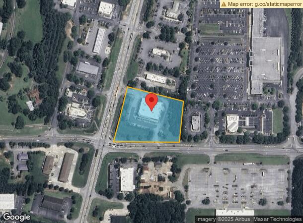
880 Glynn St S, Fayetteville, GA 30214
NEARBY LISTINGS FOR SALE OR LEASE
Property Detail
880 Glynn St S
Atlanta-Sandy Springs-Roswell, GA
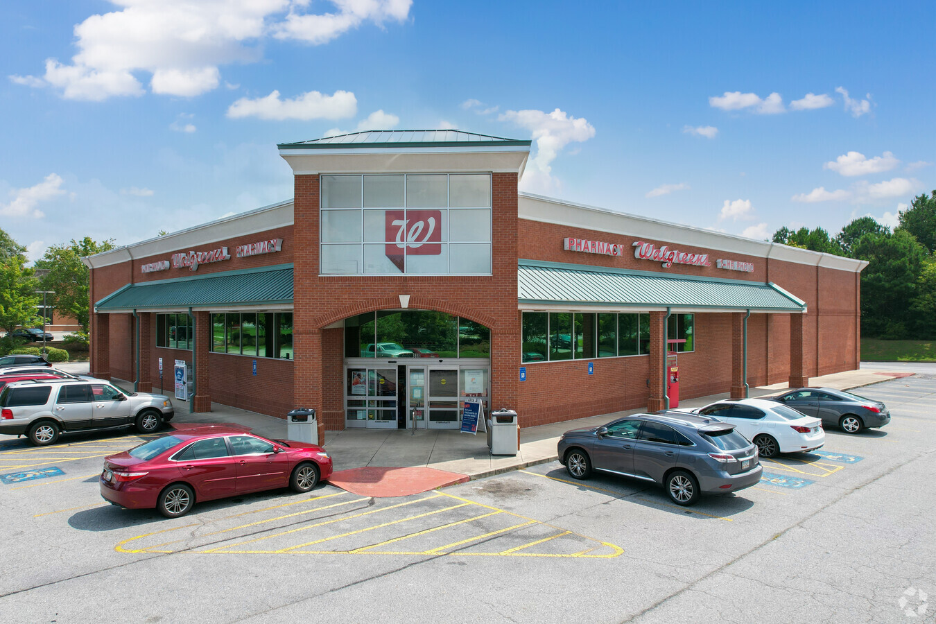
Walgreens
05-17-00-097
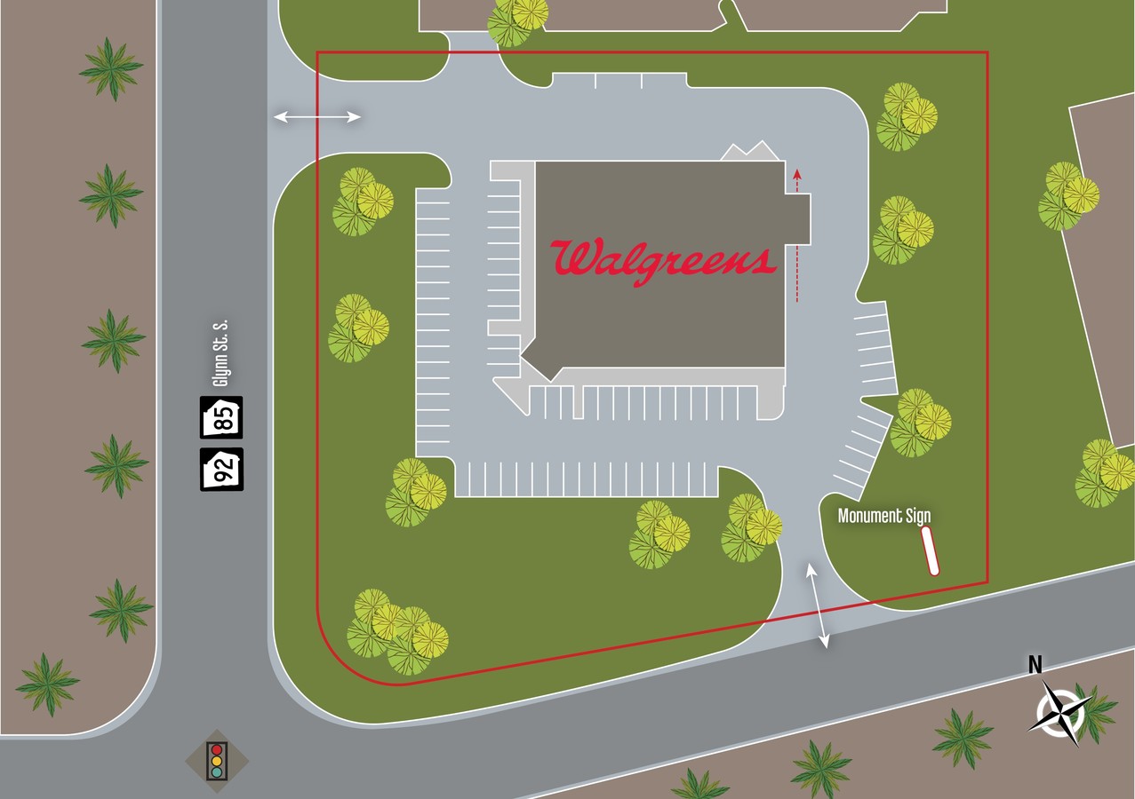
CORNER OF HWY 92 S & HWY 85 S
Storebuilding
Fayette
X
Georgia
13113C0112E
154
2024
2.33 AC
2024
Fayette/Peachtree
140405
Atlanta
15,134 SF
DEMOGRAPHICS near 880 Glynn St S
1 Mile
3 Mile
5 Mile
2024 Total Population
4,085
29,195
55,264
2029 Population
4,357
30,976
58,422
Pop Growth 2024-2029
+ 6.66%
+ 6.10%
+ 5.71%
Average Age
42
43
42
2024 Total Households
1,394
10,888
19,839
HH Growth 2024-2029
+ 6.81%
+ 6.12%
+ 5.77%
Median Household Inc
$96,096
$80,960
$87,789
Avg Household Size
2.90
2.60
2.70
2024 Avg HH Vehicles
2.00
2.00
2.00
Median Home Value
$307,096
$285,578
$286,910
Median Year Built
1993
1993
1994
Nearby Places
- Restaurants
- Banks
- Shops
- Fitness
- Groceries
PUBLIC TRANSPORTATION
AIRPORT
Hartsfield-Jackson Atlanta International
DRIVE
WALK
Distance
Hartsfield-Jackson Atlanta International
32 min
17.9 mi
Freight Ports
Georgia Ports - Savannah
DRIVE
WALK
Distance
Georgia Ports - Savannah
1 min
212.3 mi
SALE & LEASE HISTORY
LISTING DATE
SALE/LEASE

Sep 24, 2016
For Sale
Jan 23, 2018
For Sale
Dec 23, 2020
For Sale
Nearby Properties
Address
Land Use
TOTAL SIZE
Lot Size
Zoning
Address
Land Use
TOTAL SIZE
Lot Size
Zoning
224,116 SF
41.20 AC
MUC
Address
Land Use
TOTAL SIZE
Lot Size
Zoning
197,026 SF
28 AC
Address
Land Use
TOTAL SIZE
Lot Size
Zoning
151,194 SF
11.59 AC
C PUD
Address
Land Use
TOTAL SIZE
Lot Size
Zoning
81,154 SF
23.70 AC
C OI
Address
Land Use
TOTAL SIZE
Lot Size
Zoning
158,310 SF
4.76 AC
C C1
Address
Land Use
TOTAL SIZE
Lot Size
Zoning
260,883 SF
21.30 AC
C C3
Address
Land Use
TOTAL SIZE
Lot Size
Zoning
111,198 SF
8.94 AC
C C1
Address
Land Use
TOTAL SIZE
Lot Size
Zoning
92,550 SF
10.70 AC
C C1
Address
Land Use
TOTAL SIZE
Lot Size
Zoning
120,793 SF
5.60 AC
C PUD
Address
Land Use
TOTAL SIZE
Lot Size
Zoning
112,650 SF
22.78 AC
C RMF15
Address
Land Use
TOTAL SIZE
Lot Size
Zoning
132,197 SF
18 AC
C RMF15
Address
Land Use
TOTAL SIZE
Lot Size
Zoning
220,887 SF
24.70 AC
Address
Land Use
TOTAL SIZE
Lot Size
Zoning
103,641 SF
17.60 AC
C C3
Address
Land Use
TOTAL SIZE
Lot Size
Zoning
239,954 SF
77.70 AC
Address
Land Use
TOTAL SIZE
Lot Size
Zoning
35,356 SF
2.01 AC
C C1
Address
Land Use
TOTAL SIZE
Lot Size
Zoning
184,862 SF
21.90 AC
C C3
Address
Land Use
TOTAL SIZE
Lot Size
Zoning
107,232 SF
13.82 AC
C C3
Address
Land Use
TOTAL SIZE
Lot Size
Zoning
102,460 SF
10 AC
C CH
Address
Land Use
TOTAL SIZE
Lot Size
Zoning
135,115 SF
32.15 AC
Address
Land Use
TOTAL SIZE
Lot Size
Zoning
56,192 SF
9.40 AC
C RMF15
Address
Land Use
TOTAL SIZE
Lot Size
Zoning
75,043 SF
3.20 AC
HC
Address
Land Use
TOTAL SIZE
Lot Size
Zoning
63,056 SF
16.80 AC
Address
Land Use
TOTAL SIZE
Lot Size
Zoning
49,261 SF
4.33 AC
C C3
Address
Land Use
TOTAL SIZE
Lot Size
Zoning
41,450 SF
3.87 AC
C OI
Address
Land Use
TOTAL SIZE
Lot Size
Zoning
75,750 SF
10.43 AC
C C3
Address
Land Use
TOTAL SIZE
Lot Size
Zoning
8,813 SF
19 AC
C AR
Address
Land Use
TOTAL SIZE
Lot Size
Zoning
67,801 SF
14 AC
TR
Address
Land Use
TOTAL SIZE
Lot Size
Zoning
73,040 SF
6.01 AC
C RMF15
Address
Land Use
TOTAL SIZE
Lot Size
Zoning
25,980 SF
199.40 AC
Address
Land Use
TOTAL SIZE
Lot Size
Zoning
63,428 SF
7.92 AC
C OI
The World's #1 Commercial Real Estate Marketplace
Connect with us
© 2025 CoStar Group
The information above has been obtained from sources believed reliable. While we do not doubt its accuracy we have not verified it and make no guarantee, warranty or representation about it. It is your responsibility to independently confirm its accuracy and completeness. Any projections, opinions, assumptions, or estimates used are for example only and do not represent the current or future performance of the property. The value of this transaction to you depends on tax and other factors which should be evaluated by your tax, financial, and legal advisors. You and your advisors should conduct a careful, independent investigation of the property to determine to your satisfaction the suitability of the property for your needs.