Property Record
8810 W Colfax Ave, Lakewood, CO 80215
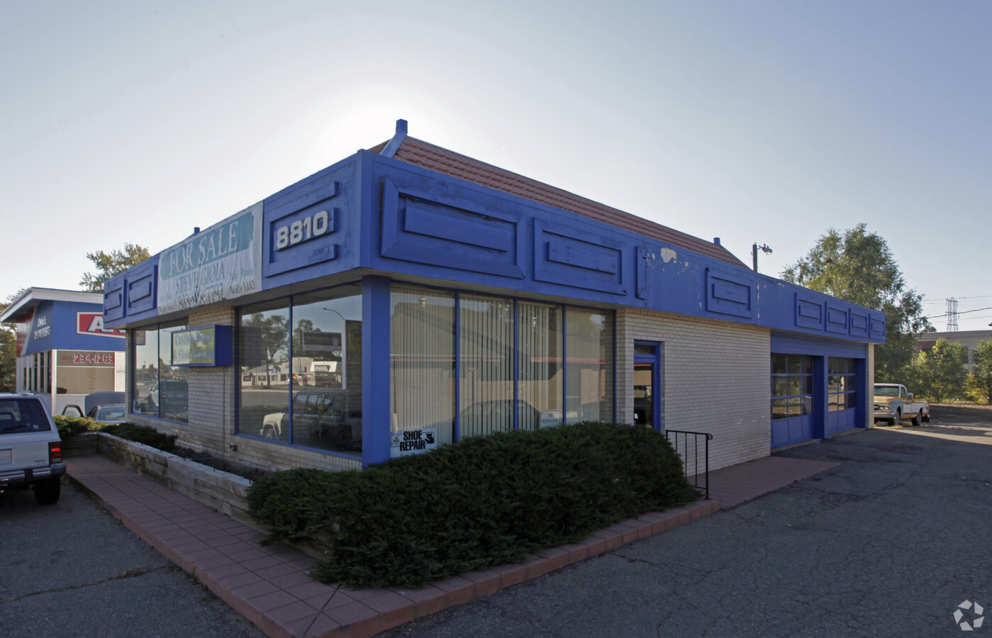
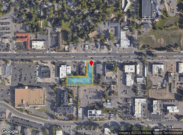
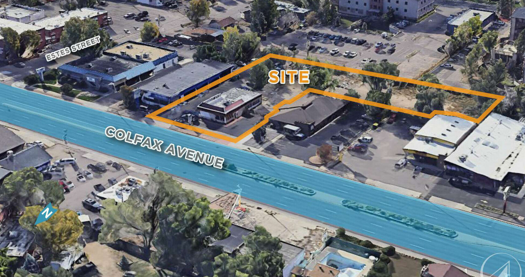
This Property Is For Sale
NEARBY LISTINGS FOR SALE OR LEASE
Property Detail
8810 W Colfax Ave
Denver-Aurora-Lakewood, CO
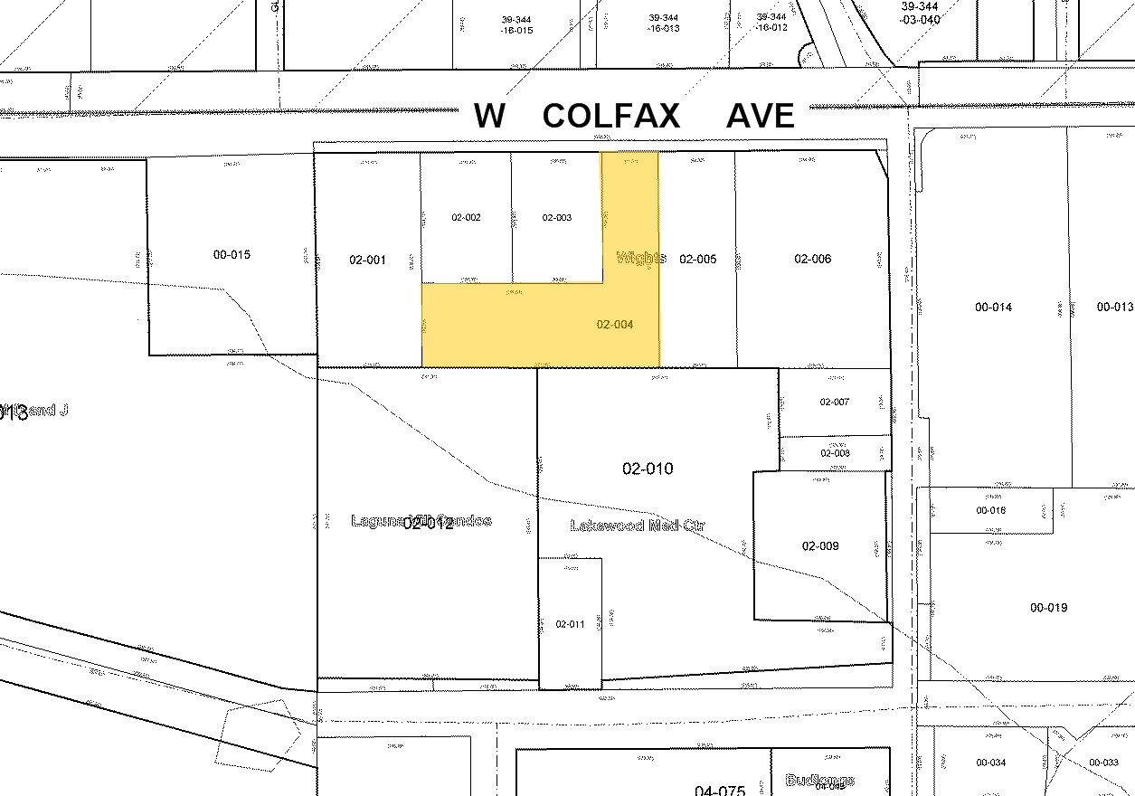
Wights Resub Blk 1 & 2
49-031-02-004
SECTION 03 TOWNSHIP 04 RANGE 69 QTR NE SUBDIVISIONCD 835800 SUBDIVISIONNAME WIGHTS RESUB BLK 1 & 2 BLOCK 001 LOT 0003 SIZE: 21193 TRACT 00D VALUE: .487 SECTION 03 TOWNSHIP 04 RANGE 69 SUBDIVISIONCD 835800 SUBDIVISIONNAME WIGHTS RESUB BLK 1 & 2 BLOCK
Commercialnec
Jefferson
AE
Colorado
08059C0301F
3-5
2023
0.71 AC
2024
West
011101
Denver
2,210 SF
DEMOGRAPHICS near 8810 W Colfax Ave
1 Mile
3 Mile
5 Mile
2024 Total Population
12,954
125,523
344,733
2029 Population
12,929
125,264
344,810
Pop Growth 2024-2029
(0.19%)
(0.21%)
+ 0.02%
Average Age
41
40
39
2024 Total Households
5,616
55,473
147,534
HH Growth 2024-2029
(0.28%)
(0.20%)
+ 0.05%
Median Household Inc
$63,991
$70,901
$78,875
Avg Household Size
2.20
2.20
2.20
2024 Avg HH Vehicles
2.00
2.00
2.00
Median Home Value
$568,677
$545,017
$522,386
Median Year Built
1967
1969
1970
Nearby Places
- Restaurants
- Banks
- Shops
- Fitness
- Groceries
PUBLIC TRANSPORTATION
TRANSIT/SUBWAY
Garrison (W Line - Denver Regional Transportation District Light Rail (TheRide))
DRIVE
WALK
Distance
Garrison (W Line - Denver Regional Transportation District Light Rail (TheRide))
1 min
9 min
0.5 mi
COMMUTER RAIL
Arvada Ridge Station Track 1 (Union Station to Wheat Ridge Ward Station - Regional Transportation District)
DRIVE
WALK
Distance
Arvada Ridge Station Track 1 (Union Station to Wheat Ridge Ward Station - Regional Transportation District)
10 min
5.0 mi
Arvada Ridge Station Track 2 (Union Station to Wheat Ridge Ward Station - Regional Transportation District)
DRIVE
WALK
Distance
Arvada Ridge Station Track 2 (Union Station to Wheat Ridge Ward Station - Regional Transportation District)
10 min
5.0 mi
AIRPORT
Denver International
DRIVE
WALK
Distance
Denver International
41 min
31.1 mi
Freight Ports
Tulsa Port Of Catoosa
DRIVE
WALK
Distance
Tulsa Port Of Catoosa
739 min
716.6 mi
Nearby Properties
Address
Land Use
TOTAL SIZE
Lot Size
Zoning
Address
Land Use
TOTAL SIZE
Lot Size
Zoning
943,179 SF
23.96 AC
Address
Land Use
TOTAL SIZE
Lot Size
Zoning
3,195,026 SF
562.97 AC
Address
Land Use
TOTAL SIZE
Lot Size
Zoning
198,081 SF
Address
Land Use
TOTAL SIZE
Lot Size
Zoning
111,673 SF
29.06 AC
Address
Land Use
TOTAL SIZE
Lot Size
Zoning
232,678 SF
27.50 AC
Address
Land Use
TOTAL SIZE
Lot Size
Zoning
233,688 SF
22.37 AC
Address
Land Use
TOTAL SIZE
Lot Size
Zoning
199,685 SF
27.73 AC
Address
Land Use
TOTAL SIZE
Lot Size
Zoning
187,095 SF
23.42 AC
Address
Land Use
TOTAL SIZE
Lot Size
Zoning
187,745 SF
16.25 AC
Address
Land Use
TOTAL SIZE
Lot Size
Zoning
247,459 SF
2.31 AC
C-MX-8
Address
Land Use
TOTAL SIZE
Lot Size
Zoning
202,867 SF
2.28 AC
C-MX-5
Address
Land Use
TOTAL SIZE
Lot Size
Zoning
238,452 SF
8.02 AC
Address
Land Use
TOTAL SIZE
Lot Size
Zoning
738 SF
3.68 AC
Address
Land Use
TOTAL SIZE
Lot Size
Zoning
298,767 SF
4.43 AC
Address
Land Use
TOTAL SIZE
Lot Size
Zoning
397,700 SF
14.45 AC
Address
Land Use
TOTAL SIZE
Lot Size
Zoning
365,230 SF
12.51 AC
Address
Land Use
TOTAL SIZE
Lot Size
Zoning
135,372 SF
11.66 AC
Address
Land Use
TOTAL SIZE
Lot Size
Zoning
284,413 SF
3.82 AC
Address
Land Use
TOTAL SIZE
Lot Size
Zoning
167,420 SF
5.84 AC
Address
Land Use
TOTAL SIZE
Lot Size
Zoning
214,839 SF
8.17 AC
Address
Land Use
TOTAL SIZE
Lot Size
Zoning
100,615 SF
2.28 AC
Address
Land Use
TOTAL SIZE
Lot Size
Zoning
82,756 SF
14.95 AC
Address
Land Use
TOTAL SIZE
Lot Size
Zoning
147,609 SF
9.22 AC
Address
Land Use
TOTAL SIZE
Lot Size
Zoning
391,227 SF
5.77 AC
Address
Land Use
TOTAL SIZE
Lot Size
Zoning
143,603 SF
4.71 AC
Address
Land Use
TOTAL SIZE
Lot Size
Zoning
311,200 SF
0.85 AC
Address
Land Use
TOTAL SIZE
Lot Size
Zoning
138,204 SF
3.68 AC
Address
Land Use
TOTAL SIZE
Lot Size
Zoning
146,133 SF
3.75 AC
Address
Land Use
TOTAL SIZE
Lot Size
Zoning
230,285 SF
3.21 AC
Address
Land Use
TOTAL SIZE
Lot Size
Zoning
330,357 SF
15.16 AC
The World's #1 Commercial Real Estate Marketplace
Connect with us
© 2025 CoStar Group
The information above has been obtained from sources believed reliable. While we do not doubt its accuracy we have not verified it and make no guarantee, warranty or representation about it. It is your responsibility to independently confirm its accuracy and completeness. Any projections, opinions, assumptions, or estimates used are for example only and do not represent the current or future performance of the property. The value of this transaction to you depends on tax and other factors which should be evaluated by your tax, financial, and legal advisors. You and your advisors should conduct a careful, independent investigation of the property to determine to your satisfaction the suitability of the property for your needs.