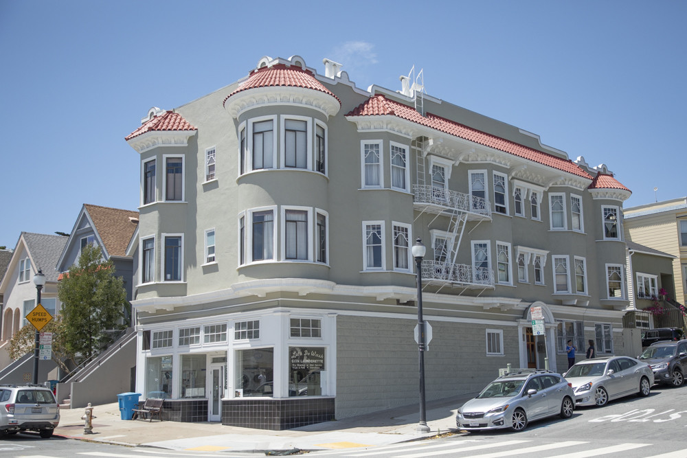
Property Record
886 Noe St, San Francisco, CA 94114

NEARBY LISTINGS FOR SALE OR LEASE
Property Detail
886 Noe St
San Francisco-Redwood City-South San Francisco, CA
Mission Bl 110
3622-012
San Francisco
Apartment
California
2023
12
2023
0.07 AC
021100
Castro
6,690 SF
San Francisco
DEMOGRAPHICS near 886 Noe St
1 Mile
3 Mile
5 Mile
2024 Total Population
78,113
561,217
844,250
2029 Population
72,528
519,123
781,262
Pop Growth 2024-2029
(7.15%)
(7.50%)
(7.46%)
Average Age
42
42
42
2024 Total Households
36,783
242,557
352,556
HH Growth 2024-2029
(7.73%)
(7.88%)
(7.80%)
Median Household Inc
$166,139
$128,569
$124,193
Avg Household Size
2.10
2.20
2.30
2024 Avg HH Vehicles
1.00
1.00
1.00
Median Home Value
$1,116,390
$1,101,130
$1,093,821
Median Year Built
1948
1948
1949
Nearby Places
- Restaurants
- Banks
- Shops
- Fitness
- Groceries
PUBLIC TRANSPORTATION
TRANSIT/SUBWAY
Church St & 22Nd St (J Church - San Francisco Municipal Railway (MUNI Metro))
DRIVE
WALK
Distance
Church St & 22Nd St (J Church - San Francisco Municipal Railway (MUNI Metro))
1 min
4 min
0.3 mi
21St Street (J Church - San Francisco Municipal Railway (MUNI Metro))
DRIVE
WALK
Distance
21St Street (J Church - San Francisco Municipal Railway (MUNI Metro))
1 min
7 min
0.4 mi
Church And 20Th Street (J Church - San Francisco Municipal Railway (MUNI Metro))
DRIVE
WALK
Distance
Church And 20Th Street (J Church - San Francisco Municipal Railway (MUNI Metro))
1 min
8 min
0.5 mi
Liberty Street (J Church - San Francisco Municipal Railway (MUNI Metro))
DRIVE
WALK
Distance
Liberty Street (J Church - San Francisco Municipal Railway (MUNI Metro))
1 min
8 min
0.5 mi
Church And 24Th Street (J Church - San Francisco Municipal Railway (MUNI Metro))
DRIVE
WALK
Distance
Church And 24Th Street (J Church - San Francisco Municipal Railway (MUNI Metro))
1 min
9 min
0.5 mi
COMMUTER RAIL
San Francisco 4Th & King (Caltrain - Caltrain (Caltrain))
DRIVE
WALK
Distance
San Francisco 4Th & King (Caltrain - Caltrain (Caltrain))
8 min
3.4 mi
22Nd Street (Caltrain - Caltrain (Caltrain))
DRIVE
WALK
Distance
22Nd Street (Caltrain - Caltrain (Caltrain))
8 min
3.5 mi
AIRPORT
San Francisco International
DRIVE
WALK
Distance
San Francisco International
22 min
12.7 mi
Metro Oakland International
DRIVE
WALK
Distance
Metro Oakland International
35 min
21.9 mi
Freight Ports
Port of San Francisco
DRIVE
WALK
Distance
Port of San Francisco
11 min
4.2 mi
SALE & LEASE HISTORY
LISTING DATE
SALE/LEASE

Aug 10, 2018
For Sale
Nearby Properties
Address
Land Use
TOTAL SIZE
Lot Size
Zoning
Address
Land Use
TOTAL SIZE
Lot Size
Zoning
10.92 AC
Address
Land Use
TOTAL SIZE
Lot Size
Zoning
750,370 SF
3.25 AC
MBR3
Address
Land Use
TOTAL SIZE
Lot Size
Zoning
508,714 SF
1.29 AC
C3R
Address
Land Use
TOTAL SIZE
Lot Size
Zoning
248,303 SF
4.35 AC
Address
Land Use
TOTAL SIZE
Lot Size
Zoning
717,234 SF
3.47 AC
UMU
Address
Land Use
TOTAL SIZE
Lot Size
Zoning
696,431 SF
0.97 AC
C3G
Address
Land Use
TOTAL SIZE
Lot Size
Zoning
475,791 SF
0.55 AC
C3OSD
Address
Land Use
TOTAL SIZE
Lot Size
Zoning
690,442 SF
0.79 AC
C3O
Address
Land Use
TOTAL SIZE
Lot Size
Zoning
750,491 SF
0.51 AC
C3O
Address
Land Use
TOTAL SIZE
Lot Size
Zoning
266,143 SF
4 AC
C-3-R
Address
Land Use
TOTAL SIZE
Lot Size
Zoning
885,581 SF
5.20 AC
M2
Address
Land Use
TOTAL SIZE
Lot Size
Zoning
505,120 SF
0.41 AC
C3O
Address
Land Use
TOTAL SIZE
Lot Size
Zoning
1,424,230 SF
2.60 AC
C3G
Address
Land Use
TOTAL SIZE
Lot Size
Zoning
1.52 AC
C3G
Address
Land Use
TOTAL SIZE
Lot Size
Zoning
139,070 SF
0.64 AC
C3O
Address
Land Use
TOTAL SIZE
Lot Size
Zoning
385,000 SF
0.80 AC
C3O
Address
Land Use
TOTAL SIZE
Lot Size
Zoning
327,339 SF
0.72 AC
C3R
Address
Land Use
TOTAL SIZE
Lot Size
Zoning
519,235 SF
0.74 AC
C3O
Address
Land Use
TOTAL SIZE
Lot Size
Zoning
263,640 SF
0.72 AC
C3R
Address
Land Use
TOTAL SIZE
Lot Size
Zoning
610,645 SF
0.82 AC
C3R
Address
Land Use
TOTAL SIZE
Lot Size
Zoning
2.74 AC
Address
Land Use
TOTAL SIZE
Lot Size
Zoning
313,306 SF
1.23 AC
WMUG
Address
Land Use
TOTAL SIZE
Lot Size
Zoning
314,826 SF
1.85 AC
MB-RA
Address
Land Use
TOTAL SIZE
Lot Size
Zoning
922,758 SF
1.94 AC
C3R
Address
Land Use
TOTAL SIZE
Lot Size
Zoning
10.92 AC
Address
Land Use
TOTAL SIZE
Lot Size
Zoning
444,770 SF
0.63 AC
C3O
Address
Land Use
TOTAL SIZE
Lot Size
Zoning
302,084 SF
0.88 AC
MBO
Address
Land Use
TOTAL SIZE
Lot Size
Zoning
393,918 SF
3.36 AC
WMUG
Address
Land Use
TOTAL SIZE
Lot Size
Zoning
393,918 SF
3.36 AC
WMUG
Address
Land Use
TOTAL SIZE
Lot Size
Zoning
291,522 SF
6.66 AC
CM
The World's #1 Commercial Real Estate Marketplace
Connect with us
© 2025 CoStar Group
The information above has been obtained from sources believed reliable. While we do not doubt its accuracy we have not verified it and make no guarantee, warranty or representation about it. It is your responsibility to independently confirm its accuracy and completeness. Any projections, opinions, assumptions, or estimates used are for example only and do not represent the current or future performance of the property. The value of this transaction to you depends on tax and other factors which should be evaluated by your tax, financial, and legal advisors. You and your advisors should conduct a careful, independent investigation of the property to determine to your satisfaction the suitability of the property for your needs.