Property Record
8900 N Kendall Dr, Miami, FL 33176


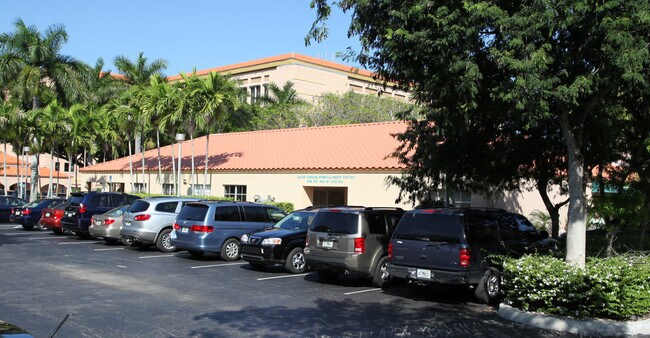
Property Detail
8900 N Kendall Dr
30-5004-000-0060
4 55 40 55.17 AC M/L W1/2 OF NE1/4 OF NE1/4 & E1/2 OF NW1/4 OF NE1/4 & N1/2 OF NE1/4 OF SW1/4 OF NE1/4 & NW1/4 OF SE1/4 OF NE1/4 & W257FT OF S1/2 OF NE1/4 OF SE1/4 OF NE1/4 LESS RD & N3/4 OF NE1/4 OF NE1/4 OF NE1/4 LESS E35FT & LESS S45FT & 15.50FTN
Hospitalpublic
Miami-Dade
5000
Florida
AH Areas with a 1% annual chance of shallow flooding, usually in the form of a pond, withan average depth ranging from 1 to 3 feet. These areas have a 26% chance of flooding over the life of a 30-year mortgage.
55.17 AC
2024
Kendall
2025
South Florida
008429
Miami-Miami Beach-Kendall, FL
1,527,515 SF
NEARBY LISTINGS FOR SALE OR LEASE
DEMOGRAPHICS near 8900 N Kendall Dr
1 mile
3 mile
5 mile
2025 Total Population
10,622
125,967
347,720
2030 Population
11,318
134,333
370,465
Pop Growth 2025-2030
+ 6.55%
+ 6.64%
+ 6.54%
Average Age
43
43
43
2025 Total Households
3,859
49,036
123,233
HH Growth 2025-2030
+ 6.43%
+ 6.69%
+ 6.60%
Median Household Inc
$131,303
$95,549
$96,355
Avg Household Size
2.60
2.50
2.70
2025 Avg HH Vehicles
2.00
2.00
2.00
Median Home Value
$843,038
$710,913
$646,391
Median Year Built
1971
1975
1975
Nearby Places
Map Layers
Map Styles
 Street
 Aerial
Layers
 Traffic
 Biking
Places
Listings with unknown addresses are not visible on the map
- Restaurants
- Banks
- Shops
- Fitness
- Groceries
PUBLIC TRANSPORTATION
COMMUTER RAIL
Dadeland South (Metrorail Green Line - Miami-Dade Transit (Metrorail/Metromover))
Drive
Walk
Distance
Dadeland South (Metrorail Green Line - Miami-Dade Transit (Metrorail/Metromover))
4 min
2.1 mi
Dadeland North (Metrorail Green Line - Miami-Dade Transit (Metrorail/Metromover))
Drive
Walk
Distance
Dadeland North (Metrorail Green Line - Miami-Dade Transit (Metrorail/Metromover))
5 min
3.1 mi
AIRPORT
Miami International
Drive
Walk
Distance
Miami International
21 min
11.4 mi
Fort Lauderdale/Hollywood International
Drive
Walk
Distance
Fort Lauderdale/Hollywood International
52 min
34.7 mi
Freight Ports
Port of Miami
Drive
Walk
Distance
Port of Miami
28 min
14.4 mi
Nearby Properties
Address
Land Use
TOTAL SIZE
Lot Size
Zoning
Address
Land Use
TOTAL SIZE
Lot Size
Zoning
2,238,641 SF
39 AC
6114
Address
Land Use
TOTAL SIZE
Lot Size
Zoning
1,018,683 SF
11.46 AC
5000
Address
Land Use
TOTAL SIZE
Lot Size
Zoning
877,136 SF
2.96 AC
6112
Address
Land Use
TOTAL SIZE
Lot Size
Zoning
1,335,151 SF
180 AC
0100
Address
Land Use
TOTAL SIZE
Lot Size
Zoning
766,093 SF
8.91 AC
5000
Address
Land Use
TOTAL SIZE
Lot Size
Zoning
764,501 SF
1.81 AC
6114
Address
Land Use
TOTAL SIZE
Lot Size
Zoning
644,929 SF
1.10 AC
6114
Address
Land Use
TOTAL SIZE
Lot Size
Zoning
846,804 SF
43 AC
6400
Address
Land Use
TOTAL SIZE
Lot Size
Zoning
634,144 SF
3.12 AC
6114
Address
Land Use
TOTAL SIZE
Lot Size
Zoning
521,667 SF
1.08 AC
6112
Address
Land Use
TOTAL SIZE
Lot Size
Zoning
532,779 SF
0000
Address
Land Use
TOTAL SIZE
Lot Size
Zoning
859,337 SF
0.13 AC
7100
Address
Land Use
TOTAL SIZE
Lot Size
Zoning
333,947 SF
21.32 AC
6400
Address
Land Use
TOTAL SIZE
Lot Size
Zoning
199,915 SF
15.19 AC
6200
Address
Land Use
TOTAL SIZE
Lot Size
Zoning
452,547 SF
0.90 AC
6114
Address
Land Use
TOTAL SIZE
Lot Size
Zoning
553,491 SF
10.64 AC
3900
Address
Land Use
TOTAL SIZE
Lot Size
Zoning
370,938 SF
1.58 AC
6112
Address
Land Use
TOTAL SIZE
Lot Size
Zoning
277,025 SF
0.01 AC
6114
Address
Land Use
TOTAL SIZE
Lot Size
Zoning
129,079 SF
4 AC
6114
Address
Land Use
TOTAL SIZE
Lot Size
Zoning
350,948 SF
22.42 AC
3800
Address
Land Use
TOTAL SIZE
Lot Size
Zoning
401,432 SF
4.63 AC
6111
Address
Land Use
TOTAL SIZE
Lot Size
Zoning
245,376 SF
27 AC
6400
Address
Land Use
TOTAL SIZE
Lot Size
Zoning
114,879 SF
7.60 AC
6114
Address
Land Use
TOTAL SIZE
Lot Size
Zoning
196,806 SF
158.17 AC
8900
Address
Land Use
TOTAL SIZE
Lot Size
Zoning
540,778 SF
0.01 AC
6114
Address
Land Use
TOTAL SIZE
Lot Size
Zoning
367,374 SF
9.89 AC
8900
Address
Land Use
TOTAL SIZE
Lot Size
Zoning
313,755 SF
5 AC
2300
Address
Land Use
TOTAL SIZE
Lot Size
Zoning
183,845 SF
18.77 AC
5000
Address
Land Use
TOTAL SIZE
Lot Size
Zoning
276,202 SF
13.46 AC
3800
The World's #1 Commercial Real Estate Marketplace
Connect with us
© 2026 CoStar Group
The information above has been obtained from sources believed reliable. While we do not doubt its accuracy we have not verified it and make no guarantee, warranty or representation about it. It is your responsibility to independently confirm its accuracy and completeness. Any projections, opinions, assumptions, or estimates used are for example only and do not represent the current or future performance of the property. The value of this transaction to you depends on tax and other factors which should be evaluated by your tax, financial, and legal advisors. You and your advisors should conduct a careful, independent investigation of the property to determine to your satisfaction the suitability of the property for your needs.