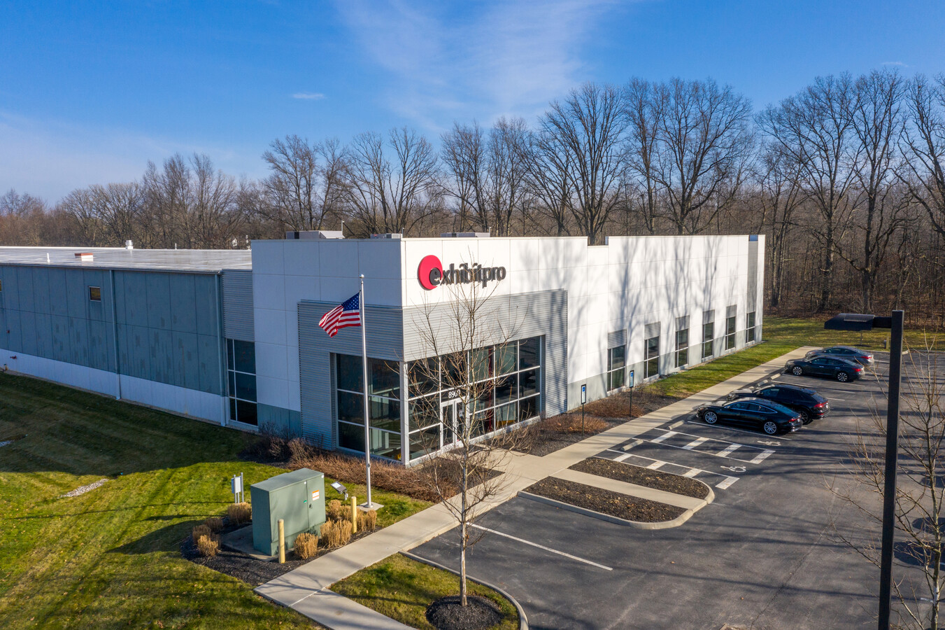
Property Record
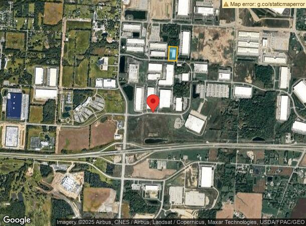
8900 Smiths Mill Rd N, New Albany, OH 43054


NEARBY LISTINGS FOR SALE OR LEASE
-
-
View all New Albany listings for sale on LoopNet.com
Property Detail
8900 Smiths Mill Rd N
095-111744-00.003
5.473 AC LOT 31 R15 T2 Q2 TIF 2012-2041 (100%)
Warehouse
Licking
ARE
Ohio
39089C0280J
31
2023
5.47 AC
2023
Licking County
755601
Columbus
54,000 SF
Columbus, OH
DEMOGRAPHICS near 8900 Smiths Mill Rd N
1 Mile
3 Mile
5 Mile
2024 Total Population
260
5,161
31,715
2029 Population
271
5,259
32,372
Pop Growth 2024-2029
+ 4.23%
+ 1.90%
+ 2.07%
Average Age
44
39
39
2024 Total Households
100
1,734
12,636
HH Growth 2024-2029
+ 4.00%
+ 2.19%
+ 1.92%
Median Household Inc
$155,952
$155,160
$117,971
Avg Household Size
2.60
2.90
2.50
2024 Avg HH Vehicles
3.00
2.00
2.00
Median Home Value
$347,500
$410,929
$392,236
Median Year Built
1983
1994
2002
Nearby Places
- Restaurants
- Banks
- Shops
- Fitness
- Groceries
PUBLIC TRANSPORTATION
AIRPORT
John Glenn Columbus International
DRIVE
WALK
Distance
John Glenn Columbus International
23 min
13.8 mi
Rickenbacker International
DRIVE
WALK
Distance
Rickenbacker International
38 min
26.6 mi
Freight Ports
Port of Toledo
DRIVE
WALK
Distance
Port of Toledo
185 min
149.8 mi
SALE & LEASE HISTORY
LISTING DATE
SALE/LEASE

Jan 20, 2021
For Sale
Nearby Properties
Address
Land Use
TOTAL SIZE
Lot Size
Zoning
Address
Land Use
TOTAL SIZE
Lot Size
Zoning
46,000 SF
214.46 AC
Address
Land Use
TOTAL SIZE
Lot Size
Zoning
624,564 SF
104.45 AC
Address
Land Use
TOTAL SIZE
Lot Size
Zoning
159,232 SF
66.44 AC
Address
Land Use
TOTAL SIZE
Lot Size
Zoning
141,988 SF
219.25 AC
Address
Land Use
TOTAL SIZE
Lot Size
Zoning
772,217 SF
98.64 AC
Address
Land Use
TOTAL SIZE
Lot Size
Zoning
1,437,389 SF
234.05 AC
Address
Land Use
TOTAL SIZE
Lot Size
Zoning
271,758 SF
131.45 AC
Address
Land Use
TOTAL SIZE
Lot Size
Zoning
368,823 SF
28.56 AC
Address
Land Use
TOTAL SIZE
Lot Size
Zoning
266,057 SF
26 AC
Address
Land Use
TOTAL SIZE
Lot Size
Zoning
520,983 SF
40.94 AC
Address
Land Use
TOTAL SIZE
Lot Size
Zoning
506,879 SF
142.43 AC
Address
Land Use
TOTAL SIZE
Lot Size
Zoning
524,527 SF
27.49 AC
Address
Land Use
TOTAL SIZE
Lot Size
Zoning
315,599 SF
25.76 AC
Address
Land Use
TOTAL SIZE
Lot Size
Zoning
416,945 SF
15.01 AC
Address
Land Use
TOTAL SIZE
Lot Size
Zoning
372,683 SF
18.14 AC
Address
Land Use
TOTAL SIZE
Lot Size
Zoning
68,620 SF
25 AC
Address
Land Use
TOTAL SIZE
Lot Size
Zoning
351,846 SF
33.05 AC
Address
Land Use
TOTAL SIZE
Lot Size
Zoning
303,001 SF
21.34 AC
Address
Land Use
TOTAL SIZE
Lot Size
Zoning
59,940 SF
4.32 AC
Address
Land Use
TOTAL SIZE
Lot Size
Zoning
303,000 SF
11.49 AC
Address
Land Use
TOTAL SIZE
Lot Size
Zoning
1,809 SF
134.92 AC
Address
Land Use
TOTAL SIZE
Lot Size
Zoning
92.69 AC
Address
Land Use
TOTAL SIZE
Lot Size
Zoning
267,500 SF
10.32 AC
Address
Land Use
TOTAL SIZE
Lot Size
Zoning
124,849 SF
11.49 AC
Address
Land Use
TOTAL SIZE
Lot Size
Zoning
222.09 AC
Address
Land Use
TOTAL SIZE
Lot Size
Zoning
206,152 SF
9.61 AC
Address
Land Use
TOTAL SIZE
Lot Size
Zoning
263,356 SF
12.27 AC
Address
Land Use
TOTAL SIZE
Lot Size
Zoning
101.87 AC
Address
Land Use
TOTAL SIZE
Lot Size
Zoning
93.79 AC
Address
Land Use
TOTAL SIZE
Lot Size
Zoning
136,145 SF
8.68 AC
The World's #1 Commercial Real Estate Marketplace
Connect with us
© 2025 CoStar Group
The information above has been obtained from sources believed reliable. While we do not doubt its accuracy we have not verified it and make no guarantee, warranty or representation about it. It is your responsibility to independently confirm its accuracy and completeness. Any projections, opinions, assumptions, or estimates used are for example only and do not represent the current or future performance of the property. The value of this transaction to you depends on tax and other factors which should be evaluated by your tax, financial, and legal advisors. You and your advisors should conduct a careful, independent investigation of the property to determine to your satisfaction the suitability of the property for your needs.