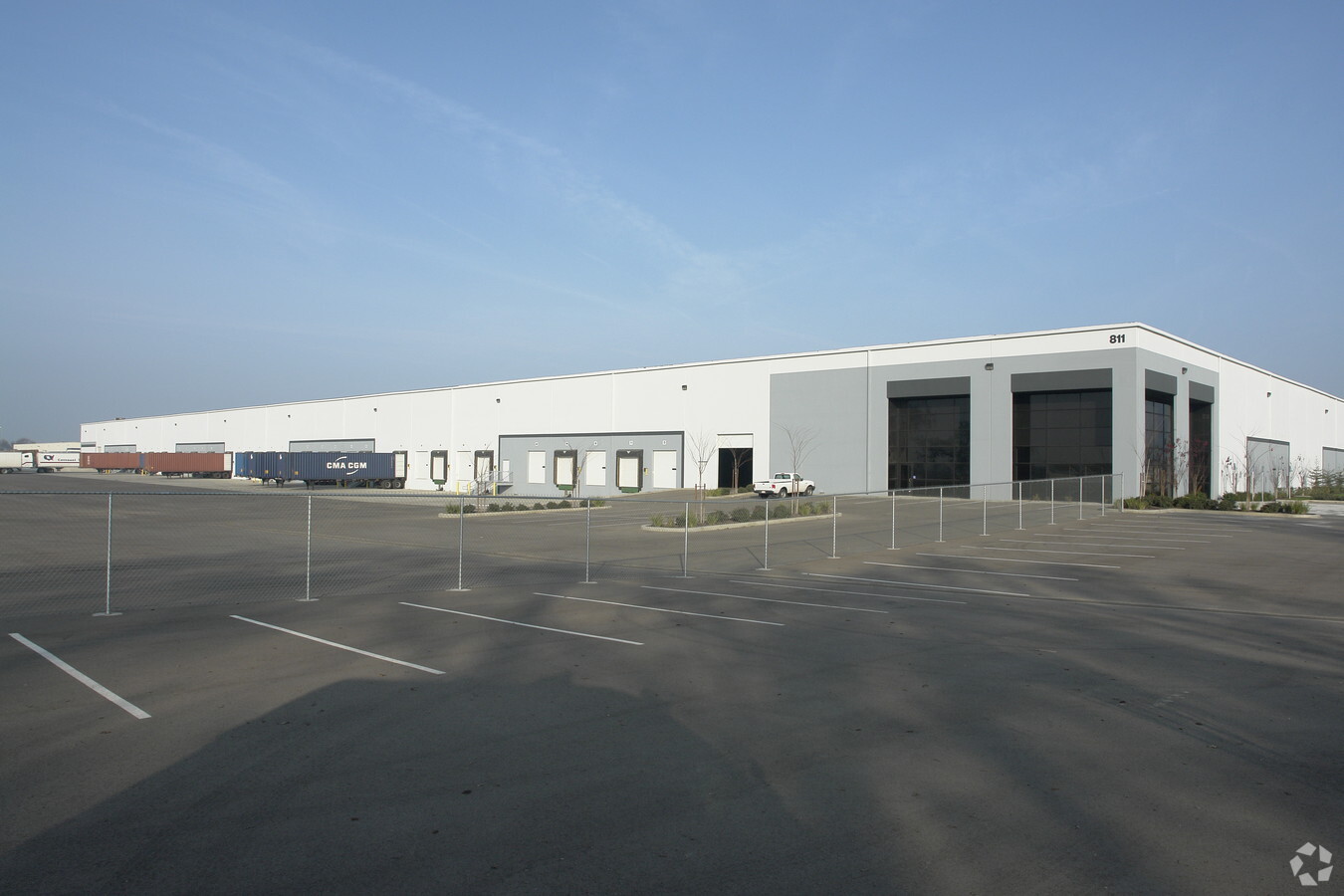
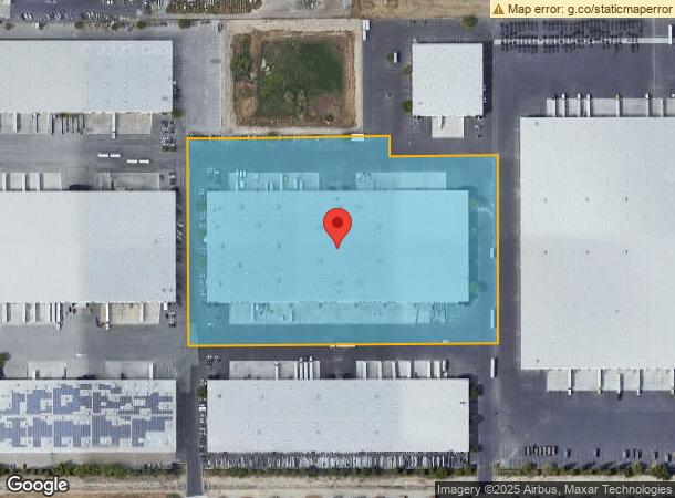
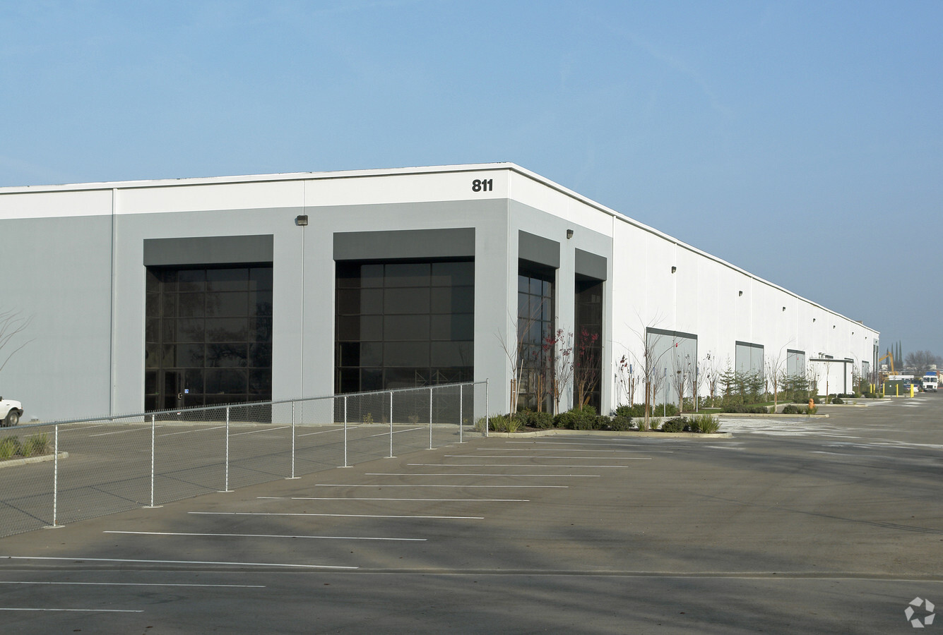
Property Record
8900 W Hurley Ave, Visalia, CA 93291
NEARBY LISTINGS FOR SALE OR LEASE
Property Detail
8900 W Hurley Ave
081-010-095-000
PARCEL 2 PARCEL MAP NO 4987 PM 50-92
Warehouse
Tulare
AE
California
06031C0250C
11.59 AC
2023
Northwest Visalia
2024
Visalia/Porterville
001008
Visalia-Porterville, CA
232,752 SF
DEMOGRAPHICS near 8900 W Hurley Ave
1 Mile
3 Mile
5 Mile
2024 Total Population
139
26,932
91,037
2029 Population
145
27,905
94,400
Pop Growth 2024-2029
+ 4.32%
+ 3.61%
+ 3.69%
Average Age
37
37
36
2024 Total Households
46
8,955
29,710
HH Growth 2024-2029
+ 4.35%
+ 3.64%
+ 3.71%
Median Household Inc
$106,250
$87,088
$74,650
Avg Household Size
2.90
2.90
3.00
2024 Avg HH Vehicles
2.00
2.00
2.00
Median Home Value
$357,142
$378,233
$317,521
Median Year Built
2001
1997
1990
Nearby Places
- Restaurants
- Banks
- Shops
- Fitness
- Groceries
SALE & LEASE HISTORY
LISTING DATE
SALE/LEASE

Sep 13, 2022
For Lease
Nearby Properties
Address
Land Use
TOTAL SIZE
Lot Size
Zoning
Address
Land Use
TOTAL SIZE
Lot Size
Zoning
326,700 SF
55.21 AC
IH
Address
Land Use
TOTAL SIZE
Lot Size
Zoning
795,140 SF
64.73 AC
IH
Address
Land Use
TOTAL SIZE
Lot Size
Zoning
300,560 SF
38.07 AC
IL
Address
Land Use
TOTAL SIZE
Lot Size
Zoning
227,486 SF
9.42 AC
Address
Land Use
TOTAL SIZE
Lot Size
Zoning
236,636 SF
23.38 AC
A1/AE40
Address
Land Use
TOTAL SIZE
Lot Size
Zoning
500,388 SF
31.90 AC
IH
Address
Land Use
TOTAL SIZE
Lot Size
Zoning
610,344 SF
83.28 AC
IH
Address
Land Use
TOTAL SIZE
Lot Size
Zoning
384,146 SF
18.37 AC
IH
Address
Land Use
TOTAL SIZE
Lot Size
Zoning
121,380 SF
24.96 AC
QP
Address
Land Use
TOTAL SIZE
Lot Size
Zoning
6.96 AC
Address
Land Use
TOTAL SIZE
Lot Size
Zoning
59,808 SF
34.14 AC
IH
Address
Land Use
TOTAL SIZE
Lot Size
Zoning
156 AC
Address
Land Use
TOTAL SIZE
Lot Size
Zoning
176,582 SF
17.09 AC
M-1
Address
Land Use
TOTAL SIZE
Lot Size
Zoning
19.34 AC
QP
Address
Land Use
TOTAL SIZE
Lot Size
Zoning
549,395 SF
29.81 AC
IL
Address
Land Use
TOTAL SIZE
Lot Size
Zoning
10.13 AC
Address
Land Use
TOTAL SIZE
Lot Size
Zoning
56,320 SF
8.79 AC
IH
Address
Land Use
TOTAL SIZE
Lot Size
Zoning
Address
Land Use
TOTAL SIZE
Lot Size
Zoning
32,048 SF
2.81 AC
CSO
Address
Land Use
TOTAL SIZE
Lot Size
Zoning
216,438 SF
14.23 AC
IH
Address
Land Use
TOTAL SIZE
Lot Size
Zoning
252,364 SF
13.68 AC
IH
Address
Land Use
TOTAL SIZE
Lot Size
Zoning
80,000 SF
8.71 AC
IH
Address
Land Use
TOTAL SIZE
Lot Size
Zoning
236,442 SF
11.29 AC
IH
Address
Land Use
TOTAL SIZE
Lot Size
Zoning
51,362 SF
1.61 AC
CH
Address
Land Use
TOTAL SIZE
Lot Size
Zoning
105,630 SF
11.50 AC
IH
Address
Land Use
TOTAL SIZE
Lot Size
Zoning
38,400 SF
13.70 AC
IH
Address
Land Use
TOTAL SIZE
Lot Size
Zoning
227,136 SF
12.18 AC
IH
Address
Land Use
TOTAL SIZE
Lot Size
Zoning
131,624 SF
7.44 AC
RM3
Address
Land Use
TOTAL SIZE
Lot Size
Zoning
91,976 SF
15.65 AC
IH
Address
Land Use
TOTAL SIZE
Lot Size
Zoning
160,000 SF
9.70 AC
IH
The World's #1 Commercial Real Estate Marketplace
Connect with us
© 2025 CoStar Group
The information above has been obtained from sources believed reliable. While we do not doubt its accuracy we have not verified it and make no guarantee, warranty or representation about it. It is your responsibility to independently confirm its accuracy and completeness. Any projections, opinions, assumptions, or estimates used are for example only and do not represent the current or future performance of the property. The value of this transaction to you depends on tax and other factors which should be evaluated by your tax, financial, and legal advisors. You and your advisors should conduct a careful, independent investigation of the property to determine to your satisfaction the suitability of the property for your needs.