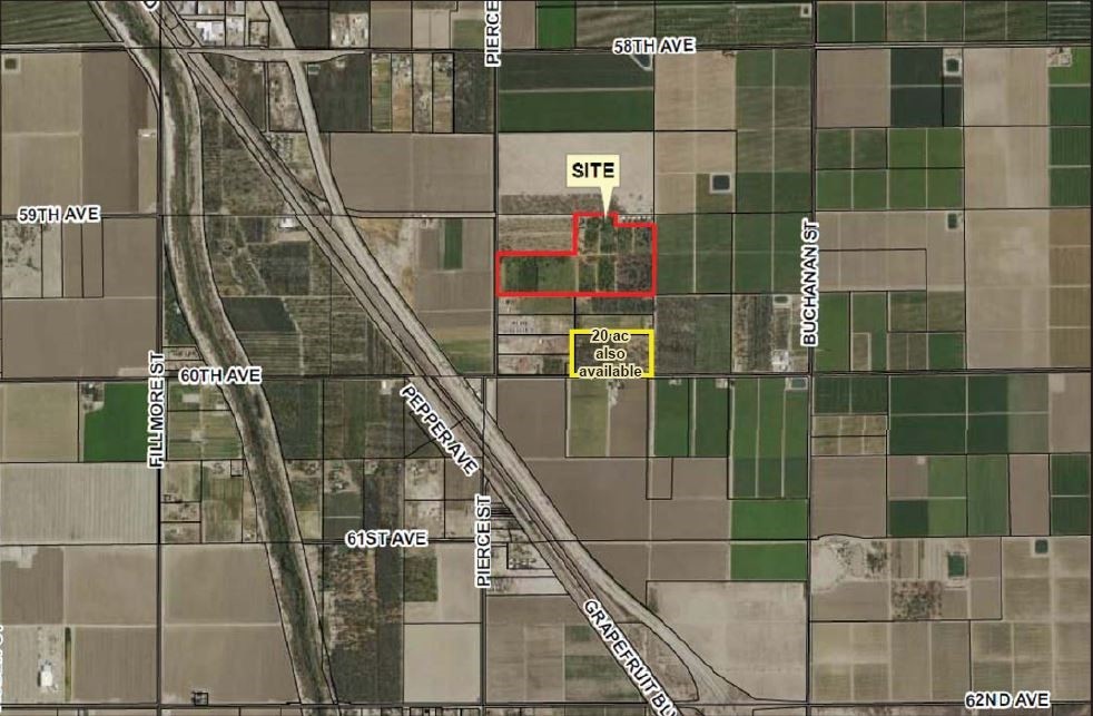
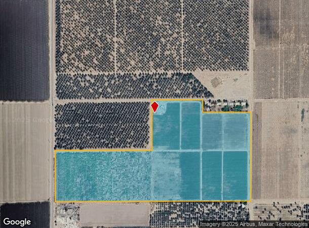
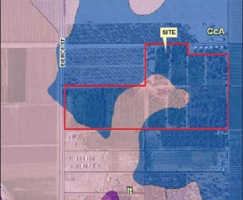
Property Record
89361 59Th Ave, Thermal, CA 92274
NEARBY LISTINGS FOR SALE OR LEASE
Property Detail
89361 59Th Ave
757-250-002
55.55 ACRES M/L IN POR SW 1/4 OF SEC 25 T6S R8E FOR TOTAL DESCRIPTION SEE ASSESSORS MAPS
Agriculturalland
Riverside
X
California
06065C2930H
55.55 AC
2023
Riverside Outlying
2023
Inland Empire (California)
045618
Riverside-San Bernardino-Ontario, CA
DEMOGRAPHICS near 89361 59Th Ave
1 Mile
3 Mile
5 Mile
2024 Total Population
558
3,728
3,972
2029 Population
561
3,797
4,036
Pop Growth 2024-2029
+ 0.54%
+ 1.85%
+ 1.61%
Average Age
31
32
32
2024 Total Households
143
848
914
HH Growth 2024-2029
0.00%
+ 0.94%
+ 0.66%
Median Household Inc
$27,302
$29,010
$28,697
Avg Household Size
3.80
4.00
4.00
2024 Avg HH Vehicles
2.00
2.00
2.00
Median Home Value
$99,999
$120,161
$116,230
Median Year Built
1980
1982
1982
Nearby Places
- Restaurants
- Banks
- Shops
- Fitness
- Groceries
PUBLIC TRANSPORTATION
AIRPORT
Palm Springs International
DRIVE
WALK
Distance
Palm Springs International
42 min
31.6 mi
Freight Ports
Port of San Diego
DRIVE
WALK
Distance
Port of San Diego
187 min
155.8 mi
SALE & LEASE HISTORY
LISTING DATE
SALE/LEASE

Sep 05, 2017
For Sale
Nearby Properties
Address
Land Use
TOTAL SIZE
Lot Size
Zoning
Address
Land Use
TOTAL SIZE
Lot Size
Zoning
36,123 SF
108.59 AC
A220
Address
Land Use
TOTAL SIZE
Lot Size
Zoning
463.45 AC
W2
Address
Land Use
TOTAL SIZE
Lot Size
Zoning
126,190 SF
19.92 AC
MH
Address
Land Use
TOTAL SIZE
Lot Size
Zoning
14,119 SF
0.34 AC
Address
Land Use
TOTAL SIZE
Lot Size
Zoning
22.81 AC
A15
Address
Land Use
TOTAL SIZE
Lot Size
Zoning
157.69 AC
MIX
Address
Land Use
TOTAL SIZE
Lot Size
Zoning
156.20 AC
A210
Address
Land Use
TOTAL SIZE
Lot Size
Zoning
57,089 SF
5.12 AC
MH
Address
Land Use
TOTAL SIZE
Lot Size
Zoning
33,720 SF
4.20 AC
MH
Address
Land Use
TOTAL SIZE
Lot Size
Zoning
2.63 AC
R2
Address
Land Use
TOTAL SIZE
Lot Size
Zoning
2,250 SF
112.73 AC
A220
Address
Land Use
TOTAL SIZE
Lot Size
Zoning
38.20 AC
A210
Address
Land Use
TOTAL SIZE
Lot Size
Zoning
5,436 SF
0.17 AC
Address
Land Use
TOTAL SIZE
Lot Size
Zoning
75 AC
A210
Address
Land Use
TOTAL SIZE
Lot Size
Zoning
76.91 AC
MIX
Address
Land Use
TOTAL SIZE
Lot Size
Zoning
153.25 AC
A220
Address
Land Use
TOTAL SIZE
Lot Size
Zoning
77.70 AC
A220
Address
Land Use
TOTAL SIZE
Lot Size
Zoning
3.20 AC
W2
Address
Land Use
TOTAL SIZE
Lot Size
Zoning
23,912 SF
38.80 AC
A220
Address
Land Use
TOTAL SIZE
Lot Size
Zoning
6,300 SF
0.17 AC
Address
Land Use
TOTAL SIZE
Lot Size
Zoning
56.50 AC
A220
Address
Land Use
TOTAL SIZE
Lot Size
Zoning
76.23 AC
A220
Address
Land Use
TOTAL SIZE
Lot Size
Zoning
79.10 AC
A110
Address
Land Use
TOTAL SIZE
Lot Size
Zoning
38.20 AC
A220
Address
Land Use
TOTAL SIZE
Lot Size
Zoning
1.81 AC
W2
Address
Land Use
TOTAL SIZE
Lot Size
Zoning
21.38 AC
RA20
Address
Land Use
TOTAL SIZE
Lot Size
Zoning
38.30 AC
A210
Address
Land Use
TOTAL SIZE
Lot Size
Zoning
1.48 AC
W2
Address
Land Use
TOTAL SIZE
Lot Size
Zoning
727.51 AC
The World's #1 Commercial Real Estate Marketplace
Connect with us
© 2025 CoStar Group
The information above has been obtained from sources believed reliable. While we do not doubt its accuracy we have not verified it and make no guarantee, warranty or representation about it. It is your responsibility to independently confirm its accuracy and completeness. Any projections, opinions, assumptions, or estimates used are for example only and do not represent the current or future performance of the property. The value of this transaction to you depends on tax and other factors which should be evaluated by your tax, financial, and legal advisors. You and your advisors should conduct a careful, independent investigation of the property to determine to your satisfaction the suitability of the property for your needs.