Property Record
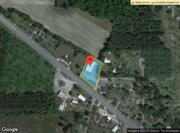
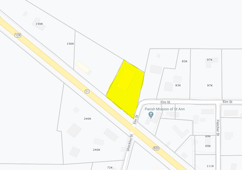
8949 Us Highway 82, Alapaha, GA 31622
NEARBY LISTINGS FOR SALE OR LEASE
-
-
View all Alapaha listings for sale on LoopNet.com
Property Detail
8949 Us Highway 82
047A-22-002
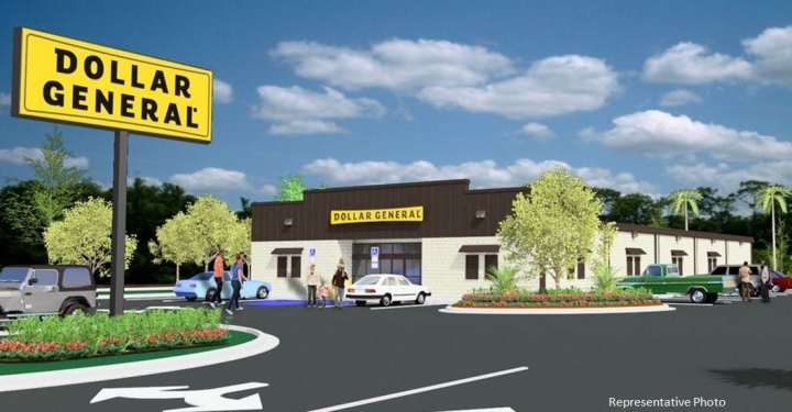
Acres Dollar General Store/Land
Wholesaleoutletdiscountstore
1.107 ACRES DOLLAR GENERAL STORE
X
Berrien
13019C0075B
Georgia
2024
409
2024
1.10 AC
970100
Georgia South Area
9,288 SF
Other Market Areas
DEMOGRAPHICS near 8949 Us Highway 82
1 Mile
3 Mile
5 Mile
2024 Total Population
419
614
1,214
2029 Population
408
602
1,196
Pop Growth 2024-2029
(2.63%)
(1.95%)
(1.48%)
Average Age
41
41
42
2024 Total Households
167
246
486
HH Growth 2024-2029
(2.40%)
(2.03%)
(1.44%)
Median Household Inc
$37,999
$44,999
$52,024
Avg Household Size
2.50
2.50
2.50
2024 Avg HH Vehicles
2.00
2.00
2.00
Median Home Value
$86,110
$96,874
$126,190
Median Year Built
1976
1977
1978
Nearby Places
- Restaurants
- Banks
- Shops
- Fitness
- Groceries
SALE & LEASE HISTORY
LISTING DATE
SALE/LEASE

Sep 23, 2016
For Sale
Nearby Properties
Address
Land Use
TOTAL SIZE
Lot Size
Zoning
Address
Land Use
TOTAL SIZE
Lot Size
Zoning
739.92 AC
RESIDENTIA
Address
Land Use
TOTAL SIZE
Lot Size
Zoning
1,860 SF
428.31 AC
UNZONED RU
Address
Land Use
TOTAL SIZE
Lot Size
Zoning
784 SF
329.14 AC
UNZONED RU
Address
Land Use
TOTAL SIZE
Lot Size
Zoning
46.25 AC
UNZONED RU
Address
Land Use
TOTAL SIZE
Lot Size
Zoning
248.29 AC
Address
Land Use
TOTAL SIZE
Lot Size
Zoning
8,320 SF
1.45 AC
Address
Land Use
TOTAL SIZE
Lot Size
Zoning
4,830 SF
4.69 AC
COMMERCIAL
Address
Land Use
TOTAL SIZE
Lot Size
Zoning
4,182 SF
0.65 AC
RESIDENTIA
Address
Land Use
TOTAL SIZE
Lot Size
Zoning
1,500 SF
89 AC
RURAL
Address
Land Use
TOTAL SIZE
Lot Size
Zoning
10.86 AC
Address
Land Use
TOTAL SIZE
Lot Size
Zoning
1,260 SF
0.58 AC
RESIDENTIA
Address
Land Use
TOTAL SIZE
Lot Size
Zoning
444 SF
101.02 AC
RURAL
Address
Land Use
TOTAL SIZE
Lot Size
Zoning
2,400 SF
50.02 AC
RESIDENTIA
Address
Land Use
TOTAL SIZE
Lot Size
Zoning
3,528 SF
1.60 AC
RESIDENTIA
Address
Land Use
TOTAL SIZE
Lot Size
Zoning
73.32 AC
UNZONED RU
Address
Land Use
TOTAL SIZE
Lot Size
Zoning
3,200 SF
1.52 AC
COMMERCIAL
Address
Land Use
TOTAL SIZE
Lot Size
Zoning
1,568 SF
53.55 AC
UNZONED RU
Address
Land Use
TOTAL SIZE
Lot Size
Zoning
1,700 SF
0.21 AC
RESIDENTIA
Address
Land Use
TOTAL SIZE
Lot Size
Zoning
19.69 AC
RESIDENTIA
Address
Land Use
TOTAL SIZE
Lot Size
Zoning
2,040 SF
0.25 AC
RESIDENTIA
Address
Land Use
TOTAL SIZE
Lot Size
Zoning
1,815 SF
0.19 AC
RESIDENTIA
Address
Land Use
TOTAL SIZE
Lot Size
Zoning
6,428 SF
0.38 AC
RESIDENTIA
Address
Land Use
TOTAL SIZE
Lot Size
Zoning
34 AC
UNZONED SM
Address
Land Use
TOTAL SIZE
Lot Size
Zoning
4,500 SF
0.19 AC
RESIDENTIA
Address
Land Use
TOTAL SIZE
Lot Size
Zoning
26.90 AC
RESIDENTIA
The World's #1 Commercial Real Estate Marketplace
Connect with us
© 2025 CoStar Group
The information above has been obtained from sources believed reliable. While we do not doubt its accuracy we have not verified it and make no guarantee, warranty or representation about it. It is your responsibility to independently confirm its accuracy and completeness. Any projections, opinions, assumptions, or estimates used are for example only and do not represent the current or future performance of the property. The value of this transaction to you depends on tax and other factors which should be evaluated by your tax, financial, and legal advisors. You and your advisors should conduct a careful, independent investigation of the property to determine to your satisfaction the suitability of the property for your needs.