Property Record
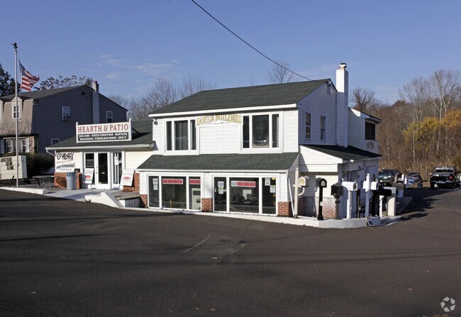
90 Buck Rd, Southampton, PA 18966


Property Detail
90 Buck Rd
31-029-008
LOT #4 MILL CREEK FARMS 104X234
Transientlodging
Bucks
C2
Pennsylvania
AE The base floodplain where base flood elevations are provided. AE Zones are now used on new format FIRMs instead of A1-A30 Zones.
4
2025
0.56 AC
2026
Lower Bucks County
105004
Philadelphia
1,548 SF
Philadelphia-Camden-Wilmington, PA-NJ-DE-MD
NEARBY LISTINGS FOR SALE OR LEASE
DEMOGRAPHICS near 90 Buck Rd
1 mile
3 mile
5 mile
2025 Total Population
5,192
64,023
198,201
2030 Population
5,191
64,192
197,785
Pop Growth 2025-2030
(0.02%)
+ 0.26%
(0.21%)
Average Age
44
44
44
2025 Total Households
1,887
23,324
74,650
HH Growth 2025-2030
(0.05%)
+ 0.12%
(0.29%)
Median Household Inc
$104,375
$115,714
$100,265
Avg Household Size
2.70
2.70
2.60
2025 Avg HH Vehicles
2.00
2.00
2.00
Median Home Value
$456,395
$459,920
$434,587
Median Year Built
1973
1971
1973
Nearby Places
Map Layers
Map Styles
 Street
 Aerial
Layers
 Traffic
 Biking
Places
Listings with unknown addresses are not visible on the map
- Restaurants
- Banks
- Shops
- Fitness
- Groceries
PUBLIC TRANSPORTATION
COMMUTER RAIL
Neshaminy Falls (R3 - Southeastern Pennsylvania Transportation Authority Regional Rail (SEPTA Regional Rail))
Drive
Walk
Distance
Neshaminy Falls (R3 - Southeastern Pennsylvania Transportation Authority Regional Rail (SEPTA Regional Rail))
6 min
2.7 mi
Trevose (R3 - Southeastern Pennsylvania Transportation Authority Regional Rail (SEPTA Regional Rail))
Drive
Walk
Distance
Trevose (R3 - Southeastern Pennsylvania Transportation Authority Regional Rail (SEPTA Regional Rail))
6 min
3.1 mi
AIRPORT
Trenton Mercer
Drive
Walk
Distance
Trenton Mercer
25 min
14.1 mi
Philadelphia International
Drive
Walk
Distance
Philadelphia International
50 min
32.8 mi
Lehigh Valley International
Drive
Walk
Distance
Lehigh Valley International
83 min
48.0 mi
Freight Ports
Port of Philadelphia
Drive
Walk
Distance
Port of Philadelphia
29 min
15.2 mi
SALE & LEASE HISTORY
LISTING DATE
SALE/LEASE

Jun 20, 2017
For Lease
Dec 27, 2016
For Lease
Nearby Properties
Address
Land Use
TOTAL SIZE
Lot Size
Zoning
Address
Land Use
TOTAL SIZE
Lot Size
Zoning
189,541 SF
13.58 AC
RM2
Address
Land Use
TOTAL SIZE
Lot Size
Zoning
75,497 SF
7.67 AC
CA1
Address
Land Use
TOTAL SIZE
Lot Size
Zoning
50,170 SF
1.84 AC
RM2
Address
Land Use
TOTAL SIZE
Lot Size
Zoning
19,484 SF
2.35 AC
RSA2
Address
Land Use
TOTAL SIZE
Lot Size
Zoning
30,144 SF
0.72 AC
RM2
Address
Land Use
TOTAL SIZE
Lot Size
Zoning
759,617 SF
23.82 AC
HC
Address
Land Use
TOTAL SIZE
Lot Size
Zoning
78,743 SF
44.63 AC
IP
Address
Land Use
TOTAL SIZE
Lot Size
Zoning
14,580 SF
1.10 AC
CMX1
Address
Land Use
TOTAL SIZE
Lot Size
Zoning
221,740 SF
13 AC
CS
Address
Land Use
TOTAL SIZE
Lot Size
Zoning
11,632 SF
18.19 AC
I
Address
Land Use
TOTAL SIZE
Lot Size
Zoning
12,811 SF
1.01 AC
CA1
Address
Land Use
TOTAL SIZE
Lot Size
Zoning
5,878 SF
0.65 AC
CA1
Address
Land Use
TOTAL SIZE
Lot Size
Zoning
206,720 SF
0.97 AC
C
Address
Land Use
TOTAL SIZE
Lot Size
Zoning
71,538 SF
12.28 AC
P1
Address
Land Use
TOTAL SIZE
Lot Size
Zoning
199,758 SF
22.16 AC
HC
Address
Land Use
TOTAL SIZE
Lot Size
Zoning
110,473 SF
13.96 AC
C
Address
Land Use
TOTAL SIZE
Lot Size
Zoning
117,294 SF
11.80 AC
C
Address
Land Use
TOTAL SIZE
Lot Size
Zoning
142,381 SF
14.69 AC
C
Address
Land Use
TOTAL SIZE
Lot Size
Zoning
33,084 SF
11.32 AC
CD
Address
Land Use
TOTAL SIZE
Lot Size
Zoning
26,340 SF
11.82 AC
CD
Address
Land Use
TOTAL SIZE
Lot Size
Zoning
29,850 SF
14.08 AC
GA
Address
Land Use
TOTAL SIZE
Lot Size
Zoning
12,285 SF
0.69 AC
RSA2
Address
Land Use
TOTAL SIZE
Lot Size
Zoning
82,358 SF
18.96 AC
M1
Address
Land Use
TOTAL SIZE
Lot Size
Zoning
4,000 SF
29.21 AC
R4
Address
Land Use
TOTAL SIZE
Lot Size
Zoning
110,625 SF
12.18 AC
CS
Address
Land Use
TOTAL SIZE
Lot Size
Zoning
218,569 SF
30.50 AC
M-1
Address
Land Use
TOTAL SIZE
Lot Size
Zoning
4,900 SF
1.14 AC
RSA2
Address
Land Use
TOTAL SIZE
Lot Size
Zoning
133,964 SF
5.53 AC
R1
Address
Land Use
TOTAL SIZE
Lot Size
Zoning
8,050 SF
0.47 AC
RSA2
Address
Land Use
TOTAL SIZE
Lot Size
Zoning
130,060 SF
7.74 AC
C
The World's #1 Commercial Real Estate Marketplace
Connect with us
© 2026 CoStar Group
The information above has been obtained from sources believed reliable. While we do not doubt its accuracy we have not verified it and make no guarantee, warranty or representation about it. It is your responsibility to independently confirm its accuracy and completeness. Any projections, opinions, assumptions, or estimates used are for example only and do not represent the current or future performance of the property. The value of this transaction to you depends on tax and other factors which should be evaluated by your tax, financial, and legal advisors. You and your advisors should conduct a careful, independent investigation of the property to determine to your satisfaction the suitability of the property for your needs.