Property Record
900 E Arrowood Rd, Charlotte, NC 28217


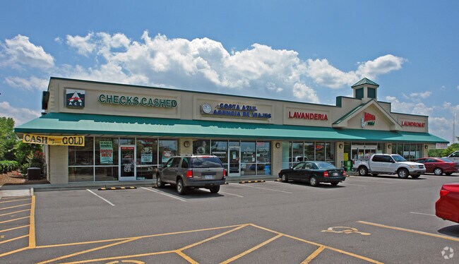
Property Detail
900 E Arrowood Rd
205-173-08
L2B M35-989
Regionalshoppingcenterormallwithanchorstore
Mecklenburg
TOD-CC
North Carolina
B and X Area of moderate flood hazard, usually the area between the limits of the 100-year and 500-year floods.
2b
0
0.81 AC
2025
Inner Southeast
005824
Charlotte
7,552 SF
Charlotte-Concord-Gastonia, NC-SC
NEARBY LISTINGS FOR SALE OR LEASE
DEMOGRAPHICS near 900 E Arrowood Rd
1 mile
3 mile
5 mile
2025 Total Population
18,145
89,918
214,079
2030 Population
19,656
97,397
232,502
Pop Growth 2025-2030
+ 8.33%
+ 8.32%
+ 8.61%
Average Age
33
37
38
2025 Total Households
7,089
39,569
93,257
HH Growth 2025-2030
+ 8.27%
+ 8.37%
+ 8.71%
Median Household Inc
$64,687
$81,465
$95,748
Avg Household Size
2.50
2.20
2.20
2025 Avg HH Vehicles
2.00
2.00
2.00
Median Home Value
$407,597
$521,280
$603,652
Median Year Built
1989
1986
1989
Nearby Places
Map Layers
Map Styles
 Street
 Aerial
Transit
 Traffic
 Biking
Places
Listings with unknown addresses are not visible on the map
- Restaurants
- Banks
- Shops
- Fitness
- Groceries
PUBLIC TRANSPORTATION
COMMUTER RAIL
Drive
Walk
Distance
17 min
9.4 mi
AIRPORT
Charlotte/Douglas International
Drive
Walk
Distance
Charlotte/Douglas International
19 min
9.1 mi
Concord-Padgett Regional
Drive
Walk
Distance
Concord-Padgett Regional
38 min
24.4 mi
SALE & LEASE HISTORY
LISTING DATE
SALE/LEASE

Sep 25, 2016
For Lease
Nearby Properties
Address
Land Use
TOTAL SIZE
Lot Size
Zoning
Address
Land Use
TOTAL SIZE
Lot Size
Zoning
875,672 SF
41.66 AC
CC
Address
Land Use
TOTAL SIZE
Lot Size
Zoning
965,867 SF
5.81 AC
O1
Address
Land Use
TOTAL SIZE
Lot Size
Zoning
709,410 SF
22.24 AC
INSTCD
Address
Land Use
TOTAL SIZE
Lot Size
Zoning
605,976 SF
46.31 AC
R17MF
Address
Land Use
TOTAL SIZE
Lot Size
Zoning
711,907 SF
4.84 AC
Address
Land Use
TOTAL SIZE
Lot Size
Zoning
573,667 SF
5.81 AC
MUDDO
Address
Land Use
TOTAL SIZE
Lot Size
Zoning
646,209 SF
72.24 AC
CC
Address
Land Use
TOTAL SIZE
Lot Size
Zoning
546,111 SF
4.85 AC
MUDDCD
Address
Land Use
TOTAL SIZE
Lot Size
Zoning
572,979 SF
5.60 AC
O3
Address
Land Use
TOTAL SIZE
Lot Size
Zoning
528,907 SF
18.13 AC
CC
Address
Land Use
TOTAL SIZE
Lot Size
Zoning
460,937 SF
2.67 AC
O1
Address
Land Use
TOTAL SIZE
Lot Size
Zoning
544,973 SF
3.42 AC
Address
Land Use
TOTAL SIZE
Lot Size
Zoning
393,779 SF
26.71 AC
R17MF
Address
Land Use
TOTAL SIZE
Lot Size
Zoning
356,838 SF
27.63 AC
B1
Address
Land Use
TOTAL SIZE
Lot Size
Zoning
427,305 SF
3.21 AC
O2CD
Address
Land Use
TOTAL SIZE
Lot Size
Zoning
326,013 SF
25.59 AC
RMF
Address
Land Use
TOTAL SIZE
Lot Size
Zoning
471,303 SF
4.30 AC
O3
Address
Land Use
TOTAL SIZE
Lot Size
Zoning
408,632 SF
50 AC
R12MFCD
Address
Land Use
TOTAL SIZE
Lot Size
Zoning
518,503 SF
5.34 AC
O1
Address
Land Use
TOTAL SIZE
Lot Size
Zoning
430,000 SF
7.25 AC
MUDDO
Address
Land Use
TOTAL SIZE
Lot Size
Zoning
381,729 SF
22.37 AC
R17MF
Address
Land Use
TOTAL SIZE
Lot Size
Zoning
371,416 SF
30.90 AC
BPCD
Address
Land Use
TOTAL SIZE
Lot Size
Zoning
424,279 SF
4.20 AC
R43MF
Address
Land Use
TOTAL SIZE
Lot Size
Zoning
298,298 SF
16.60 AC
R17MFCD
Address
Land Use
TOTAL SIZE
Lot Size
Zoning
339,546 SF
7.52 AC
Address
Land Use
TOTAL SIZE
Lot Size
Zoning
307,493 SF
24.47 AC
R12MFCD
Address
Land Use
TOTAL SIZE
Lot Size
Zoning
604,827 SF
41.01 AC
O1CD
Address
Land Use
TOTAL SIZE
Lot Size
Zoning
302,196 SF
6.60 AC
I2
Address
Land Use
TOTAL SIZE
Lot Size
Zoning
476,244 SF
2.78 AC
Address
Land Use
TOTAL SIZE
Lot Size
Zoning
231,502 SF
2.22 AC
MUDDO
The World's #1 Commercial Real Estate Marketplace
Connect with us
© 2026 CoStar Group
The information above has been obtained from sources believed reliable. While we do not doubt its accuracy we have not verified it and make no guarantee, warranty or representation about it. It is your responsibility to independently confirm its accuracy and completeness. Any projections, opinions, assumptions, or estimates used are for example only and do not represent the current or future performance of the property. The value of this transaction to you depends on tax and other factors which should be evaluated by your tax, financial, and legal advisors. You and your advisors should conduct a careful, independent investigation of the property to determine to your satisfaction the suitability of the property for your needs.