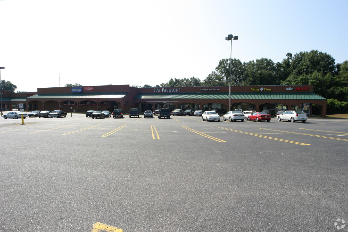
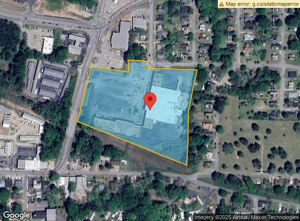
Property Record
900 Hogansville Rd, Lagrange, GA 30241
NEARBY LISTINGS FOR SALE OR LEASE
Property Detail
900 Hogansville Rd
LaGrange, GA
Lakewood Estates (1-2)
050-2D-015-009
900 A-S & 908 HOGANSVILLE RD/PB 2 PG 323/PB-2
Stripcommercialcenter
Troup
X
Georgia
13285C0142E
182
2024
8.23 AC
2024
Troup County
960501
Columbus GA
76,540 SF
DEMOGRAPHICS near 900 Hogansville Rd
1 Mile
3 Mile
5 Mile
2024 Total Population
6,033
30,796
38,978
2029 Population
6,093
31,400
39,667
Pop Growth 2024-2029
+ 0.99%
+ 1.96%
+ 1.77%
Average Age
36
37
38
2024 Total Households
2,360
12,020
14,989
HH Growth 2024-2029
+ 1.02%
+ 1.96%
+ 1.80%
Median Household Inc
$42,463
$44,186
$45,822
Avg Household Size
2.50
2.50
2.50
2024 Avg HH Vehicles
2.00
2.00
2.00
Median Home Value
$104,430
$149,362
$162,778
Median Year Built
1980
1980
1981
Nearby Places
- Restaurants
- Banks
- Shops
- Fitness
- Groceries
SALE & LEASE HISTORY
LISTING DATE
SALE/LEASE

Sep 25, 2016
For Lease
Nov 22, 2016
For Lease
Jan 19, 2017
For Lease
Aug 07, 2018
For Lease
Nearby Properties
Address
Land Use
TOTAL SIZE
Lot Size
Zoning
Address
Land Use
TOTAL SIZE
Lot Size
Zoning
2,095 SF
16.50 AC
16- CP-GB
Address
Land Use
TOTAL SIZE
Lot Size
Zoning
Address
Land Use
TOTAL SIZE
Lot Size
Zoning
17,328 SF
10.66 AC
16- CP-GB
Address
Land Use
TOTAL SIZE
Lot Size
Zoning
109,533 SF
1.80 AC
16- DT-MX
Address
Land Use
TOTAL SIZE
Lot Size
Zoning
28,575 SF
45.67 AC
16- CR-MX
Address
Land Use
TOTAL SIZE
Lot Size
Zoning
174,899 SF
7.52 AC
16- TN-R
Address
Land Use
TOTAL SIZE
Lot Size
Zoning
35,269 SF
22.34 AC
16- CR-MR
Address
Land Use
TOTAL SIZE
Lot Size
Zoning
20,096 SF
36.59 AC
16- AC-MX
Address
Land Use
TOTAL SIZE
Lot Size
Zoning
25,314 SF
25.48 AC
16- AC-MR
Address
Land Use
TOTAL SIZE
Lot Size
Zoning
2,152 SF
21.70 AC
16- CR-MR
Address
Land Use
TOTAL SIZE
Lot Size
Zoning
117,684 SF
12.61 AC
16- AC-MX
Address
Land Use
TOTAL SIZE
Lot Size
Zoning
Address
Land Use
TOTAL SIZE
Lot Size
Zoning
190,149 SF
20.67 AC
16- CP-GI
Address
Land Use
TOTAL SIZE
Lot Size
Zoning
92,907 SF
41.61 AC
16- CP-GI
Address
Land Use
TOTAL SIZE
Lot Size
Zoning
141,328 SF
7.18 AC
16- TN-MX
Address
Land Use
TOTAL SIZE
Lot Size
Zoning
159,645 SF
2.98 AC
16- DT-MX
Address
Land Use
TOTAL SIZE
Lot Size
Zoning
3,798 SF
22.81 AC
16- CR-MR
Address
Land Use
TOTAL SIZE
Lot Size
Zoning
29,520 SF
1.92 AC
16- CP-GB
Address
Land Use
TOTAL SIZE
Lot Size
Zoning
56,620 SF
5.22 AC
16- CR-MX
Address
Land Use
TOTAL SIZE
Lot Size
Zoning
136,640 SF
41.91 AC
16- CP-GI
Address
Land Use
TOTAL SIZE
Lot Size
Zoning
551,306 SF
72.64 AC
16- CP-GI
Address
Land Use
TOTAL SIZE
Lot Size
Zoning
27,080 SF
27.40 AC
16- CP-GB
Address
Land Use
TOTAL SIZE
Lot Size
Zoning
9,290 SF
11.58 AC
16- CP-GB
Address
Land Use
TOTAL SIZE
Lot Size
Zoning
Address
Land Use
TOTAL SIZE
Lot Size
Zoning
56,580 SF
12.87 AC
16- CR-MX
Address
Land Use
TOTAL SIZE
Lot Size
Zoning
8,448 SF
25.78 AC
16- CR-MX
Address
Land Use
TOTAL SIZE
Lot Size
Zoning
3,433 SF
19.65 AC
16- CR-MR
Address
Land Use
TOTAL SIZE
Lot Size
Zoning
4,428 SF
9.67 AC
16- CR-MR
Address
Land Use
TOTAL SIZE
Lot Size
Zoning
2,366 SF
8.70 AC
16- CR-MR
Address
Land Use
TOTAL SIZE
Lot Size
Zoning
202,500 SF
17.55 AC
16- CP-GI
The World's #1 Commercial Real Estate Marketplace
Connect with us
© 2025 CoStar Group
The information above has been obtained from sources believed reliable. While we do not doubt its accuracy we have not verified it and make no guarantee, warranty or representation about it. It is your responsibility to independently confirm its accuracy and completeness. Any projections, opinions, assumptions, or estimates used are for example only and do not represent the current or future performance of the property. The value of this transaction to you depends on tax and other factors which should be evaluated by your tax, financial, and legal advisors. You and your advisors should conduct a careful, independent investigation of the property to determine to your satisfaction the suitability of the property for your needs.