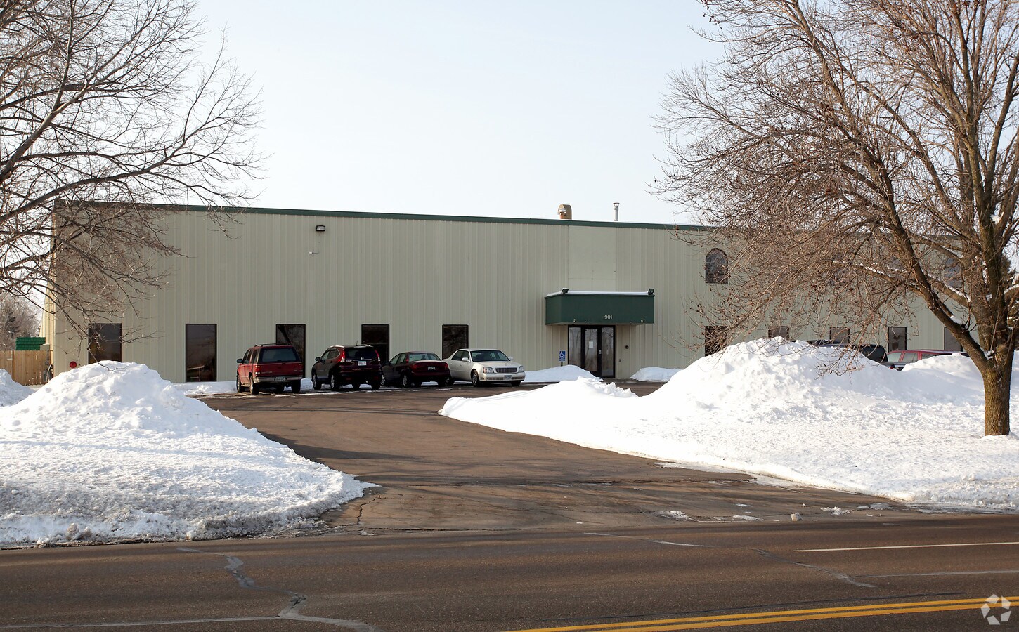
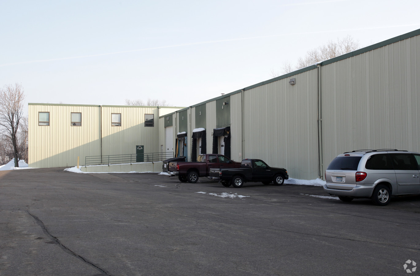
Property Record
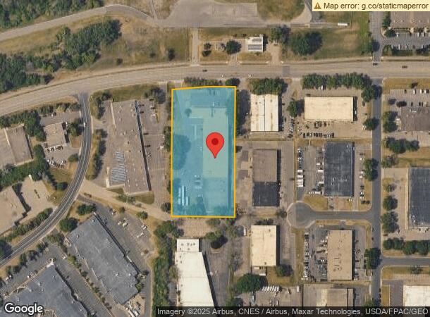
901 Cliff Rd E, Burnsville, MN 55337
This Property Is For Sale
NEARBY LISTINGS FOR SALE OR LEASE
Property Detail
901 Cliff Rd E
Minneapolis-St. Paul-Bloomington, MN-WI
Riverwood Industrial Park Plat 5
02-64304-02-030
RIVERWOOD INDUSTRIAL PARK PLAT 5 3 2
Industrialgeneral
Dakota
X
Minnesota
27053C0467F
30
2024
2.93 AC
2023
South Central
060748
Minneapolis/St Paul
46,432 SF
DEMOGRAPHICS near 901 Cliff Rd E
1 Mile
3 Mile
5 Mile
2024 Total Population
7,088
67,642
196,335
2029 Population
7,254
68,172
198,287
Pop Growth 2024-2029
+ 2.34%
+ 0.78%
+ 0.99%
Average Age
39
40
41
2024 Total Households
3,125
27,307
77,826
HH Growth 2024-2029
+ 2.46%
+ 0.78%
+ 0.99%
Median Household Inc
$72,139
$83,030
$85,524
Avg Household Size
2.20
2.40
2.40
2024 Avg HH Vehicles
2.00
2.00
2.00
Median Home Value
$266,991
$300,234
$311,215
Median Year Built
1985
1977
1978
Nearby Places
- Restaurants
- Banks
- Shops
- Fitness
- Groceries
PUBLIC TRANSPORTATION
AIRPORT
Minneapolis-St Paul International/Wold-Chamberlain
DRIVE
WALK
Distance
Minneapolis-St Paul International/Wold-Chamberlain
17 min
9.3 mi
Freight Ports
Port Milwaukee
DRIVE
WALK
Distance
Port Milwaukee
382 min
343.8 mi
Nearby Properties
Address
Land Use
TOTAL SIZE
Lot Size
Zoning
Address
Land Use
TOTAL SIZE
Lot Size
Zoning
1,341.19 AC
Address
Land Use
TOTAL SIZE
Lot Size
Zoning
129,658 SF
13.52 AC
Address
Land Use
TOTAL SIZE
Lot Size
Zoning
122,021 SF
21.74 AC
Address
Land Use
TOTAL SIZE
Lot Size
Zoning
142,229 SF
26.61 AC
Address
Land Use
TOTAL SIZE
Lot Size
Zoning
282,095 SF
2.71 AC
Address
Land Use
TOTAL SIZE
Lot Size
Zoning
230,883 SF
2.49 AC
Address
Land Use
TOTAL SIZE
Lot Size
Zoning
419,750 SF
13.83 AC
Address
Land Use
TOTAL SIZE
Lot Size
Zoning
374,415 SF
20.10 AC
Address
Land Use
TOTAL SIZE
Lot Size
Zoning
287,255 SF
14.69 AC
Address
Land Use
TOTAL SIZE
Lot Size
Zoning
265,406 SF
26.78 AC
Address
Land Use
TOTAL SIZE
Lot Size
Zoning
178,425 SF
9.18 AC
Address
Land Use
TOTAL SIZE
Lot Size
Zoning
419,750 SF
10.86 AC
Address
Land Use
TOTAL SIZE
Lot Size
Zoning
112.48 AC
Address
Land Use
TOTAL SIZE
Lot Size
Zoning
158,620 SF
1.80 AC
Address
Land Use
TOTAL SIZE
Lot Size
Zoning
171,832 SF
6.14 AC
Address
Land Use
TOTAL SIZE
Lot Size
Zoning
36,921 SF
3.26 AC
Address
Land Use
TOTAL SIZE
Lot Size
Zoning
85,602 SF
5.66 AC
Address
Land Use
TOTAL SIZE
Lot Size
Zoning
41,970 SF
5.24 AC
Address
Land Use
TOTAL SIZE
Lot Size
Zoning
20,545 SF
1.48 AC
Address
Land Use
TOTAL SIZE
Lot Size
Zoning
231,928 SF
16.63 AC
Address
Land Use
TOTAL SIZE
Lot Size
Zoning
169,984 SF
6.03 AC
Address
Land Use
TOTAL SIZE
Lot Size
Zoning
287,255 SF
6.68 AC
Address
Land Use
TOTAL SIZE
Lot Size
Zoning
27,395 SF
1.41 AC
Address
Land Use
TOTAL SIZE
Lot Size
Zoning
95,763 SF
34.55 AC
Address
Land Use
TOTAL SIZE
Lot Size
Zoning
Address
Land Use
TOTAL SIZE
Lot Size
Zoning
Address
Land Use
TOTAL SIZE
Lot Size
Zoning
Address
Land Use
TOTAL SIZE
Lot Size
Zoning
Address
Land Use
TOTAL SIZE
Lot Size
Zoning
58,458 SF
9.91 AC
The World's #1 Commercial Real Estate Marketplace
Connect with us
© 2025 CoStar Group
The information above has been obtained from sources believed reliable. While we do not doubt its accuracy we have not verified it and make no guarantee, warranty or representation about it. It is your responsibility to independently confirm its accuracy and completeness. Any projections, opinions, assumptions, or estimates used are for example only and do not represent the current or future performance of the property. The value of this transaction to you depends on tax and other factors which should be evaluated by your tax, financial, and legal advisors. You and your advisors should conduct a careful, independent investigation of the property to determine to your satisfaction the suitability of the property for your needs.