Property Record
901 Stryker St, Archbold, OH 43502

NEARBY LISTINGS FOR SALE OR LEASE
Property Detail
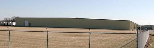
901 Stryker St
17-033580-00.000
5E-7N-32 PT N1/2 NW SE 50 FT X 30 FT NW COR PAR 64 .03A
Foodprocessing
Fulton
X
Ohio
39051C0164D
19.74 AC
2024
Fulton County
2023
Toledo
040900
Toledo, OH
10,804 SF
DEMOGRAPHICS near 901 Stryker St
1 Mile
3 Mile
5 Mile
2024 Total Population
3,538
5,418
7,402
2029 Population
3,510
5,356
7,250
Pop Growth 2024-2029
(0.79%)
(1.14%)
(2.05%)
Average Age
43
43
42
2024 Total Households
1,464
2,223
2,939
HH Growth 2024-2029
(0.82%)
(1.17%)
(2.04%)
Median Household Inc
$65,930
$66,040
$68,220
Avg Household Size
2.30
2.30
2.40
2024 Avg HH Vehicles
2.00
2.00
2.00
Median Home Value
$165,679
$167,347
$170,482
Median Year Built
1968
1968
1966
Nearby Places
- Restaurants
- Banks
- Shops
- Fitness
- Groceries
PUBLIC TRANSPORTATION
AIRPORT
Eugene F Kranz Toledo Express
DRIVE
WALK
Distance
Eugene F Kranz Toledo Express
53 min
31.3 mi
Freight Ports
Port of Toledo
DRIVE
WALK
Distance
Port of Toledo
76 min
55.7 mi
Nearby Properties
Address
Land Use
TOTAL SIZE
Lot Size
Zoning
Address
Land Use
TOTAL SIZE
Lot Size
Zoning
751,940 SF
37.84 AC
M2
Address
Land Use
TOTAL SIZE
Lot Size
Zoning
103,304 SF
39.67 AC
S
Address
Land Use
TOTAL SIZE
Lot Size
Zoning
10.21 AC
S
Address
Land Use
TOTAL SIZE
Lot Size
Zoning
32.55 AC
Address
Land Use
TOTAL SIZE
Lot Size
Zoning
712,800 SF
10 AC
M2
Address
Land Use
TOTAL SIZE
Lot Size
Zoning
16,831 SF
10.18 AC
Address
Land Use
TOTAL SIZE
Lot Size
Zoning
29,338 SF
2.35 AC
Address
Land Use
TOTAL SIZE
Lot Size
Zoning
66,680 SF
17.17 AC
S
Address
Land Use
TOTAL SIZE
Lot Size
Zoning
39,044 SF
23.36 AC
Address
Land Use
TOTAL SIZE
Lot Size
Zoning
52,861 SF
9.20 AC
M2
Address
Land Use
TOTAL SIZE
Lot Size
Zoning
99,156 SF
1.04 AC
S
Address
Land Use
TOTAL SIZE
Lot Size
Zoning
502,500 SF
35.95 AC
M2
Address
Land Use
TOTAL SIZE
Lot Size
Zoning
150,946 SF
4.09 AC
M2
Address
Land Use
TOTAL SIZE
Lot Size
Zoning
66,000 SF
4.45 AC
M1
Address
Land Use
TOTAL SIZE
Lot Size
Zoning
243,100 SF
5.99 AC
M2
Address
Land Use
TOTAL SIZE
Lot Size
Zoning
21,838 SF
3.75 AC
Address
Land Use
TOTAL SIZE
Lot Size
Zoning
76.22 AC
S
Address
Land Use
TOTAL SIZE
Lot Size
Zoning
298,080 SF
31.20 AC
M2
Address
Land Use
TOTAL SIZE
Lot Size
Zoning
26,144 SF
7.29 AC
S
Address
Land Use
TOTAL SIZE
Lot Size
Zoning
72,000 SF
10.63 AC
M2
Address
Land Use
TOTAL SIZE
Lot Size
Zoning
1,600 SF
15 AC
M2
Address
Land Use
TOTAL SIZE
Lot Size
Zoning
27,211 SF
2.35 AC
R2
Address
Land Use
TOTAL SIZE
Lot Size
Zoning
10,392 SF
11.88 AC
S
Address
Land Use
TOTAL SIZE
Lot Size
Zoning
28,361 SF
5.65 AC
B2
Address
Land Use
TOTAL SIZE
Lot Size
Zoning
242,865 SF
13.39 AC
M2
Address
Land Use
TOTAL SIZE
Lot Size
Zoning
1,860 SF
53.60 AC
S
Address
Land Use
TOTAL SIZE
Lot Size
Zoning
93,155 SF
7.23 AC
M2
Address
Land Use
TOTAL SIZE
Lot Size
Zoning
22,129 SF
4.06 AC
S
Address
Land Use
TOTAL SIZE
Lot Size
Zoning
4,236 SF
6.73 AC
M1
The World's #1 Commercial Real Estate Marketplace
Connect with us
© 2025 CoStar Group
The information above has been obtained from sources believed reliable. While we do not doubt its accuracy we have not verified it and make no guarantee, warranty or representation about it. It is your responsibility to independently confirm its accuracy and completeness. Any projections, opinions, assumptions, or estimates used are for example only and do not represent the current or future performance of the property. The value of this transaction to you depends on tax and other factors which should be evaluated by your tax, financial, and legal advisors. You and your advisors should conduct a careful, independent investigation of the property to determine to your satisfaction the suitability of the property for your needs.