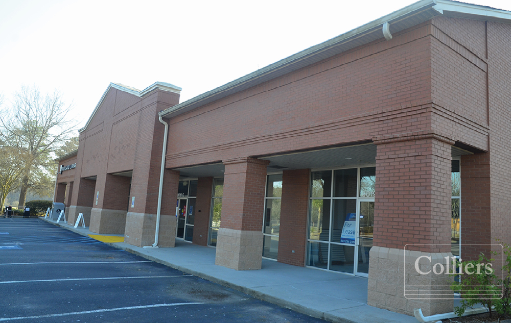
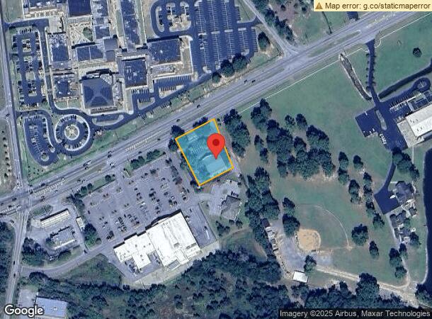
Property Record
9019 Garners Ferry Rd, Hopkins, SC 29061
NEARBY LISTINGS FOR SALE OR LEASE
-
-
View all Hopkins listings for lease on LoopNet.com
Property Detail
9019 Garners Ferry Rd
21800-04-21
Garners Ferry
Commercialnec
TRACT 2-A 196.7X238.1X171.6X236.6 #PR RB952-2857 1290-2622
X
Richland
45079C0405L
South Carolina
2024
1 AC
2023
Southeast Columbia
011901
Columbia
8,760 SF
Columbia, SC
DEMOGRAPHICS near 9019 Garners Ferry Rd
1 Mile
3 Mile
5 Mile
2024 Total Population
962
16,017
34,313
2029 Population
965
16,241
34,892
Pop Growth 2024-2029
+ 0.31%
+ 1.40%
+ 1.69%
Average Age
37
40
39
2024 Total Households
360
6,423
14,233
HH Growth 2024-2029
+ 0.28%
+ 1.45%
+ 1.74%
Median Household Inc
$67,031
$54,612
$55,646
Avg Household Size
2.60
2.40
2.40
2024 Avg HH Vehicles
2.00
2.00
2.00
Median Home Value
$165,034
$156,627
$160,787
Median Year Built
1999
1988
1989
Nearby Places
- Restaurants
- Banks
- Shops
- Fitness
- Groceries
PUBLIC TRANSPORTATION
AIRPORT
Columbia Metro
DRIVE
WALK
Distance
Columbia Metro
33 min
21.1 mi
Freight Ports
North Charleston Terminal
DRIVE
WALK
Distance
North Charleston Terminal
127 min
112.5 mi
SALE & LEASE HISTORY
LISTING DATE
SALE/LEASE

Sep 25, 2016
For Lease
Apr 27, 2017
For Lease
Nearby Properties
Address
Land Use
TOTAL SIZE
Lot Size
Zoning
Address
Land Use
TOTAL SIZE
Lot Size
Zoning
294,105 SF
19 AC
RG-2
Address
Land Use
TOTAL SIZE
Lot Size
Zoning
51,516 SF
9.12 AC
GC
Address
Land Use
TOTAL SIZE
Lot Size
Zoning
91,726 SF
9.54 AC
RM-HD
Address
Land Use
TOTAL SIZE
Lot Size
Zoning
19,465 SF
4.41 AC
RU
Address
Land Use
TOTAL SIZE
Lot Size
Zoning
1,399.70 AC
RU
Address
Land Use
TOTAL SIZE
Lot Size
Zoning
25,184 SF
31 AC
M-1
Address
Land Use
TOTAL SIZE
Lot Size
Zoning
7,642 SF
2.42 AC
GC
Address
Land Use
TOTAL SIZE
Lot Size
Zoning
10,868 SF
1.79 AC
GC
Address
Land Use
TOTAL SIZE
Lot Size
Zoning
30,162 SF
3.46 AC
RS-MD
Address
Land Use
TOTAL SIZE
Lot Size
Zoning
34,900 SF
20 AC
PDD
Address
Land Use
TOTAL SIZE
Lot Size
Zoning
11.72 AC
M-1
Address
Land Use
TOTAL SIZE
Lot Size
Zoning
9,591 SF
14.68 AC
RU
Address
Land Use
TOTAL SIZE
Lot Size
Zoning
6,575 SF
2.06 AC
GC
Address
Land Use
TOTAL SIZE
Lot Size
Zoning
2,800 SF
1.38 AC
GC
Address
Land Use
TOTAL SIZE
Lot Size
Zoning
8,263 SF
1.39 AC
GC
Address
Land Use
TOTAL SIZE
Lot Size
Zoning
16,460 SF
3.15 AC
RSF-3
Address
Land Use
TOTAL SIZE
Lot Size
Zoning
3,924 SF
12.41 AC
RU
Address
Land Use
TOTAL SIZE
Lot Size
Zoning
5,400 SF
0.85 AC
GC
Address
Land Use
TOTAL SIZE
Lot Size
Zoning
48.92 AC
RM-MD
Address
Land Use
TOTAL SIZE
Lot Size
Zoning
5,664 SF
1.47 AC
GC
Address
Land Use
TOTAL SIZE
Lot Size
Zoning
204.44 AC
RU
Address
Land Use
TOTAL SIZE
Lot Size
Zoning
12,438 SF
8.02 AC
RS-LD
Address
Land Use
TOTAL SIZE
Lot Size
Zoning
9,743 SF
3 AC
GC
Address
Land Use
TOTAL SIZE
Lot Size
Zoning
2,265 SF
43.87 AC
GC
Address
Land Use
TOTAL SIZE
Lot Size
Zoning
19.15 AC
PDD
Address
Land Use
TOTAL SIZE
Lot Size
Zoning
1,656 SF
4.87 AC
GC
Address
Land Use
TOTAL SIZE
Lot Size
Zoning
136.38 AC
RU
Address
Land Use
TOTAL SIZE
Lot Size
Zoning
15,000 SF
17 AC
M-1
Address
Land Use
TOTAL SIZE
Lot Size
Zoning
22,796 SF
18.49 AC
M-1
The World's #1 Commercial Real Estate Marketplace
Connect with us
© 2025 CoStar Group
The information above has been obtained from sources believed reliable. While we do not doubt its accuracy we have not verified it and make no guarantee, warranty or representation about it. It is your responsibility to independently confirm its accuracy and completeness. Any projections, opinions, assumptions, or estimates used are for example only and do not represent the current or future performance of the property. The value of this transaction to you depends on tax and other factors which should be evaluated by your tax, financial, and legal advisors. You and your advisors should conduct a careful, independent investigation of the property to determine to your satisfaction the suitability of the property for your needs.