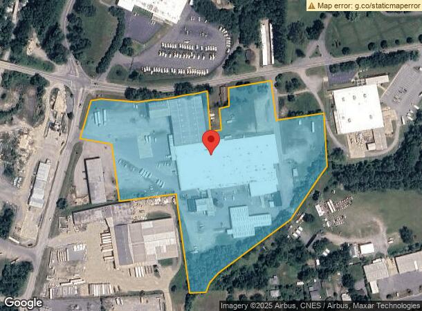
Property Record
905 Old Us Hwy 70 Hwy W, Black Mountain, NC 28711

Current Lease Availabilities
NEARBY LISTINGS FOR SALE OR LEASE
-
-
View all Black Mountain listings for lease on LoopNet.com
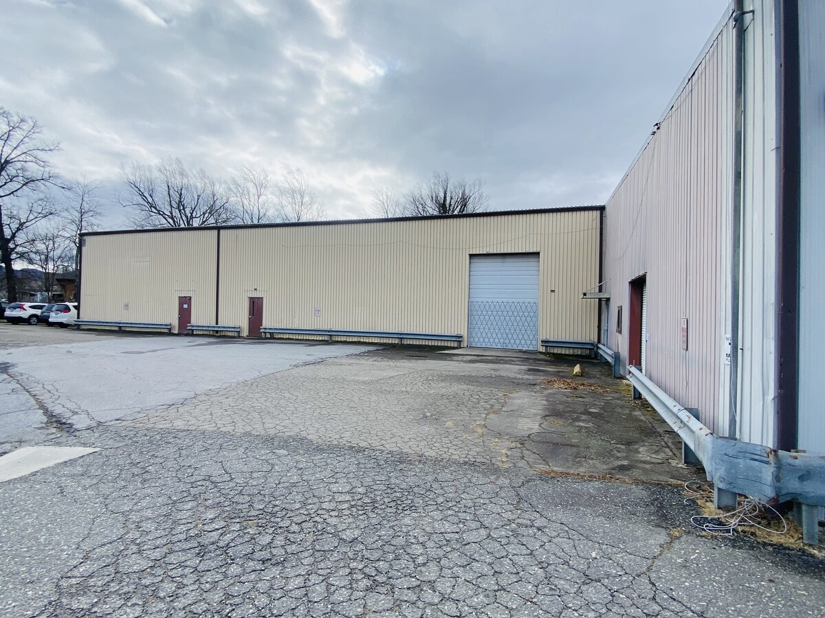
Property Detail
905 Old Us Hwy 70 Hwy W
0609-13-6165-00000
Riverside Business Park Llc
Industrialgeneral
PLAT: 0174-0111
AE
Buncombe
3710060900J
North Carolina
2023
14.02 AC
2023
Buncombe County
003107
Asheville
165,852 SF
Asheville, NC
DEMOGRAPHICS near 905 Old Us Hwy 70 Hwy W
1 Mile
3 Mile
5 Mile
2024 Total Population
2,385
15,862
26,753
2029 Population
2,486
16,519
27,862
Pop Growth 2024-2029
+ 4.23%
+ 4.14%
+ 4.15%
Average Age
49
46
45
2024 Total Households
896
6,734
10,996
HH Growth 2024-2029
+ 4.02%
+ 3.65%
+ 3.68%
Median Household Inc
$45,221
$64,996
$64,515
Avg Household Size
2.20
2.20
2.30
2024 Avg HH Vehicles
1.00
2.00
2.00
Median Home Value
$316,000
$313,014
$305,244
Median Year Built
1987
1985
1986
Nearby Places
- Restaurants
- Banks
- Shops
- Fitness
- Groceries
PUBLIC TRANSPORTATION
AIRPORT
Asheville Regional
DRIVE
WALK
Distance
Asheville Regional
33 min
20.3 mi
Freight Ports
North Charleston Terminal
DRIVE
WALK
Distance
North Charleston Terminal
305 min
264.0 mi
Nearby Properties
Address
Land Use
TOTAL SIZE
Lot Size
Zoning
Address
Land Use
TOTAL SIZE
Lot Size
Zoning
300,000 SF
51.82 AC
PS
Address
Land Use
TOTAL SIZE
Lot Size
Zoning
810,074 SF
46.41 AC
LI-8
Address
Land Use
TOTAL SIZE
Lot Size
Zoning
192,232 SF
119.64 AC
OI-6
Address
Land Use
TOTAL SIZE
Lot Size
Zoning
323,429 SF
1,005.50 AC
PS
Address
Land Use
TOTAL SIZE
Lot Size
Zoning
405,624 SF
75.73 AC
OI-6
Address
Land Use
TOTAL SIZE
Lot Size
Zoning
208,084 SF
156.33 AC
PS
Address
Land Use
TOTAL SIZE
Lot Size
Zoning
93,360 SF
12.51 AC
PS
Address
Land Use
TOTAL SIZE
Lot Size
Zoning
131,752 SF
42.98 AC
PS
Address
Land Use
TOTAL SIZE
Lot Size
Zoning
53,002 SF
7.06 AC
I
Address
Land Use
TOTAL SIZE
Lot Size
Zoning
44,450 SF
8.97 AC
PS
Address
Land Use
TOTAL SIZE
Lot Size
Zoning
771,179 SF
73.04 AC
LI-8
Address
Land Use
TOTAL SIZE
Lot Size
Zoning
27,837 SF
1,153.53 AC
CR
Address
Land Use
TOTAL SIZE
Lot Size
Zoning
72,628 SF
8.65 AC
C-2
Address
Land Use
TOTAL SIZE
Lot Size
Zoning
105,431 SF
10.79 AC
HB-8
Address
Land Use
TOTAL SIZE
Lot Size
Zoning
70,225 SF
278.55 AC
PS
Address
Land Use
TOTAL SIZE
Lot Size
Zoning
14,692 SF
11 AC
PS
Address
Land Use
TOTAL SIZE
Lot Size
Zoning
32,988 SF
89.19 AC
ICD
Address
Land Use
TOTAL SIZE
Lot Size
Zoning
51,513 SF
48.90 AC
PS
Address
Land Use
TOTAL SIZE
Lot Size
Zoning
37,471 SF
7.56 AC
OI-6
Address
Land Use
TOTAL SIZE
Lot Size
Zoning
28,512 SF
4.22 AC
HB-8
Address
Land Use
TOTAL SIZE
Lot Size
Zoning
17,507 SF
1.81 AC
Address
Land Use
TOTAL SIZE
Lot Size
Zoning
68,648 SF
7.87 AC
CS
Address
Land Use
TOTAL SIZE
Lot Size
Zoning
43,236 SF
26.92 AC
I
Address
Land Use
TOTAL SIZE
Lot Size
Zoning
43,219 SF
10.74 AC
HB-8
Address
Land Use
TOTAL SIZE
Lot Size
Zoning
38.41 AC
EMP
Address
Land Use
TOTAL SIZE
Lot Size
Zoning
41,290 SF
112.91 AC
R-LD
Address
Land Use
TOTAL SIZE
Lot Size
Zoning
27,762 SF
4.45 AC
C-2
Address
Land Use
TOTAL SIZE
Lot Size
Zoning
14,172 SF
3.17 AC
HB-8
Address
Land Use
TOTAL SIZE
Lot Size
Zoning
31,196 SF
43.77 AC
PS
The World's #1 Commercial Real Estate Marketplace
Connect with us
© 2025 CoStar Group
The information above has been obtained from sources believed reliable. While we do not doubt its accuracy we have not verified it and make no guarantee, warranty or representation about it. It is your responsibility to independently confirm its accuracy and completeness. Any projections, opinions, assumptions, or estimates used are for example only and do not represent the current or future performance of the property. The value of this transaction to you depends on tax and other factors which should be evaluated by your tax, financial, and legal advisors. You and your advisors should conduct a careful, independent investigation of the property to determine to your satisfaction the suitability of the property for your needs.