Property Record
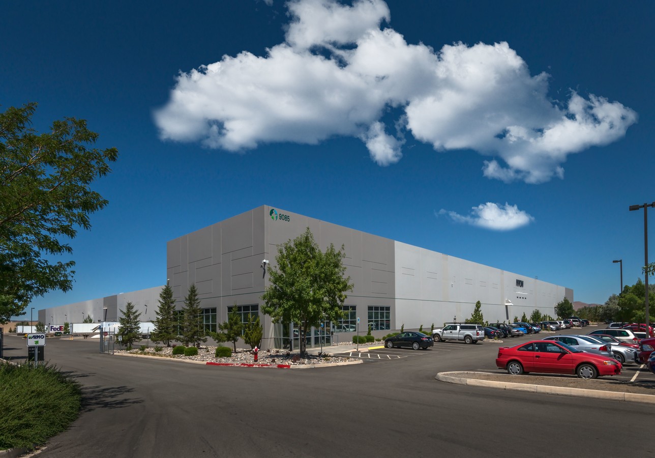
9085 Moya Blvd, Reno, NV 89506
Current Lease Availabilities
NEARBY LISTINGS FOR SALE OR LEASE
Property Detail
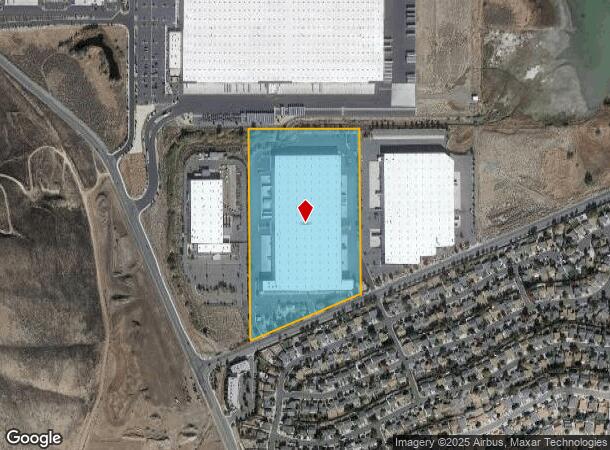
9085 Moya Blvd
Reno, NV
_Unspecified
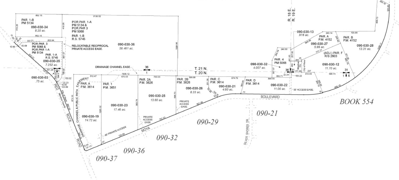
090-030-23
PM 3651 LT 1
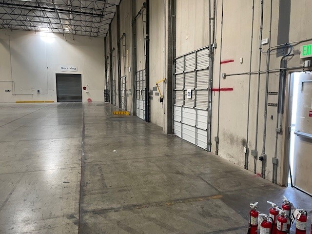
Industrialgeneral
Washoe
X
Nevada
32031C2818G
1
2024
17.46 AC
2024
North Valleys
002603
Reno/Sparks
336,055 SF
DEMOGRAPHICS near 9085 Moya Blvd
1 Mile
3 Mile
5 Mile
2024 Total Population
5,436
24,666
47,152
2029 Population
5,650
26,251
50,332
Pop Growth 2024-2029
+ 3.94%
+ 6.43%
+ 6.74%
Average Age
35
35
37
2024 Total Households
1,823
8,329
16,186
HH Growth 2024-2029
+ 4.11%
+ 6.54%
+ 6.78%
Median Household Inc
$73,279
$73,551
$74,922
Avg Household Size
3.00
2.90
2.80
2024 Avg HH Vehicles
2.00
2.00
2.00
Median Home Value
$344,895
$364,671
$370,225
Median Year Built
1996
1998
1999
Nearby Places
- Restaurants
- Banks
- Shops
- Fitness
- Groceries
PUBLIC TRANSPORTATION
AIRPORT
Reno/Tahoe International
DRIVE
WALK
Distance
Reno/Tahoe International
36 min
16.4 mi
Freight Ports
Port of Stockton
DRIVE
WALK
Distance
Port of Stockton
221 min
190.7 mi
Nearby Properties
Address
Land Use
TOTAL SIZE
Lot Size
Zoning
Address
Land Use
TOTAL SIZE
Lot Size
Zoning
799,980 SF
44.67 AC
IC
Address
Land Use
TOTAL SIZE
Lot Size
Zoning
622,807 SF
45.97 AC
IC
Address
Land Use
TOTAL SIZE
Lot Size
Zoning
770,330 SF
58.46 AC
PD
Address
Land Use
TOTAL SIZE
Lot Size
Zoning
1,629,177 SF
129.51 AC
MS
Address
Land Use
TOTAL SIZE
Lot Size
Zoning
215,893 SF
33.79 AC
PF
Address
Land Use
TOTAL SIZE
Lot Size
Zoning
10,255 SF
45.62 AC
PF
Address
Land Use
TOTAL SIZE
Lot Size
Zoning
144,098 SF
36.23 AC
IC 98% / M
Address
Land Use
TOTAL SIZE
Lot Size
Zoning
405,270 SF
24.86 AC
IC
Address
Land Use
TOTAL SIZE
Lot Size
Zoning
462,722 SF
38.34 AC
I
Address
Land Use
TOTAL SIZE
Lot Size
Zoning
545,550 SF
24.77 AC
I
Address
Land Use
TOTAL SIZE
Lot Size
Zoning
676,431 SF
32.10 AC
I
Address
Land Use
TOTAL SIZE
Lot Size
Zoning
421,970 SF
66.81 AC
I
Address
Land Use
TOTAL SIZE
Lot Size
Zoning
357,500 SF
18.98 AC
IC
Address
Land Use
TOTAL SIZE
Lot Size
Zoning
806,920 SF
33.38 AC
I
Address
Land Use
TOTAL SIZE
Lot Size
Zoning
224,504 SF
22.46 AC
MF14
Address
Land Use
TOTAL SIZE
Lot Size
Zoning
259,740 SF
12.49 AC
IC
Address
Land Use
TOTAL SIZE
Lot Size
Zoning
312,820 SF
15.59 AC
IC
Address
Land Use
TOTAL SIZE
Lot Size
Zoning
394,400 SF
26.17 AC
I
Address
Land Use
TOTAL SIZE
Lot Size
Zoning
187,275 SF
32.99 AC
I
Address
Land Use
TOTAL SIZE
Lot Size
Zoning
286,487 SF
18.90 AC
I
Address
Land Use
TOTAL SIZE
Lot Size
Zoning
429,000 SF
21.62 AC
I
Address
Land Use
TOTAL SIZE
Lot Size
Zoning
390,000 SF
20.23 AC
I
Address
Land Use
TOTAL SIZE
Lot Size
Zoning
396,120 SF
21.24 AC
I
Address
Land Use
TOTAL SIZE
Lot Size
Zoning
200,000 SF
8.20 AC
PD
Address
Land Use
TOTAL SIZE
Lot Size
Zoning
228,547 SF
16.85 AC
IC
Address
Land Use
TOTAL SIZE
Lot Size
Zoning
228,547 SF
15.20 AC
IC
Address
Land Use
TOTAL SIZE
Lot Size
Zoning
170,761 SF
12.60 AC
MF30
Address
Land Use
TOTAL SIZE
Lot Size
Zoning
334,500 SF
17.10 AC
I
Address
Land Use
TOTAL SIZE
Lot Size
Zoning
138,170 SF
54.43 AC
I
Address
Land Use
TOTAL SIZE
Lot Size
Zoning
265,375 SF
16.11 AC
I
The World's #1 Commercial Real Estate Marketplace
Connect with us
© 2025 CoStar Group
The information above has been obtained from sources believed reliable. While we do not doubt its accuracy we have not verified it and make no guarantee, warranty or representation about it. It is your responsibility to independently confirm its accuracy and completeness. Any projections, opinions, assumptions, or estimates used are for example only and do not represent the current or future performance of the property. The value of this transaction to you depends on tax and other factors which should be evaluated by your tax, financial, and legal advisors. You and your advisors should conduct a careful, independent investigation of the property to determine to your satisfaction the suitability of the property for your needs.