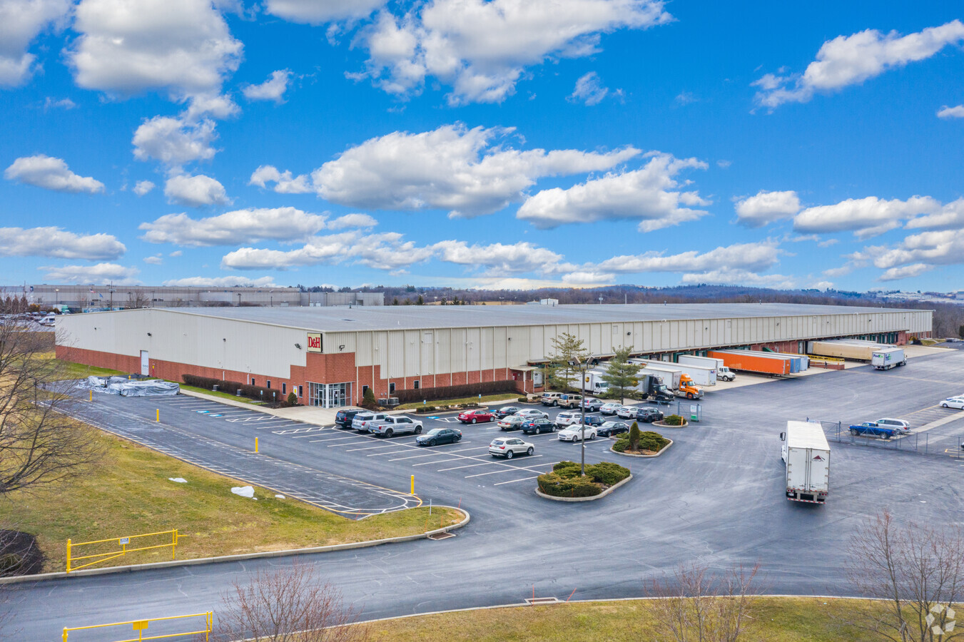
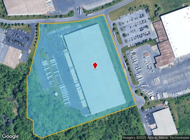
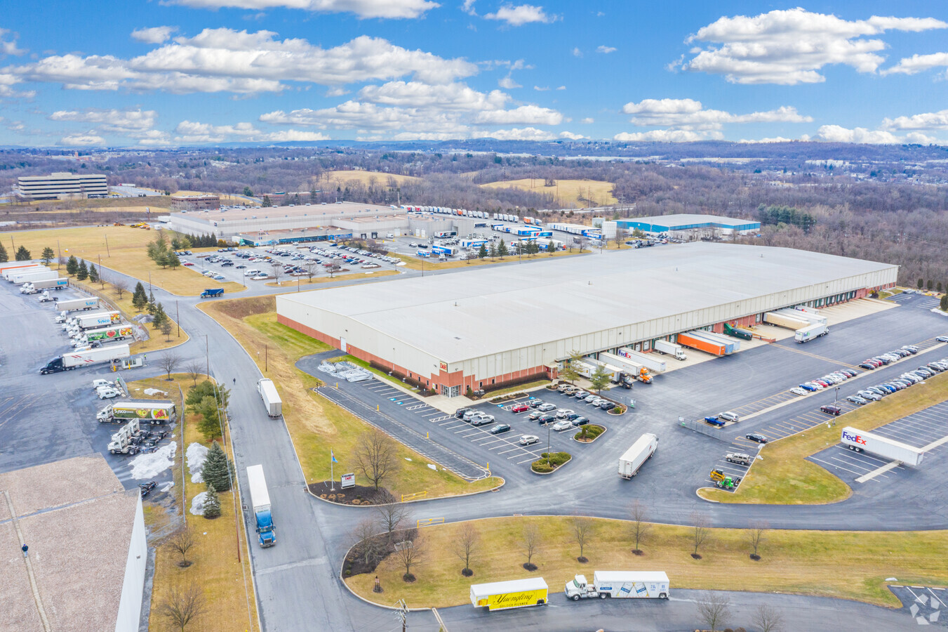
Property Record
909 Katie Ct, Harrisburg, PA 17109
NEARBY LISTINGS FOR SALE OR LEASE
Property Detail
909 Katie Ct
62-040-068
Preliminary Land Dev
Warehouse
Dauphin
X
Pennsylvania
42043C0339D
19.58 AC
2024
Harrisburg Area East
2024
Philadelphia
022100
Harrisburg-Carlisle, PA
280,000 SF
DEMOGRAPHICS near 909 Katie Ct
1 Mile
3 Mile
5 Mile
2024 Total Population
8,279
96,767
192,848
2029 Population
8,457
98,832
198,213
Pop Growth 2024-2029
+ 2.15%
+ 2.13%
+ 2.78%
Average Age
43
38
39
2024 Total Households
3,666
37,912
79,880
HH Growth 2024-2029
+ 2.29%
+ 2.18%
+ 2.94%
Median Household Inc
$59,421
$55,425
$63,480
Avg Household Size
2.20
2.40
2.30
2024 Avg HH Vehicles
1.00
1.00
2.00
Median Home Value
$170,873
$156,022
$180,003
Median Year Built
1963
1958
1963
Nearby Places
- Restaurants
- Banks
- Shops
- Fitness
- Groceries
PUBLIC TRANSPORTATION
COMMUTER RAIL
Harrisburg (Keystone Service - Amtrak, Pennsylvanian - Amtrak)
DRIVE
WALK
Distance
Harrisburg (Keystone Service - Amtrak, Pennsylvanian - Amtrak)
10 min
4.5 mi
Middletown (Keystone Service - Amtrak)
DRIVE
WALK
Distance
Middletown (Keystone Service - Amtrak)
19 min
9.9 mi
AIRPORT
Harrisburg International
DRIVE
WALK
Distance
Harrisburg International
17 min
9.8 mi
Freight Ports
Port of Baltimore
DRIVE
WALK
Distance
Port of Baltimore
117 min
84.7 mi
SALE & LEASE HISTORY
LISTING DATE
SALE/LEASE

Jun 15, 2021
For Lease
Nearby Properties
Address
Land Use
TOTAL SIZE
Lot Size
Zoning
Address
Land Use
TOTAL SIZE
Lot Size
Zoning
570,800 SF
1.29 AC
Address
Land Use
TOTAL SIZE
Lot Size
Zoning
210,464 SF
28.80 AC
Address
Land Use
TOTAL SIZE
Lot Size
Zoning
15,480 SF
17.80 AC
Address
Land Use
TOTAL SIZE
Lot Size
Zoning
365,162 SF
19.11 AC
Address
Land Use
TOTAL SIZE
Lot Size
Zoning
74,032 SF
74.81 AC
Address
Land Use
TOTAL SIZE
Lot Size
Zoning
2,200 SF
216.85 AC
Address
Land Use
TOTAL SIZE
Lot Size
Zoning
122,301 SF
32.30 AC
Address
Land Use
TOTAL SIZE
Lot Size
Zoning
172,289 SF
86.54 AC
Address
Land Use
TOTAL SIZE
Lot Size
Zoning
9,188 SF
46.70 AC
Address
Land Use
TOTAL SIZE
Lot Size
Zoning
91,929 SF
45.10 AC
Address
Land Use
TOTAL SIZE
Lot Size
Zoning
2,913 SF
24.28 AC
Address
Land Use
TOTAL SIZE
Lot Size
Zoning
47,022 SF
47.55 AC
Address
Land Use
TOTAL SIZE
Lot Size
Zoning
284,737 SF
28.16 AC
Address
Land Use
TOTAL SIZE
Lot Size
Zoning
5,588 SF
9.29 AC
Address
Land Use
TOTAL SIZE
Lot Size
Zoning
192,390 SF
43.19 AC
Address
Land Use
TOTAL SIZE
Lot Size
Zoning
167,713 SF
11.50 AC
Address
Land Use
TOTAL SIZE
Lot Size
Zoning
247,216 SF
46.91 AC
Address
Land Use
TOTAL SIZE
Lot Size
Zoning
27,632 SF
59.50 AC
Address
Land Use
TOTAL SIZE
Lot Size
Zoning
2,000 SF
21.13 AC
Address
Land Use
TOTAL SIZE
Lot Size
Zoning
242,534 SF
47.26 AC
Address
Land Use
TOTAL SIZE
Lot Size
Zoning
112,388 SF
38.01 AC
Address
Land Use
TOTAL SIZE
Lot Size
Zoning
226,101 SF
46.29 AC
Address
Land Use
TOTAL SIZE
Lot Size
Zoning
24,567 SF
15.33 AC
Address
Land Use
TOTAL SIZE
Lot Size
Zoning
33,916 SF
10 AC
Address
Land Use
TOTAL SIZE
Lot Size
Zoning
2,823 SF
36.87 AC
Address
Land Use
TOTAL SIZE
Lot Size
Zoning
207,012 SF
24.50 AC
Address
Land Use
TOTAL SIZE
Lot Size
Zoning
139,381 SF
42.61 AC
Address
Land Use
TOTAL SIZE
Lot Size
Zoning
13,348 SF
25.38 AC
Address
Land Use
TOTAL SIZE
Lot Size
Zoning
66,864 SF
26.25 AC
Address
Land Use
TOTAL SIZE
Lot Size
Zoning
142,038 SF
9.39 AC
The World's #1 Commercial Real Estate Marketplace
Connect with us
© 2025 CoStar Group
The information above has been obtained from sources believed reliable. While we do not doubt its accuracy we have not verified it and make no guarantee, warranty or representation about it. It is your responsibility to independently confirm its accuracy and completeness. Any projections, opinions, assumptions, or estimates used are for example only and do not represent the current or future performance of the property. The value of this transaction to you depends on tax and other factors which should be evaluated by your tax, financial, and legal advisors. You and your advisors should conduct a careful, independent investigation of the property to determine to your satisfaction the suitability of the property for your needs.