Property Record
9090 Union Park Way, Elk Grove, CA 95624


NEARBY LISTINGS FOR SALE OR LEASE
Property Detail
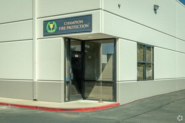
9090 Union Park Way
Sacramento--Roseville--Arden-Arcade, CA
Union Industrial Park
134-0630-062
LOT 7 UNION INDUSTRIAL PARK EXC POR DES AS BEG AT NE COR OF SD LOT 7., TH FR SD POB S40D49'17E 487.48FT., TH S50D19'22W 95.08FT., TH N40D49'17W 485.58FT., TH N49D10'43E 95.06FT TO POB
Multitenantindustrial
Sacramento
X
California
06067C0338H
7
2024
2.27 AC
2025
Elk Grove/Laguna
009310
Sacramento
37,800 SF
DEMOGRAPHICS near 9090 Union Park Way
1 Mile
3 Mile
5 Mile
2024 Total Population
6,706
56,288
155,709
2029 Population
6,912
57,311
157,130
Pop Growth 2024-2029
+ 3.07%
+ 1.82%
+ 0.91%
Average Age
37
39
38
2024 Total Households
2,061
17,709
47,257
HH Growth 2024-2029
+ 2.86%
+ 1.77%
+ 0.87%
Median Household Inc
$112,529
$111,262
$107,764
Avg Household Size
3.20
3.10
3.20
2024 Avg HH Vehicles
2.00
2.00
2.00
Median Home Value
$508,747
$602,092
$562,808
Median Year Built
1994
2000
2000
Nearby Places
Map Layers
Map Styles
 Street
 Aerial
- Restaurants
- Banks
- Shops
- Fitness
- Groceries
PUBLIC TRANSPORTATION
AIRPORT
Sacramento International
DRIVE
WALK
Distance
Sacramento International
41 min
29.4 mi
Stockton Metro
DRIVE
WALK
Distance
Stockton Metro
50 min
38.6 mi
Freight Ports
Port of Stockton
DRIVE
WALK
Distance
Port of Stockton
48 min
37.1 mi
SALE & LEASE HISTORY
LISTING DATE
SALE/LEASE

Nov 14, 2016
For Lease
Nearby Properties
Address
Land Use
TOTAL SIZE
Lot Size
Zoning
Address
Land Use
TOTAL SIZE
Lot Size
Zoning
43.54 AC
LI
Address
Land Use
TOTAL SIZE
Lot Size
Zoning
7.65 AC
RD-20
Address
Land Use
TOTAL SIZE
Lot Size
Zoning
43.06 AC
LRSPA
Address
Land Use
TOTAL SIZE
Lot Size
Zoning
221,556 SF
20.10 AC
HI
Address
Land Use
TOTAL SIZE
Lot Size
Zoning
9.02 AC
SPASEPA
Address
Land Use
TOTAL SIZE
Lot Size
Zoning
64,579 SF
5.41 AC
LRSPA
Address
Land Use
TOTAL SIZE
Lot Size
Zoning
242,577 SF
0.10 AC
RD-20
Address
Land Use
TOTAL SIZE
Lot Size
Zoning
105,511 SF
4.79 AC
BP
Address
Land Use
TOTAL SIZE
Lot Size
Zoning
111,489 SF
4.96 AC
MP
Address
Land Use
TOTAL SIZE
Lot Size
Zoning
76,090 SF
3.32 AC
RD-25
Address
Land Use
TOTAL SIZE
Lot Size
Zoning
221,954 SF
7.71 AC
RD-15
Address
Land Use
TOTAL SIZE
Lot Size
Zoning
102,526 SF
4.06 AC
MP
Address
Land Use
TOTAL SIZE
Lot Size
Zoning
100 SF
50.85 AC
LRSPA
Address
Land Use
TOTAL SIZE
Lot Size
Zoning
68,190 SF
3.75 AC
BP
Address
Land Use
TOTAL SIZE
Lot Size
Zoning
68,217 SF
8.95 AC
RD-20
Address
Land Use
TOTAL SIZE
Lot Size
Zoning
5.38 AC
SC
Address
Land Use
TOTAL SIZE
Lot Size
Zoning
148,119 SF
11.23 AC
SC
Address
Land Use
TOTAL SIZE
Lot Size
Zoning
63,550 SF
5.53 AC
AC
Address
Land Use
TOTAL SIZE
Lot Size
Zoning
21.18 AC
HI
Address
Land Use
TOTAL SIZE
Lot Size
Zoning
45,413 SF
7.31 AC
SC
Address
Land Use
TOTAL SIZE
Lot Size
Zoning
53,949 SF
5.33 AC
AC
Address
Land Use
TOTAL SIZE
Lot Size
Zoning
15.50 AC
LRSPA
Address
Land Use
TOTAL SIZE
Lot Size
Zoning
1.99 AC
GC
Address
Land Use
TOTAL SIZE
Lot Size
Zoning
14.46 AC
LRSPA
Address
Land Use
TOTAL SIZE
Lot Size
Zoning
13.28 AC
LRSPA
Address
Land Use
TOTAL SIZE
Lot Size
Zoning
125,640 SF
10.25 AC
SC
Address
Land Use
TOTAL SIZE
Lot Size
Zoning
150,210 SF
6.25 AC
LI
Address
Land Use
TOTAL SIZE
Lot Size
Zoning
94,365 SF
6.49 AC
RD-20
Address
Land Use
TOTAL SIZE
Lot Size
Zoning
15.48 AC
RD-30
Address
Land Use
TOTAL SIZE
Lot Size
Zoning
3.71 AC
RD-20
The World's #1 Commercial Real Estate Marketplace
Connect with us
© 2026 CoStar Group
The information above has been obtained from sources believed reliable. While we do not doubt its accuracy we have not verified it and make no guarantee, warranty or representation about it. It is your responsibility to independently confirm its accuracy and completeness. Any projections, opinions, assumptions, or estimates used are for example only and do not represent the current or future performance of the property. The value of this transaction to you depends on tax and other factors which should be evaluated by your tax, financial, and legal advisors. You and your advisors should conduct a careful, independent investigation of the property to determine to your satisfaction the suitability of the property for your needs.