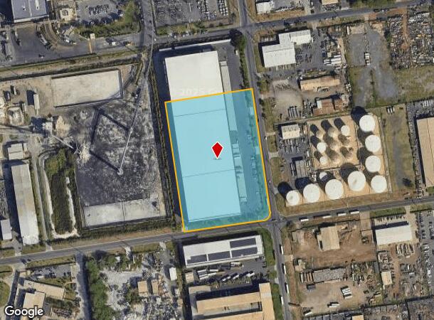
Property Record
91 Hanua St, Kapolei, HI 96707


NEARBY LISTINGS FOR SALE OR LEASE
Property Detail
91 Hanua St
Urban Honolulu, HI
Hawn Western Steel
1-9-1-026-010-0000
LOT 610 309,057 SF MAP 95 LCAPP 1069 TOG/ESMTS
Industrialgeneral
Honolulu
D
Hawaii
15003C0312G
610
2024
7.10 AC
2024
West Oahu
980300
Hawaii
226,260 SF
DEMOGRAPHICS near 91 Hanua St
1 Mile
3 Mile
5 Mile
2024 Total Population
0
12,442
51,154
2029 Population
0
12,287
49,172
Pop Growth 2024-2029
0.00%
(1.25%)
(3.87%)
Average Age
0
36
37
2024 Total Households
0
4,110
15,198
HH Growth 2024-2029
0.00%
(1.29%)
(4.40%)
Median Household Inc
$0
$110,370
$115,650
Avg Household Size
.00
2.80
3.20
2024 Avg HH Vehicles
.00
2.00
2.00
Median Home Value
$0
$725,000
$742,451
Median Year Built
0
2008
2000
Nearby Places
- Restaurants
- Banks
- Shops
- Fitness
- Groceries
PUBLIC TRANSPORTATION
AIRPORT
Daniel K Inouye International
DRIVE
WALK
Distance
Daniel K Inouye International
30 min
19.6 mi
Freight Ports
Honolulu Harbor, Oahu
DRIVE
WALK
Distance
Honolulu Harbor, Oahu
38 min
23.7 mi
SALE & LEASE HISTORY
LISTING DATE
SALE/LEASE

Sep 25, 2016
For Lease
Apr 12, 2018
For Sale
Nearby Properties
Address
Land Use
TOTAL SIZE
Lot Size
Zoning
Address
Land Use
TOTAL SIZE
Lot Size
Zoning
736 AC
U/63/80
Address
Land Use
TOTAL SIZE
Lot Size
Zoning
80,641 SF
227.76 AC
U/42/40 -
Address
Land Use
TOTAL SIZE
Lot Size
Zoning
288,660 SF
10.94 AC
U/12/12
Address
Land Use
TOTAL SIZE
Lot Size
Zoning
447,096 SF
9.98 AC
U/12/12
Address
Land Use
TOTAL SIZE
Lot Size
Zoning
222.34 AC
U/43/70
Address
Land Use
TOTAL SIZE
Lot Size
Zoning
139.30 AC
U/63/80
Address
Land Use
TOTAL SIZE
Lot Size
Zoning
61,643 SF
116.66 AC
U/42/40
Address
Land Use
TOTAL SIZE
Lot Size
Zoning
10 AC
U/21/20
Address
Land Use
TOTAL SIZE
Lot Size
Zoning
14.70 AC
U/21/20
Address
Land Use
TOTAL SIZE
Lot Size
Zoning
418.62 AC
DROPPED PA
Address
Land Use
TOTAL SIZE
Lot Size
Zoning
10,182 SF
10.30 AC
U/21/20
Address
Land Use
TOTAL SIZE
Lot Size
Zoning
334.93 AC
U/42/40
Address
Land Use
TOTAL SIZE
Lot Size
Zoning
307,171 SF
24.64 AC
U/42/40
Address
Land Use
TOTAL SIZE
Lot Size
Zoning
222,228 SF
7.14 AC
U/32/30
Address
Land Use
TOTAL SIZE
Lot Size
Zoning
149,923 SF
13.35 AC
U/BM/30
Address
Land Use
TOTAL SIZE
Lot Size
Zoning
183,343 SF
15.27 AC
U/BM/30
Address
Land Use
TOTAL SIZE
Lot Size
Zoning
238,418 SF
9.46 AC
U/63/80
Address
Land Use
TOTAL SIZE
Lot Size
Zoning
19.38 AC
U/12/12
Address
Land Use
TOTAL SIZE
Lot Size
Zoning
182,481 SF
31.62 AC
U/42/40
Address
Land Use
TOTAL SIZE
Lot Size
Zoning
3,202 SF
7.81 AC
U/21/20
Address
Land Use
TOTAL SIZE
Lot Size
Zoning
208,386 SF
2.84 AC
U/32/30
Address
Land Use
TOTAL SIZE
Lot Size
Zoning
6.23 AC
U/21/20
Address
Land Use
TOTAL SIZE
Lot Size
Zoning
139,755 SF
18.78 AC
U/32/30
Address
Land Use
TOTAL SIZE
Lot Size
Zoning
45.60 AC
U/63/80
Address
Land Use
TOTAL SIZE
Lot Size
Zoning
1,068,018 SF
11.54 AC
U/32/30
Address
Land Use
TOTAL SIZE
Lot Size
Zoning
477,333 SF
17.76 AC
U/BM/30
Address
Land Use
TOTAL SIZE
Lot Size
Zoning
14.56 AC
U/12/12
Address
Land Use
TOTAL SIZE
Lot Size
Zoning
51.37 AC
U/42/40
The World's #1 Commercial Real Estate Marketplace
Connect with us
© 2025 CoStar Group
The information above has been obtained from sources believed reliable. While we do not doubt its accuracy we have not verified it and make no guarantee, warranty or representation about it. It is your responsibility to independently confirm its accuracy and completeness. Any projections, opinions, assumptions, or estimates used are for example only and do not represent the current or future performance of the property. The value of this transaction to you depends on tax and other factors which should be evaluated by your tax, financial, and legal advisors. You and your advisors should conduct a careful, independent investigation of the property to determine to your satisfaction the suitability of the property for your needs.