Property Record
9105 Highway 87 N, Milton, FL 32570
NEARBY LISTINGS FOR SALE OR LEASE
Property Detail
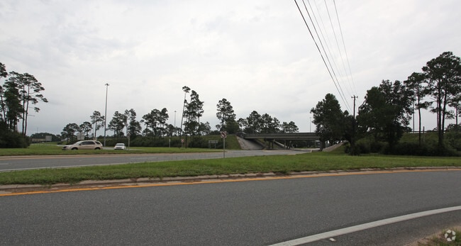
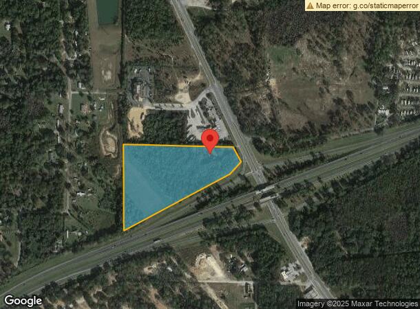
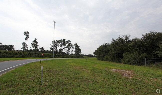
9105 Highway 87 N
05-1N-27-0000-00300-0000
Milton Plaza Center
Commercialacreage
*DESCRIPTION UPDATE FOR 2021* SE 1/4 OF SE 1/4 LESS N 1/2 OF N 1/2 LYING N OF I-10 AND N 110 YARDS OF SE 1/4 OF SE 1/4 OF SECTION 5 TOWNSHIP 1 NORTH RANGE 27 WEST LESS RD R/W AS DES IN OR 4038 PG 446
X
Santa Rosa
12113C0455H
Florida
2024
13.69 AC
2025
SE Santa Rosa County
010505
Pensacola
630 SF
Pensacola-Ferry Pass-Brent, FL
DEMOGRAPHICS near 9105 Highway 87 N
1 Mile
3 Mile
5 Mile
2024 Total Population
2,895
11,287
20,493
2029 Population
3,228
12,961
23,589
Pop Growth 2024-2029
+ 11.50%
+ 14.83%
+ 15.11%
Average Age
40
41
41
2024 Total Households
433
3,197
6,743
HH Growth 2024-2029
+ 16.63%
+ 17.58%
+ 16.68%
Median Household Inc
$59,339
$62,864
$63,051
Avg Household Size
2.50
2.50
2.50
2024 Avg HH Vehicles
2.00
2.00
2.00
Median Home Value
$207,143
$203,351
$203,236
Median Year Built
1994
1996
1994
Nearby Places
Map Layers
Map Styles
 Street
 Aerial
- Restaurants
- Banks
- Shops
- Fitness
- Groceries
PUBLIC TRANSPORTATION
AIRPORT
Pensacola International
DRIVE
WALK
Distance
Pensacola International
32 min
22.0 mi
Eglin AFB/Destin-Ft Walton Beach
DRIVE
WALK
Distance
Eglin AFB/Destin-Ft Walton Beach
70 min
48.6 mi
Freight Ports
Port of Mobile
DRIVE
WALK
Distance
Port of Mobile
81 min
72.1 mi
Nearby Properties
Address
Land Use
TOTAL SIZE
Lot Size
Zoning
Address
Land Use
TOTAL SIZE
Lot Size
Zoning
342,125 SF
58.46 AC
M2
Address
Land Use
TOTAL SIZE
Lot Size
Zoning
281,607 SF
306.03 AC
M2
Address
Land Use
TOTAL SIZE
Lot Size
Zoning
183,076 SF
85.91 AC
M2
Address
Land Use
TOTAL SIZE
Lot Size
Zoning
198,543 SF
34.63 AC
M2
Address
Land Use
TOTAL SIZE
Lot Size
Zoning
31,124 SF
36.55 AC
AG-RR
Address
Land Use
TOTAL SIZE
Lot Size
Zoning
258,149 SF
8.42 AC
M2
Address
Land Use
TOTAL SIZE
Lot Size
Zoning
197,050 SF
29.93 AC
M2
Address
Land Use
TOTAL SIZE
Lot Size
Zoning
141,508 SF
26.62 AC
M2
Address
Land Use
TOTAL SIZE
Lot Size
Zoning
164,844 SF
8.33 AC
M2
Address
Land Use
TOTAL SIZE
Lot Size
Zoning
52,817 SF
79.32 AC
M1
Address
Land Use
TOTAL SIZE
Lot Size
Zoning
67,182 SF
9.54 AC
M2
Address
Land Use
TOTAL SIZE
Lot Size
Zoning
47,976 SF
102.61 AC
M2
Address
Land Use
TOTAL SIZE
Lot Size
Zoning
186.32 AC
HCD
Address
Land Use
TOTAL SIZE
Lot Size
Zoning
82,869 SF
10 AC
M2
Address
Land Use
TOTAL SIZE
Lot Size
Zoning
9,030 SF
20.47 AC
HCD
Address
Land Use
TOTAL SIZE
Lot Size
Zoning
72,675 SF
20 AC
M2
Address
Land Use
TOTAL SIZE
Lot Size
Zoning
103,000 SF
7.24 AC
M2
Address
Land Use
TOTAL SIZE
Lot Size
Zoning
89,249 SF
66.21 AC
AG-RR
Address
Land Use
TOTAL SIZE
Lot Size
Zoning
81,521 SF
7.63 AC
M2
Address
Land Use
TOTAL SIZE
Lot Size
Zoning
51,765 SF
14 AC
M2
Address
Land Use
TOTAL SIZE
Lot Size
Zoning
2,409 SF
158.24 AC
M2
Address
Land Use
TOTAL SIZE
Lot Size
Zoning
83,222 SF
7 AC
M2
Address
Land Use
TOTAL SIZE
Lot Size
Zoning
38,619 SF
2.31 AC
HCD
Address
Land Use
TOTAL SIZE
Lot Size
Zoning
199.56 AC
AG-RR
Address
Land Use
TOTAL SIZE
Lot Size
Zoning
33,570 SF
4.25 AC
HCD
Address
Land Use
TOTAL SIZE
Lot Size
Zoning
33,454 SF
13.16 AC
M2
Address
Land Use
TOTAL SIZE
Lot Size
Zoning
82,362 SF
6.95 AC
M2
Address
Land Use
TOTAL SIZE
Lot Size
Zoning
20,964 SF
26.97 AC
M2
Address
Land Use
TOTAL SIZE
Lot Size
Zoning
15,067 SF
3.09 AC
M2
Address
Land Use
TOTAL SIZE
Lot Size
Zoning
20,468 SF
16 AC
M2
The World's #1 Commercial Real Estate Marketplace
Connect with us
© 2026 CoStar Group
The information above has been obtained from sources believed reliable. While we do not doubt its accuracy we have not verified it and make no guarantee, warranty or representation about it. It is your responsibility to independently confirm its accuracy and completeness. Any projections, opinions, assumptions, or estimates used are for example only and do not represent the current or future performance of the property. The value of this transaction to you depends on tax and other factors which should be evaluated by your tax, financial, and legal advisors. You and your advisors should conduct a careful, independent investigation of the property to determine to your satisfaction the suitability of the property for your needs.