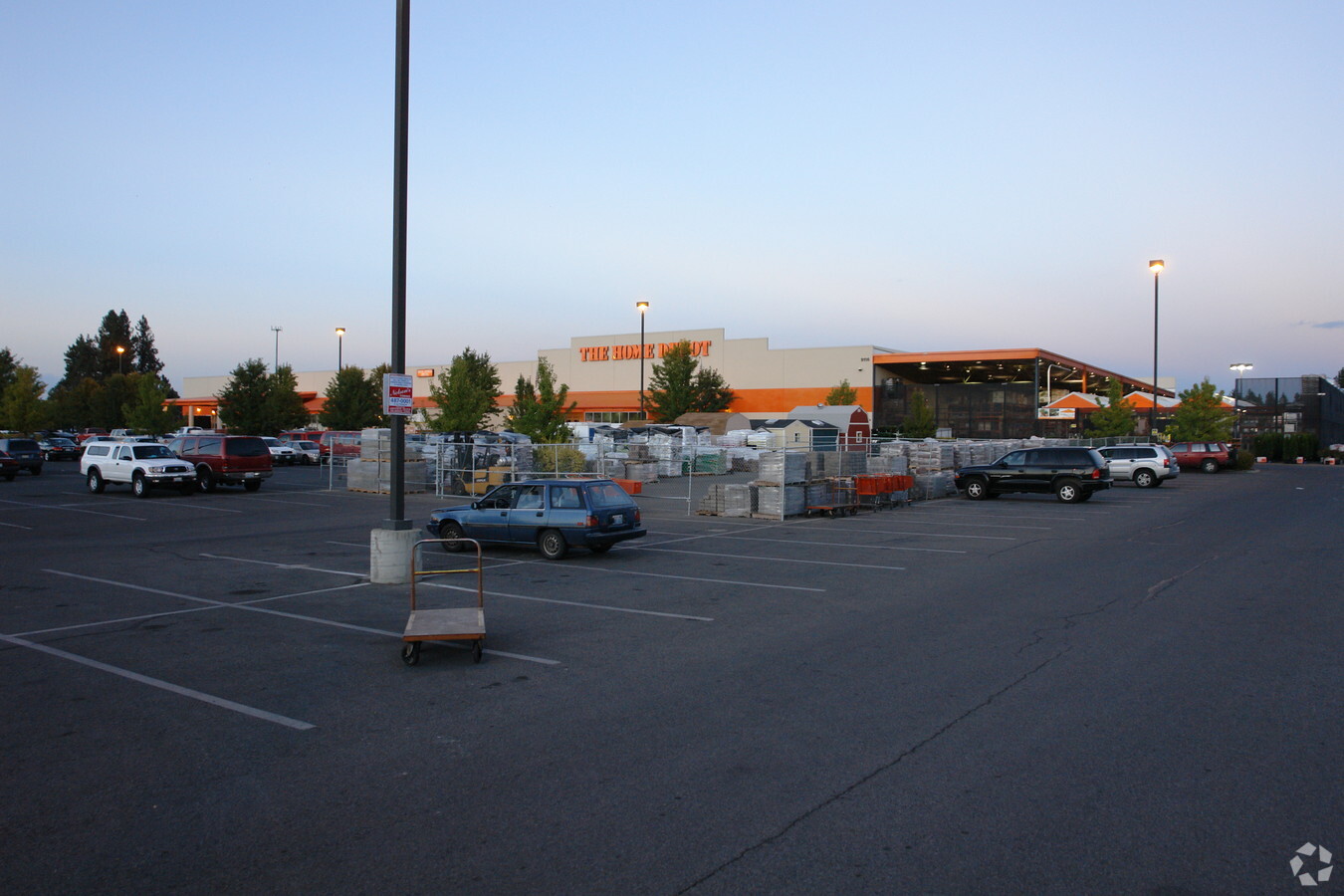
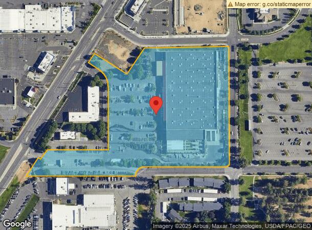
Property Record
9116 N Newport Hwy, Spokane, WA 99218

NEARBY LISTINGS FOR SALE OR LEASE
Property Detail
9116 N Newport Hwy
36202.0038
Binding Site Plan 91-01 Prcl B
Storebuilding
20-26-43 ( HOME DEPOT ) PARCELS B, E & E-1 OF 2ND AMENDMENT BSP 91-01 AUDITORS #4131205 BK 1 PG 99-101 BEING A PTN OF NW1/4
X
Spokane
53063C0531D
Washington
2024
9.91 AC
2024
NE North Metro
011102
Spokane
108,904 SF
Spokane-Spokane Valley, WA
DEMOGRAPHICS near 9116 N Newport Hwy
1 Mile
3 Mile
5 Mile
2024 Total Population
12,904
79,905
178,464
2029 Population
13,714
84,838
189,288
Pop Growth 2024-2029
+ 6.28%
+ 6.17%
+ 6.07%
Average Age
36
39
39
2024 Total Households
4,877
31,462
69,622
HH Growth 2024-2029
+ 6.64%
+ 6.33%
+ 6.23%
Median Household Inc
$59,080
$60,155
$62,043
Avg Household Size
2.30
2.40
2.40
2024 Avg HH Vehicles
2.00
2.00
2.00
Median Home Value
$321,002
$319,286
$307,674
Median Year Built
1978
1975
1970
Nearby Places
- Restaurants
- Banks
- Shops
- Fitness
- Groceries
PUBLIC TRANSPORTATION
COMMUTER RAIL
Spokane (Empire Builder - Amtrak)
DRIVE
WALK
Distance
Spokane (Empire Builder - Amtrak)
16 min
6.2 mi
AIRPORT
Spokane International
DRIVE
WALK
Distance
Spokane International
26 min
12.6 mi
Freight Ports
Port of Everett
DRIVE
WALK
Distance
Port of Everett
353 min
308.2 mi
Nearby Properties
Address
Land Use
TOTAL SIZE
Lot Size
Zoning
Address
Land Use
TOTAL SIZE
Lot Size
Zoning
523,081 SF
92.96 AC
LDR
Address
Land Use
TOTAL SIZE
Lot Size
Zoning
531,295 SF
17.11 AC
CC2
Address
Land Use
TOTAL SIZE
Lot Size
Zoning
278,777 SF
5.47 AC
HDR
Address
Land Use
TOTAL SIZE
Lot Size
Zoning
188,040 SF
68.10 AC
UR
Address
Land Use
TOTAL SIZE
Lot Size
Zoning
696,382 SF
37.43 AC
LI
Address
Land Use
TOTAL SIZE
Lot Size
Zoning
317,476 SF
31.10 AC
GC
Address
Land Use
TOTAL SIZE
Lot Size
Zoning
1,065,742 SF
23.80 AC
GC
Address
Land Use
TOTAL SIZE
Lot Size
Zoning
78,497 SF
9.19 AC
MU
Address
Land Use
TOTAL SIZE
Lot Size
Zoning
56,600 SF
4.98 AC
GC
Address
Land Use
TOTAL SIZE
Lot Size
Zoning
159,508 SF
18.52 AC
RSF
Address
Land Use
TOTAL SIZE
Lot Size
Zoning
155,976 SF
6.60 AC
RMF
Address
Land Use
TOTAL SIZE
Lot Size
Zoning
64,602 SF
8.75 AC
RMF
Address
Land Use
TOTAL SIZE
Lot Size
Zoning
82,688 SF
10.31 AC
RMF
Address
Land Use
TOTAL SIZE
Lot Size
Zoning
73,593 SF
7.24 AC
RMF
Address
Land Use
TOTAL SIZE
Lot Size
Zoning
116,772 SF
8.56 AC
MU
Address
Land Use
TOTAL SIZE
Lot Size
Zoning
55,050 SF
5.48 AC
RMF
Address
Land Use
TOTAL SIZE
Lot Size
Zoning
76,559 SF
7.11 AC
LDR
Address
Land Use
TOTAL SIZE
Lot Size
Zoning
77,804 SF
12.84 AC
RMF
Address
Land Use
TOTAL SIZE
Lot Size
Zoning
76,224 SF
12.67 AC
RMF
Address
Land Use
TOTAL SIZE
Lot Size
Zoning
150,061 SF
5.01 AC
GC
Address
Land Use
TOTAL SIZE
Lot Size
Zoning
76,224 SF
13.94 AC
RMF
Address
Land Use
TOTAL SIZE
Lot Size
Zoning
110,836 SF
14.85 AC
RMF
Address
Land Use
TOTAL SIZE
Lot Size
Zoning
166,390 SF
19.33 AC
MU
Address
Land Use
TOTAL SIZE
Lot Size
Zoning
107,246 SF
6.63 AC
GC
Address
Land Use
TOTAL SIZE
Lot Size
Zoning
67,094 SF
9.33 AC
RSF
Address
Land Use
TOTAL SIZE
Lot Size
Zoning
230,295 SF
22.41 AC
GC
Address
Land Use
TOTAL SIZE
Lot Size
Zoning
35,343 SF
5.31 AC
GC
Address
Land Use
TOTAL SIZE
Lot Size
Zoning
59,303 SF
5.52 AC
HDR
Address
Land Use
TOTAL SIZE
Lot Size
Zoning
156,212 SF
11.31 AC
MU
Address
Land Use
TOTAL SIZE
Lot Size
Zoning
209,047 SF
41.68 AC
HI
The World's #1 Commercial Real Estate Marketplace
Connect with us
© 2025 CoStar Group
The information above has been obtained from sources believed reliable. While we do not doubt its accuracy we have not verified it and make no guarantee, warranty or representation about it. It is your responsibility to independently confirm its accuracy and completeness. Any projections, opinions, assumptions, or estimates used are for example only and do not represent the current or future performance of the property. The value of this transaction to you depends on tax and other factors which should be evaluated by your tax, financial, and legal advisors. You and your advisors should conduct a careful, independent investigation of the property to determine to your satisfaction the suitability of the property for your needs.