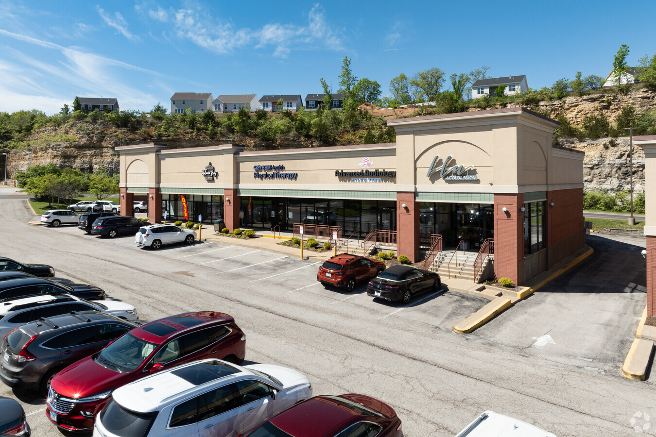
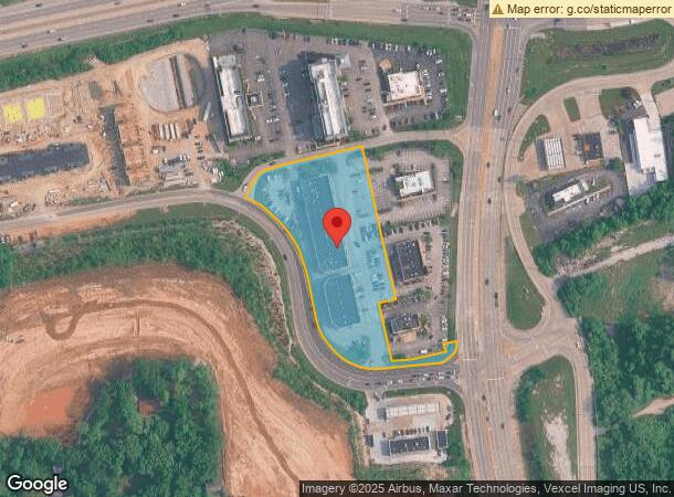
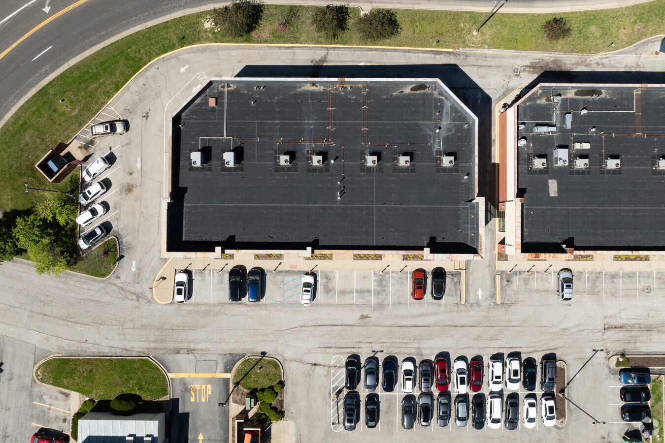
Property Record
912 Meramec Station Rd, Valley Park, MO 63088
Current Lease Availabilities
NEARBY LISTINGS FOR SALE OR LEASE
Property Detail
912 Meramec Station Rd
St. Louis, MO-IL
Drury Acres Plat Two Lot Pts 11 13 & 14
27Q-63-0505
DRURY ACRES PLAT TWO LOT PTS 11 13 & 14 LOT 11
Stripcommercialcenter
St. Louis
X
Missouri
29099C0050F
11
2023
3.28 AC
2023
Southwest County
221421
St. Louis
27,661 SF
DEMOGRAPHICS near 912 Meramec Station Rd
1 Mile
3 Mile
5 Mile
2024 Total Population
4,830
48,382
124,673
2029 Population
4,696
47,263
122,941
Pop Growth 2024-2029
(2.77%)
(2.31%)
(1.39%)
Average Age
42
41
41
2024 Total Households
1,850
19,641
49,750
HH Growth 2024-2029
(2.86%)
(2.33%)
(1.37%)
Median Household Inc
$112,173
$90,368
$93,271
Avg Household Size
2.60
2.40
2.50
2024 Avg HH Vehicles
2.00
2.00
2.00
Median Home Value
$295,068
$281,304
$289,739
Median Year Built
1991
1983
1980
Nearby Places
- Restaurants
- Banks
- Shops
- Fitness
- Groceries
PUBLIC TRANSPORTATION
AIRPORT
Lambert-St. Louis International
DRIVE
WALK
Distance
Lambert-St. Louis International
33 min
26.9 mi
Freight Ports
Port of Shreveport
DRIVE
WALK
Distance
Port of Shreveport
1 min
461.8 mi
Nearby Properties
Address
Land Use
TOTAL SIZE
Lot Size
Zoning
Address
Land Use
TOTAL SIZE
Lot Size
Zoning
429,212 SF
53.13 AC
C-8
Address
Land Use
TOTAL SIZE
Lot Size
Zoning
862,067 SF
40.98 AC
C-8
Address
Land Use
TOTAL SIZE
Lot Size
Zoning
96.62 AC
R3
Address
Land Use
TOTAL SIZE
Lot Size
Zoning
633,127 SF
51.20 AC
NU
Address
Land Use
TOTAL SIZE
Lot Size
Zoning
256,956 SF
23.68 AC
21IP-1
Address
Land Use
TOTAL SIZE
Lot Size
Zoning
460,421 SF
34.91 AC
21BP-2
Address
Land Use
TOTAL SIZE
Lot Size
Zoning
534,280 SF
23.37 AC
21IP-1
Address
Land Use
TOTAL SIZE
Lot Size
Zoning
194,252 SF
10.66 AC
21IP-1
Address
Land Use
TOTAL SIZE
Lot Size
Zoning
62.50 AC
NU
Address
Land Use
TOTAL SIZE
Lot Size
Zoning
284,400 SF
10.72 AC
55RSING
Address
Land Use
TOTAL SIZE
Lot Size
Zoning
139,212 SF
15.58 AC
21C-1
Address
Land Use
TOTAL SIZE
Lot Size
Zoning
112,840 SF
0.54 AC
C-8
Address
Land Use
TOTAL SIZE
Lot Size
Zoning
375,522 SF
42.58 AC
C-8
Address
Land Use
TOTAL SIZE
Lot Size
Zoning
148,800 SF
26.31 AC
21IP-1
Address
Land Use
TOTAL SIZE
Lot Size
Zoning
19.25 AC
55INSTU
Address
Land Use
TOTAL SIZE
Lot Size
Zoning
129,090 SF
17.78 AC
21C-1
Address
Land Use
TOTAL SIZE
Lot Size
Zoning
68,441 SF
26.01 AC
58PDC
Address
Land Use
TOTAL SIZE
Lot Size
Zoning
117.18 AC
FPPS
Address
Land Use
TOTAL SIZE
Lot Size
Zoning
10.41 AC
21IP-1
Address
Land Use
TOTAL SIZE
Lot Size
Zoning
206,018 SF
18.78 AC
R1
Address
Land Use
TOTAL SIZE
Lot Size
Zoning
246,426 SF
8.87 AC
94R-6
Address
Land Use
TOTAL SIZE
Lot Size
Zoning
105.49 AC
Address
Land Use
TOTAL SIZE
Lot Size
Zoning
127,464 SF
7.40 AC
21IP-1
Address
Land Use
TOTAL SIZE
Lot Size
Zoning
133,200 SF
10.50 AC
21IP-1
Address
Land Use
TOTAL SIZE
Lot Size
Zoning
8.28 AC
58NODTA
Address
Land Use
TOTAL SIZE
Lot Size
Zoning
182,616 SF
15.86 AC
21IP-1
Address
Land Use
TOTAL SIZE
Lot Size
Zoning
9.63 AC
21IP-1
Address
Land Use
TOTAL SIZE
Lot Size
Zoning
1,782 SF
120.27 AC
NU
Address
Land Use
TOTAL SIZE
Lot Size
Zoning
141,806 SF
7.65 AC
C-8
Address
Land Use
TOTAL SIZE
Lot Size
Zoning
157,584 SF
13.60 AC
21IP-1
The World's #1 Commercial Real Estate Marketplace
Connect with us
© 2025 CoStar Group
The information above has been obtained from sources believed reliable. While we do not doubt its accuracy we have not verified it and make no guarantee, warranty or representation about it. It is your responsibility to independently confirm its accuracy and completeness. Any projections, opinions, assumptions, or estimates used are for example only and do not represent the current or future performance of the property. The value of this transaction to you depends on tax and other factors which should be evaluated by your tax, financial, and legal advisors. You and your advisors should conduct a careful, independent investigation of the property to determine to your satisfaction the suitability of the property for your needs.