Property Record
9120 Mormon Bridge Rd, Omaha, NE 68152
NEARBY LISTINGS FOR SALE OR LEASE
-
-
View all Omaha listings for sale on LoopNet.com
Property Detail
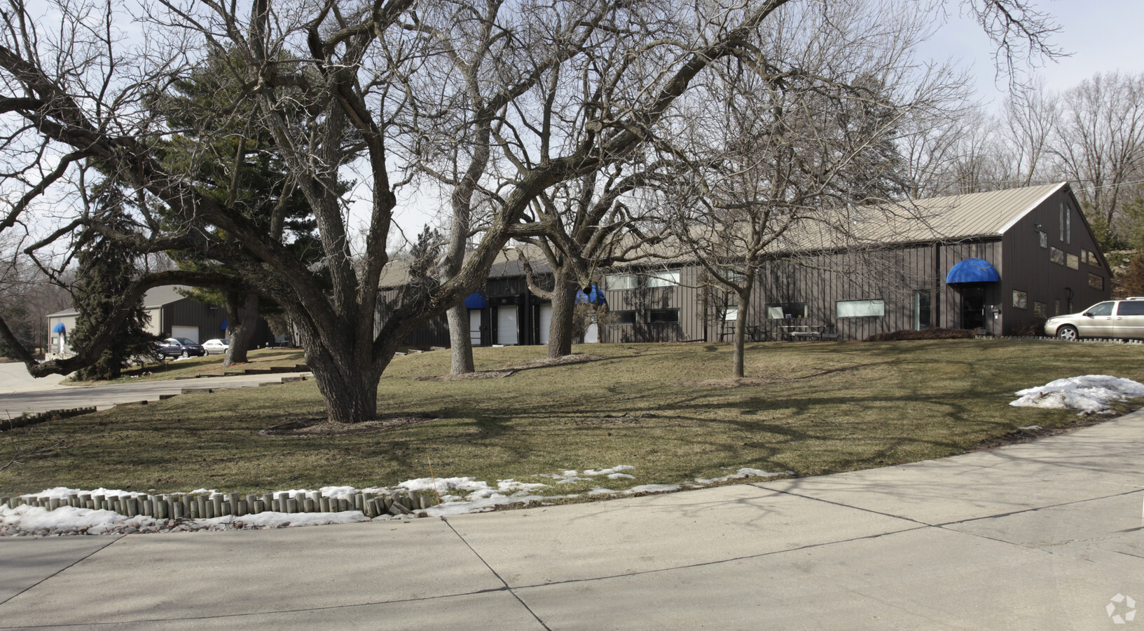
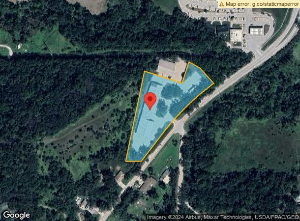
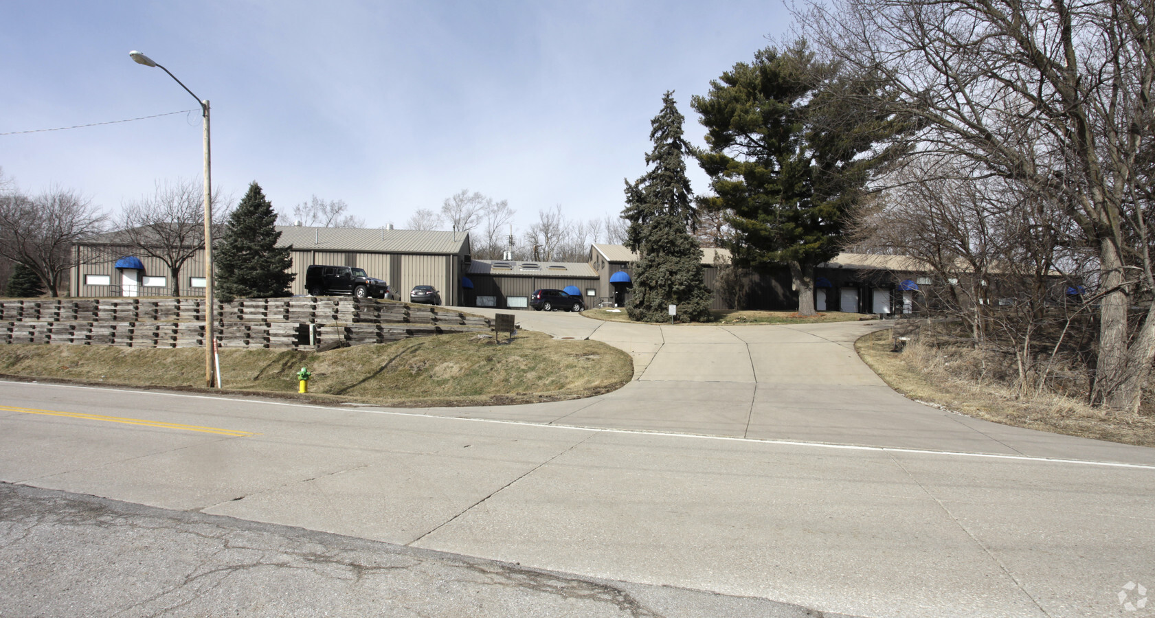
9120 Mormon Bridge Rd
Omaha-Council Bluffs, NE-IA
Raven Oaks
5359-0000-20
RAVEN OAKS LOT 1 BLOCK 13 -EX IRR NTHLY 89.52 FT- IRREG 3.002 AC
Industrialgeneral
Douglas
X
Nebraska
31055C0228H
1
2023
3 AC
2023
Northeast Omaha
007304
Omaha/Council Bluffs
27,998 SF
DEMOGRAPHICS near 9120 Mormon Bridge Rd
1 Mile
3 Mile
5 Mile
2024 Total Population
1,664
43,768
119,847
2029 Population
1,698
44,585
122,039
Pop Growth 2024-2029
+ 2.04%
+ 1.87%
+ 1.83%
Average Age
49
39
37
2024 Total Households
718
16,155
45,343
HH Growth 2024-2029
+ 2.09%
+ 1.89%
+ 1.84%
Median Household Inc
$100,833
$49,201
$52,249
Avg Household Size
2.30
2.60
2.50
2024 Avg HH Vehicles
2.00
2.00
2.00
Median Home Value
$294,883
$152,140
$158,623
Median Year Built
1973
1964
1960
Nearby Places
- Restaurants
- Banks
- Shops
- Fitness
- Groceries
PUBLIC TRANSPORTATION
COMMUTER RAIL
Omaha Amtrak Station (California Zephyr - Amtrak)
Drive
Walk
Distance
Omaha Amtrak Station (California Zephyr - Amtrak)
16 min
9.5 mi
AIRPORT
Eppley Airfield
Drive
Walk
Distance
Eppley Airfield
17 min
7.6 mi
Freight Ports
Tulsa Port Of Catoosa
Drive
Walk
Distance
Tulsa Port Of Catoosa
473 min
425.9 mi
Nearby Properties
Address
Land Use
TOTAL SIZE
Lot Size
Zoning
Address
Land Use
TOTAL SIZE
Lot Size
Zoning
125945
Address
Land Use
TOTAL SIZE
Lot Size
Zoning
172424
2.88 AC
R7
Address
Land Use
TOTAL SIZE
Lot Size
Zoning
92817
5.68 AC
GO
Address
Land Use
TOTAL SIZE
Lot Size
Zoning
282500
8.67 AC
Address
Land Use
TOTAL SIZE
Lot Size
Zoning
178896
16.92 AC
Address
Land Use
TOTAL SIZE
Lot Size
Zoning
126372
11.81 AC
Address
Land Use
TOTAL SIZE
Lot Size
Zoning
111770
2.65 AC
Address
Land Use
TOTAL SIZE
Lot Size
Zoning
91557
5 AC
MU
Address
Land Use
TOTAL SIZE
Lot Size
Zoning
801643
1.72 AC
Address
Land Use
TOTAL SIZE
Lot Size
Zoning
28084
5.22 AC
Address
Land Use
TOTAL SIZE
Lot Size
Zoning
92214
4.67 AC
GI
Address
Land Use
TOTAL SIZE
Lot Size
Zoning
51129
10.18 AC
DR
Address
Land Use
TOTAL SIZE
Lot Size
Zoning
74920
4.53 AC
Address
Land Use
TOTAL SIZE
Lot Size
Zoning
115137
7.45 AC
R6
Address
Land Use
TOTAL SIZE
Lot Size
Zoning
73976
6.80 AC
Address
Land Use
TOTAL SIZE
Lot Size
Zoning
82341
27.11 AC
DR
Address
Land Use
TOTAL SIZE
Lot Size
Zoning
61500
6.84 AC
MU
Address
Land Use
TOTAL SIZE
Lot Size
Zoning
77976
4 AC
R6
Address
Land Use
TOTAL SIZE
Lot Size
Zoning
97368
5.51 AC
GI
Address
Land Use
TOTAL SIZE
Lot Size
Zoning
167580
10.63 AC
GI
Address
Land Use
TOTAL SIZE
Lot Size
Zoning
35028
2.64 AC
R7
Address
Land Use
TOTAL SIZE
Lot Size
Zoning
44545
4.40 AC
R7
Address
Land Use
TOTAL SIZE
Lot Size
Zoning
54041
4.44 AC
Address
Land Use
TOTAL SIZE
Lot Size
Zoning
41717
5.25 AC
CC
Address
Land Use
TOTAL SIZE
Lot Size
Zoning
84698
7 AC
Address
Land Use
TOTAL SIZE
Lot Size
Zoning
37120
2.74 AC
CC
Address
Land Use
TOTAL SIZE
Lot Size
Zoning
131150
3.28 AC
GI
Address
Land Use
TOTAL SIZE
Lot Size
Zoning
130933
3.02 AC
Address
Land Use
TOTAL SIZE
Lot Size
Zoning
67662
3.92 AC
Address
Land Use
TOTAL SIZE
Lot Size
Zoning
14466
1.70 AC
CC
Start a new search to find other properties for sale or lease
Connect with us
© 2024 CoStar Group
The information above has been obtained from sources believed reliable. While we do not doubt its accuracy we have not verified it and make no guarantee, warranty or representation about it. It is your responsibility to independently confirm its accuracy and completeness. Any projections, opinions, assumptions, or estimates used are for example only and do not represent the current or future performance of the property. The value of this transaction to you depends on tax and other factors which should be evaluated by your tax, financial, and legal advisors. You and your advisors should conduct a careful, independent investigation of the property to determine to your satisfaction the suitability of the property for your needs.