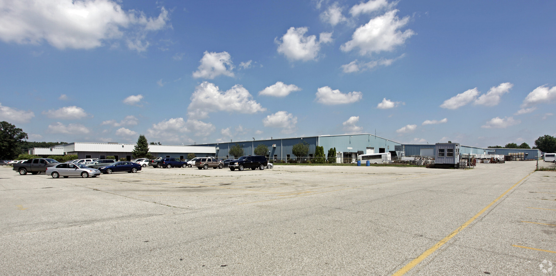
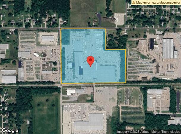
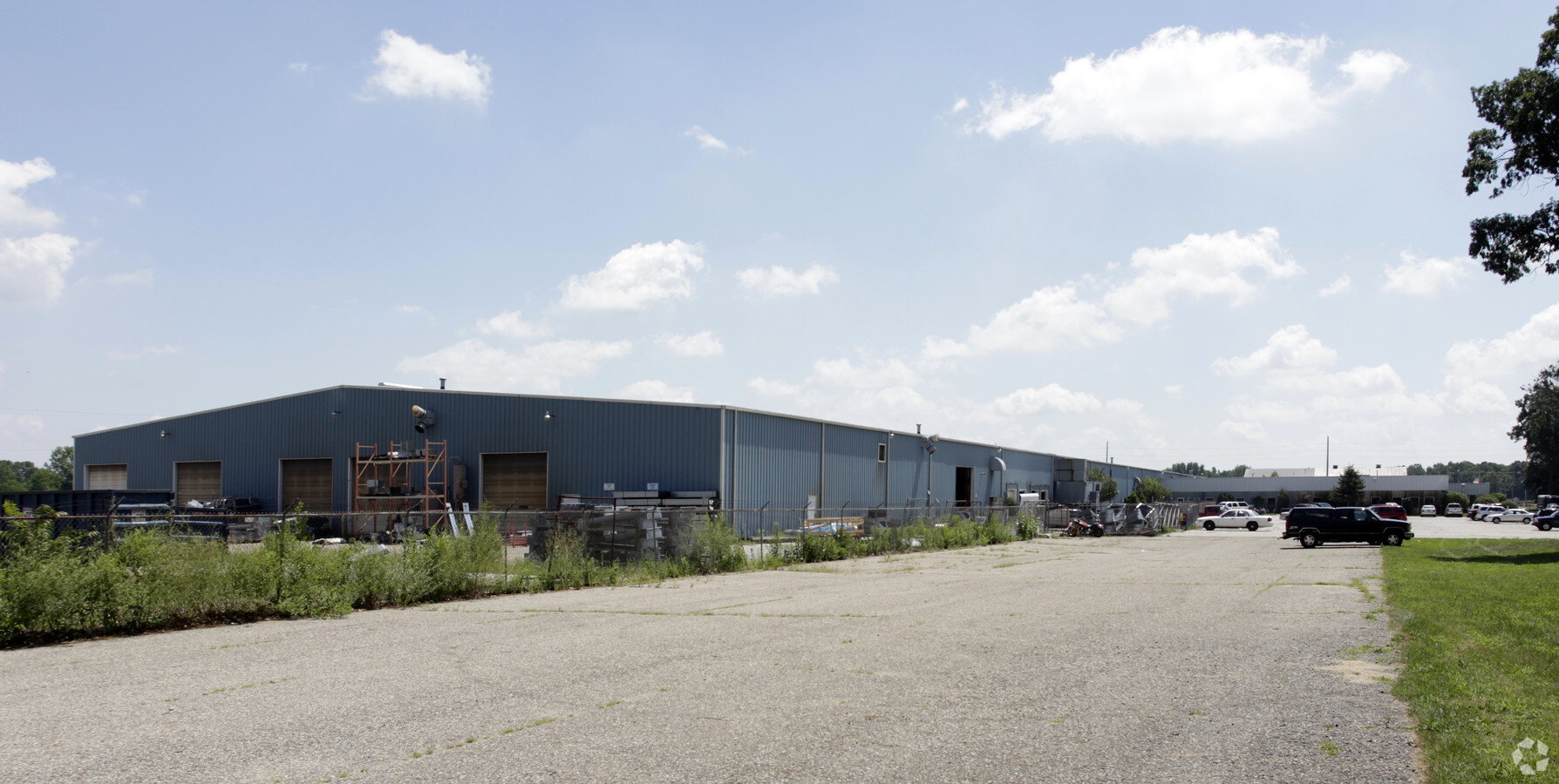
Property Record
914 County Road 1 N, Elkhart, IN 46514
NEARBY LISTINGS FOR SALE OR LEASE
Property Detail
914 County Road 1 N
20-05-02-101-009.000-006
Century Industrial Park Subdivision
Lightindustrial
PT NW1/4 SEC 2 27.455A
X
Elkhart
18039C0108D
Indiana
2023
27.46 AC
2024
Outlying Elkhart County
001501
South Bend/Mishawaka
316,658 SF
Elkhart-Goshen, IN
DEMOGRAPHICS near 914 County Road 1 N
1 Mile
3 Mile
5 Mile
2024 Total Population
3,039
33,707
94,676
2029 Population
3,031
33,539
94,580
Pop Growth 2024-2029
(0.26%)
(0.50%)
(0.10%)
Average Age
38
38
38
2024 Total Households
1,125
12,219
35,006
HH Growth 2024-2029
(0.27%)
(0.59%)
(0.07%)
Median Household Inc
$63,860
$64,188
$57,683
Avg Household Size
2.70
2.70
2.60
2024 Avg HH Vehicles
2.00
2.00
2.00
Median Home Value
$163,079
$161,983
$163,635
Median Year Built
1982
1972
1972
Nearby Places
- Restaurants
- Banks
- Shops
- Fitness
- Groceries
PUBLIC TRANSPORTATION
COMMUTER RAIL
Elkhart Amtrak Station (Capitol Limited - Amtrak, Lake Shore Limited - Amtrak)
DRIVE
WALK
Distance
Elkhart Amtrak Station (Capitol Limited - Amtrak, Lake Shore Limited - Amtrak)
8 min
4.4 mi
AIRPORT
South Bend International
DRIVE
WALK
Distance
South Bend International
37 min
17.3 mi
Freight Ports
Port Milwaukee
DRIVE
WALK
Distance
Port Milwaukee
231 min
191.5 mi
Nearby Properties
Address
Land Use
TOTAL SIZE
Lot Size
Zoning
Address
Land Use
TOTAL SIZE
Lot Size
Zoning
384,095 SF
64.77 AC
Address
Land Use
TOTAL SIZE
Lot Size
Zoning
333,124 SF
16.47 AC
ZO01
Address
Land Use
TOTAL SIZE
Lot Size
Zoning
377,169 SF
23.85 AC
ZO01
Address
Land Use
TOTAL SIZE
Lot Size
Zoning
278,692 SF
13.86 AC
ZO01
Address
Land Use
TOTAL SIZE
Lot Size
Zoning
184,212 SF
23.71 AC
ZO01
Address
Land Use
TOTAL SIZE
Lot Size
Zoning
36,851 SF
22.72 AC
Address
Land Use
TOTAL SIZE
Lot Size
Zoning
83,856 SF
54.56 AC
ZO01
Address
Land Use
TOTAL SIZE
Lot Size
Zoning
53,109 SF
45.11 AC
ZO01
Address
Land Use
TOTAL SIZE
Lot Size
Zoning
203,942 SF
32.52 AC
ZO01
Address
Land Use
TOTAL SIZE
Lot Size
Zoning
81,452 SF
33.51 AC
ZO01
Address
Land Use
TOTAL SIZE
Lot Size
Zoning
144,000 SF
18.31 AC
ZO01
Address
Land Use
TOTAL SIZE
Lot Size
Zoning
153,910 SF
15.14 AC
Address
Land Use
TOTAL SIZE
Lot Size
Zoning
188,176 SF
13.90 AC
ZO01
Address
Land Use
TOTAL SIZE
Lot Size
Zoning
86,252 SF
9.13 AC
ZO01
Address
Land Use
TOTAL SIZE
Lot Size
Zoning
51,620 SF
30.21 AC
ZO01
Address
Land Use
TOTAL SIZE
Lot Size
Zoning
120,320 SF
8.40 AC
Address
Land Use
TOTAL SIZE
Lot Size
Zoning
61,877 SF
13.54 AC
Address
Land Use
TOTAL SIZE
Lot Size
Zoning
120,535 SF
14 AC
Address
Land Use
TOTAL SIZE
Lot Size
Zoning
180,180 SF
10.77 AC
ZO01
Address
Land Use
TOTAL SIZE
Lot Size
Zoning
315,405 SF
5 AC
ZO01
Address
Land Use
TOTAL SIZE
Lot Size
Zoning
106,084 SF
9.11 AC
ZO01
Address
Land Use
TOTAL SIZE
Lot Size
Zoning
89,650 SF
7.58 AC
Address
Land Use
TOTAL SIZE
Lot Size
Zoning
81,196 SF
7.80 AC
ZO01
Address
Land Use
TOTAL SIZE
Lot Size
Zoning
85,660 SF
13.60 AC
ZO01
Address
Land Use
TOTAL SIZE
Lot Size
Zoning
159,677 SF
6.67 AC
Address
Land Use
TOTAL SIZE
Lot Size
Zoning
90,864 SF
13.72 AC
ZO01
Address
Land Use
TOTAL SIZE
Lot Size
Zoning
182,018 SF
30.91 AC
ZO01
Address
Land Use
TOTAL SIZE
Lot Size
Zoning
155,790 SF
7.99 AC
ZO01
Address
Land Use
TOTAL SIZE
Lot Size
Zoning
136,400 SF
6.48 AC
M-1
The World's #1 Commercial Real Estate Marketplace
Connect with us
© 2025 CoStar Group
The information above has been obtained from sources believed reliable. While we do not doubt its accuracy we have not verified it and make no guarantee, warranty or representation about it. It is your responsibility to independently confirm its accuracy and completeness. Any projections, opinions, assumptions, or estimates used are for example only and do not represent the current or future performance of the property. The value of this transaction to you depends on tax and other factors which should be evaluated by your tax, financial, and legal advisors. You and your advisors should conduct a careful, independent investigation of the property to determine to your satisfaction the suitability of the property for your needs.