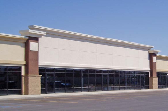
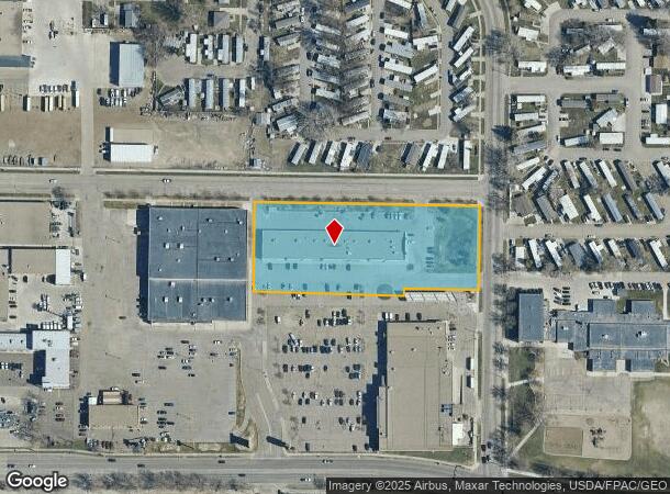
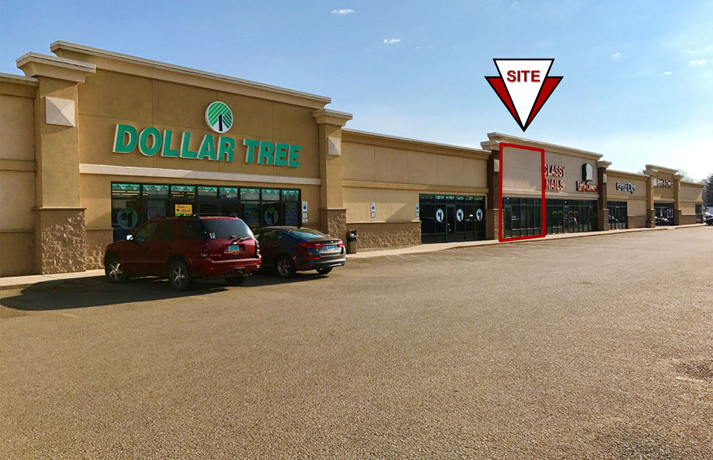
Property Record
914 S 12Th St, Bismarck, ND 58504
NEARBY LISTINGS FOR SALE OR LEASE
Property Detail
914 S 12Th St
Bismarck, ND
Arbor Avenue
1075-001-001
ARBOR AVENUE PT LOT 1 BEG NE COR; WLY 551.15'TO NW COR SLY ALONG W LINE 219.79'TO PT 80'N SW COR; ELY 550.79' 120'N SE COR NL
Stripcommercialcenter
Burleigh
AE
North Dakota
38015C0795E
1
2023
2.71 AC
2023
Downtown Bismarck
010800
Other Market Areas
24,500 SF
DEMOGRAPHICS near 914 S 12Th St
1 Mile
3 Mile
5 Mile
2024 Total Population
8,857
52,008
92,254
2029 Population
9,117
53,500
95,079
Pop Growth 2024-2029
+ 2.94%
+ 2.87%
+ 3.06%
Average Age
40
40
40
2024 Total Households
4,264
23,322
38,764
HH Growth 2024-2029
+ 3.10%
+ 2.94%
+ 3.12%
Median Household Inc
$50,505
$58,661
$67,520
Avg Household Size
2.00
2.10
2.20
2024 Avg HH Vehicles
2.00
2.00
2.00
Median Home Value
$174,886
$240,718
$266,036
Median Year Built
1974
1976
1988
Nearby Places
- Restaurants
- Banks
- Shops
- Fitness
- Groceries
PUBLIC TRANSPORTATION
AIRPORT
Bismarck Municipal
DRIVE
WALK
Distance
Bismarck Municipal
13 min
3.4 mi
Freight Ports
Port Milwaukee
DRIVE
WALK
Distance
Port Milwaukee
824 min
765.9 mi
SALE & LEASE HISTORY
LISTING DATE
SALE/LEASE

Nov 30, 2016
For Lease
Nearby Properties
Address
Land Use
TOTAL SIZE
Lot Size
Zoning
Address
Land Use
TOTAL SIZE
Lot Size
Zoning
45.23 AC
CG
Address
Land Use
TOTAL SIZE
Lot Size
Zoning
7.67 AC
CG
Address
Land Use
TOTAL SIZE
Lot Size
Zoning
26.42 AC
MA
Address
Land Use
TOTAL SIZE
Lot Size
Zoning
93,860 SF
1.44 AC
HM
Address
Land Use
TOTAL SIZE
Lot Size
Zoning
35.42 AC
MA
Address
Land Use
TOTAL SIZE
Lot Size
Zoning
28.03 AC
MA
Address
Land Use
TOTAL SIZE
Lot Size
Zoning
60,105 SF
11.86 AC
RM30
Address
Land Use
TOTAL SIZE
Lot Size
Zoning
70,182 SF
3.83 AC
PUD
Address
Land Use
TOTAL SIZE
Lot Size
Zoning
44,652 SF
13.84 AC
RM30
Address
Land Use
TOTAL SIZE
Lot Size
Zoning
6.29 AC
RM30
Address
Land Use
TOTAL SIZE
Lot Size
Zoning
81,092 SF
4.17 AC
HM
Address
Land Use
TOTAL SIZE
Lot Size
Zoning
20.41 AC
MA
Address
Land Use
TOTAL SIZE
Lot Size
Zoning
38,467 SF
13.88 AC
CG
Address
Land Use
TOTAL SIZE
Lot Size
Zoning
13.98 AC
CG
Address
Land Use
TOTAL SIZE
Lot Size
Zoning
51,723 SF
1.69 AC
HM
Address
Land Use
TOTAL SIZE
Lot Size
Zoning
10.84 AC
CG
Address
Land Use
TOTAL SIZE
Lot Size
Zoning
57,580 SF
8.85 AC
CG
Address
Land Use
TOTAL SIZE
Lot Size
Zoning
14.22 AC
MA
Address
Land Use
TOTAL SIZE
Lot Size
Zoning
14.70 AC
MA
Address
Land Use
TOTAL SIZE
Lot Size
Zoning
7,288 SF
7.50 AC
CG
Address
Land Use
TOTAL SIZE
Lot Size
Zoning
62,652 SF
2.34 AC
HM
Address
Land Use
TOTAL SIZE
Lot Size
Zoning
42,908 SF
12.44 AC
MA
Address
Land Use
TOTAL SIZE
Lot Size
Zoning
99,684 SF
2.33 AC
MA
Address
Land Use
TOTAL SIZE
Lot Size
Zoning
15,656 SF
8.98 AC
RM30
Address
Land Use
TOTAL SIZE
Lot Size
Zoning
25.59 AC
CG
Address
Land Use
TOTAL SIZE
Lot Size
Zoning
43,708 SF
4.27 AC
RT
Address
Land Use
TOTAL SIZE
Lot Size
Zoning
10.14 AC
CG
Address
Land Use
TOTAL SIZE
Lot Size
Zoning
14.65 AC
CG
Address
Land Use
TOTAL SIZE
Lot Size
Zoning
88,263 SF
8.58 AC
CG
Address
Land Use
TOTAL SIZE
Lot Size
Zoning
64,008 SF
12.61 AC
MA
The World's #1 Commercial Real Estate Marketplace
Connect with us
© 2025 CoStar Group
The information above has been obtained from sources believed reliable. While we do not doubt its accuracy we have not verified it and make no guarantee, warranty or representation about it. It is your responsibility to independently confirm its accuracy and completeness. Any projections, opinions, assumptions, or estimates used are for example only and do not represent the current or future performance of the property. The value of this transaction to you depends on tax and other factors which should be evaluated by your tax, financial, and legal advisors. You and your advisors should conduct a careful, independent investigation of the property to determine to your satisfaction the suitability of the property for your needs.