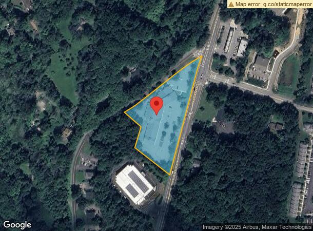
Property Record
915 County Road 517, Hackettstown, NJ 07840

NEARBY LISTINGS FOR SALE OR LEASE
Property Detail
915 County Road 517
12-00005-0000-00001
Warren
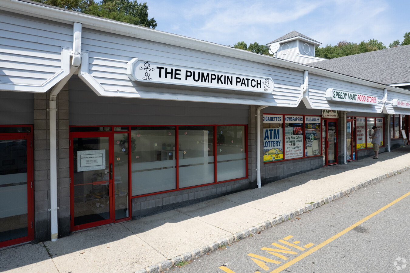
Regionalshoppingcenterormallwithanchorstore
New Jersey
X
1
34041C0252E
3.06 AC
2023
Warren County
2024
Northern New Jersey
031301
Allentown-Bethlehem-Easton, PA-NJ
DEMOGRAPHICS near 915 County Road 517
1 Mile
3 Mile
5 Mile
2024 Total Population
4,469
26,942
47,600
2029 Population
4,513
27,226
47,839
Pop Growth 2024-2029
+ 0.98%
+ 1.05%
+ 0.50%
Average Age
45
42
42
2024 Total Households
2,025
10,698
18,341
HH Growth 2024-2029
+ 1.23%
+ 1.29%
+ 0.59%
Median Household Inc
$82,879
$97,410
$101,540
Avg Household Size
2.20
2.40
2.50
2024 Avg HH Vehicles
2.00
2.00
2.00
Median Home Value
$271,064
$349,557
$371,635
Median Year Built
1982
1981
1978
Nearby Places
- Restaurants
- Banks
- Shops
- Fitness
- Groceries
PUBLIC TRANSPORTATION
COMMUTER RAIL
Hackettstown (Montclair-Boonton Line - NJ Transit Commuter Rail (NJ Transit), Morris & Essex Morristown Line - NJ Transit Commuter Rail (NJ Transit))
DRIVE
WALK
Distance
Hackettstown (Montclair-Boonton Line - NJ Transit Commuter Rail (NJ Transit), Morris & Essex Morristown Line - NJ Transit Commuter Rail (NJ Transit))
5 min
1.6 mi
Freight Ports
Maher Terminal
DRIVE
WALK
Distance
Maher Terminal
64 min
49.2 mi
SALE & LEASE HISTORY
LISTING DATE
SALE/LEASE

Sep 24, 2016
For Lease
Sep 02, 2021
For Lease
Nearby Properties
Address
Land Use
TOTAL SIZE
Lot Size
Zoning
Address
Land Use
TOTAL SIZE
Lot Size
Zoning
521,918 SF
61.60 AC
LM
Address
Land Use
TOTAL SIZE
Lot Size
Zoning
16,916 SF
39.96 AC
R30
Address
Land Use
TOTAL SIZE
Lot Size
Zoning
Address
Land Use
TOTAL SIZE
Lot Size
Zoning
16.54 AC
Address
Land Use
TOTAL SIZE
Lot Size
Zoning
255,000 SF
39.57 AC
Address
Land Use
TOTAL SIZE
Lot Size
Zoning
187,660 SF
15 AC
HF
Address
Land Use
TOTAL SIZE
Lot Size
Zoning
133,042 SF
23.25 AC
HC
Address
Land Use
TOTAL SIZE
Lot Size
Zoning
Address
Land Use
TOTAL SIZE
Lot Size
Zoning
70,182 SF
10.68 AC
L-I
Address
Land Use
TOTAL SIZE
Lot Size
Zoning
127,307 SF
26.84 AC
C2
Address
Land Use
TOTAL SIZE
Lot Size
Zoning
6.80 AC
C2
Address
Land Use
TOTAL SIZE
Lot Size
Zoning
2,420 SF
2.55 AC
Address
Land Use
TOTAL SIZE
Lot Size
Zoning
13.51 AC
RCH
Address
Land Use
TOTAL SIZE
Lot Size
Zoning
180,814 SF
15 AC
LM
Address
Land Use
TOTAL SIZE
Lot Size
Zoning
1,352 SF
166.25 AC
C
Address
Land Use
TOTAL SIZE
Lot Size
Zoning
49,430 SF
5 AC
HF
Address
Land Use
TOTAL SIZE
Lot Size
Zoning
116,386 SF
33.90 AC
R125
Address
Land Use
TOTAL SIZE
Lot Size
Zoning
2,046 SF
13.54 AC
C2
Address
Land Use
TOTAL SIZE
Lot Size
Zoning
1,908 SF
6.35 AC
HC
Address
Land Use
TOTAL SIZE
Lot Size
Zoning
41,361 SF
8.86 AC
HF
Address
Land Use
TOTAL SIZE
Lot Size
Zoning
45,090 SF
4.78 AC
LM
Address
Land Use
TOTAL SIZE
Lot Size
Zoning
161,776 SF
18.75 AC
FTZ2
Address
Land Use
TOTAL SIZE
Lot Size
Zoning
69,380 SF
3.58 AC
HF
Address
Land Use
TOTAL SIZE
Lot Size
Zoning
37,794 SF
14.28 AC
HF
Address
Land Use
TOTAL SIZE
Lot Size
Zoning
96,548 SF
28.76 AC
C-2
Address
Land Use
TOTAL SIZE
Lot Size
Zoning
8,008 SF
6.94 AC
APT
Address
Land Use
TOTAL SIZE
Lot Size
Zoning
40,630 SF
14.10 AC
HF
Address
Land Use
TOTAL SIZE
Lot Size
Zoning
90.90 AC
R125
Address
Land Use
TOTAL SIZE
Lot Size
Zoning
94,420 SF
2.49 AC
R125
Address
Land Use
TOTAL SIZE
Lot Size
Zoning
54,589 SF
19.28 AC
R-1
The World's #1 Commercial Real Estate Marketplace
Connect with us
© 2025 CoStar Group
The information above has been obtained from sources believed reliable. While we do not doubt its accuracy we have not verified it and make no guarantee, warranty or representation about it. It is your responsibility to independently confirm its accuracy and completeness. Any projections, opinions, assumptions, or estimates used are for example only and do not represent the current or future performance of the property. The value of this transaction to you depends on tax and other factors which should be evaluated by your tax, financial, and legal advisors. You and your advisors should conduct a careful, independent investigation of the property to determine to your satisfaction the suitability of the property for your needs.