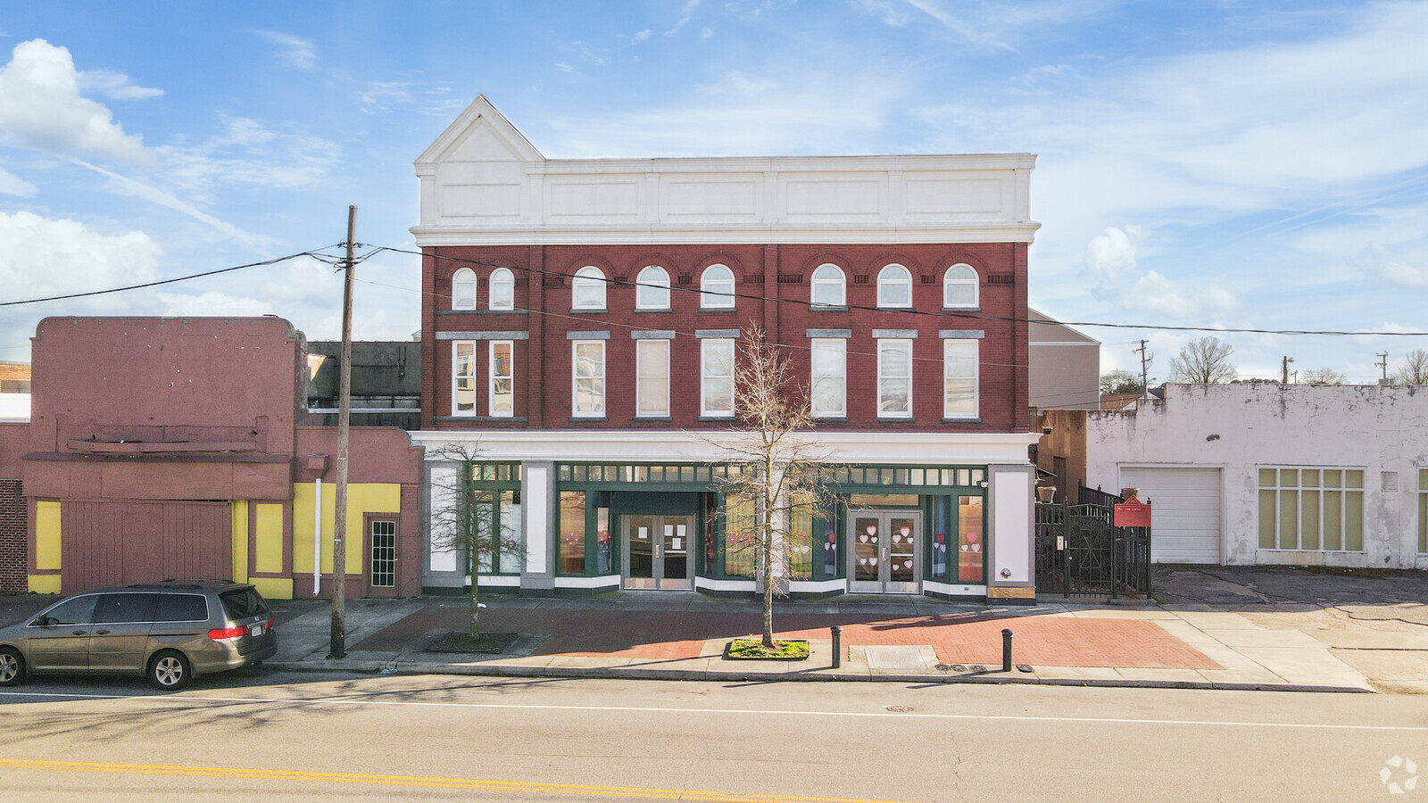
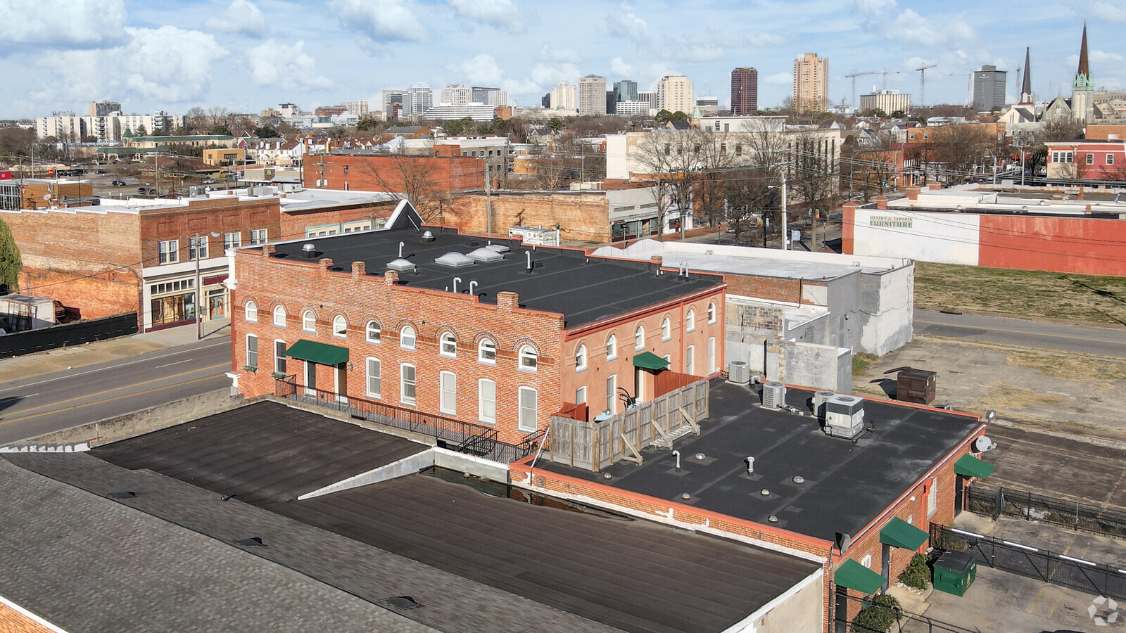
Property Record
915 High St, Portsmouth, VA 23704
NEARBY LISTINGS FOR SALE OR LEASE
Property Detail
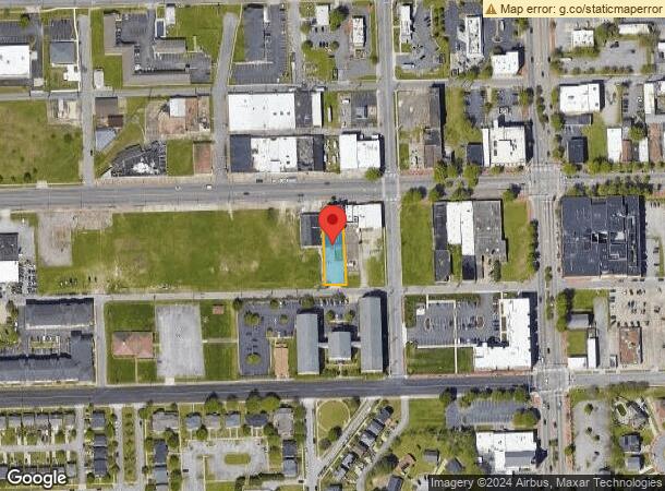
915 High St
0049-0040
Commercial District 2
Commercialofficeresidentialmixeduse
LOT A MIN SUB OF LTS 9,10,11 & 12 S
X
Portsmouth
5101040058H
Virginia
2024
0.31 AC
2024
Downtown Portsmouth
211100
Hampton Roads
12,152 SF
Virginia Beach-Norfolk-Newport News, VA-NC
DEMOGRAPHICS near 915 High St
1 Mile
3 Mile
5 Mile
2024 Total Population
13,548
98,579
242,681
2029 Population
13,457
98,489
242,738
Pop Growth 2024-2029
(0.67%)
(0.09%)
+ 0.02%
Average Age
38
36
37
2024 Total Households
6,113
41,243
97,209
HH Growth 2024-2029
(0.87%)
(0.46%)
(0.18%)
Median Household Inc
$46,172
$49,104
$57,389
Avg Household Size
2.10
2.20
2.30
2024 Avg HH Vehicles
1.00
1.00
2.00
Median Home Value
$187,499
$201,922
$221,834
Median Year Built
1960
1961
1966
Nearby Places
- Restaurants
- Banks
- Shops
- Fitness
- Groceries
PUBLIC TRANSPORTATION
COMMUTER RAIL
Norfolk (Northeast Regional - Amtrak)
Drive
Walk
Distance
Norfolk (Northeast Regional - Amtrak)
6 min
2.9 mi
AIRPORT
Norfolk International
Drive
Walk
Distance
Norfolk International
18 min
9.3 mi
Newport News/Williamsburg International
Drive
Walk
Distance
Newport News/Williamsburg International
46 min
32.3 mi
Freight Ports
Virginia Port Authority - Portsmouth
Drive
Walk
Distance
Virginia Port Authority - Portsmouth
9 min
3.2 mi
SALE & LEASE HISTORY
LISTING DATE
SALE/LEASE

Oct 18, 2018
For Sale
Jun 05, 2020
For Sale
Aug 14, 2020
For Sale
Nearby Properties
Address
Land Use
TOTAL SIZE
Lot Size
Zoning
Address
Land Use
TOTAL SIZE
Lot Size
Zoning
331760
24.97 AC
Address
Land Use
TOTAL SIZE
Lot Size
Zoning
5704
4.67 AC
D2
Address
Land Use
TOTAL SIZE
Lot Size
Zoning
192422
10.70 AC
D4
Address
Land Use
TOTAL SIZE
Lot Size
Zoning
421540
2.37 AC
Address
Land Use
TOTAL SIZE
Lot Size
Zoning
250766
31.14 AC
NMU
Address
Land Use
TOTAL SIZE
Lot Size
Zoning
85756
3.59 AC
D5
Address
Land Use
TOTAL SIZE
Lot Size
Zoning
390960
4.43 AC
Address
Land Use
TOTAL SIZE
Lot Size
Zoning
390960
4.43 AC
Address
Land Use
TOTAL SIZE
Lot Size
Zoning
55.11 AC
IN2
Address
Land Use
TOTAL SIZE
Lot Size
Zoning
73136
5.34 AC
IN2
Address
Land Use
TOTAL SIZE
Lot Size
Zoning
971654
6.01 AC
D2
Address
Land Use
TOTAL SIZE
Lot Size
Zoning
421856
2.64 AC
D1
Address
Land Use
TOTAL SIZE
Lot Size
Zoning
473072
9.72 AC
SD
Address
Land Use
TOTAL SIZE
Lot Size
Zoning
563325
0.72 AC
D2
Address
Land Use
TOTAL SIZE
Lot Size
Zoning
310912
3.94 AC
Address
Land Use
TOTAL SIZE
Lot Size
Zoning
192270
1.99 AC
D2
Address
Land Use
TOTAL SIZE
Lot Size
Zoning
363974
1.49 AC
Address
Land Use
TOTAL SIZE
Lot Size
Zoning
4.92 AC
IN1
Address
Land Use
TOTAL SIZE
Lot Size
Zoning
356598
1.84 AC
D2
Address
Land Use
TOTAL SIZE
Lot Size
Zoning
66718
4.09 AC
D5
Address
Land Use
TOTAL SIZE
Lot Size
Zoning
160677
29.46 AC
IN
Address
Land Use
TOTAL SIZE
Lot Size
Zoning
24710
0.44 AC
Address
Land Use
TOTAL SIZE
Lot Size
Zoning
291748
3.40 AC
G1
Address
Land Use
TOTAL SIZE
Lot Size
Zoning
406344
8.45 AC
GMU
Address
Land Use
TOTAL SIZE
Lot Size
Zoning
197074
6.69 AC
Address
Land Use
TOTAL SIZE
Lot Size
Zoning
130750
68.79 AC
IN
Address
Land Use
TOTAL SIZE
Lot Size
Zoning
50384
0.74 AC
Address
Land Use
TOTAL SIZE
Lot Size
Zoning
640920
3.67 AC
HCEF
Address
Land Use
TOTAL SIZE
Lot Size
Zoning
188152
16.93 AC
Address
Land Use
TOTAL SIZE
Lot Size
Zoning
251984
0.40 AC
D2
Start a new search to find other properties for sale or lease
Connect with us
© 2024 CoStar Group
The information above has been obtained from sources believed reliable. While we do not doubt its accuracy we have not verified it and make no guarantee, warranty or representation about it. It is your responsibility to independently confirm its accuracy and completeness. Any projections, opinions, assumptions, or estimates used are for example only and do not represent the current or future performance of the property. The value of this transaction to you depends on tax and other factors which should be evaluated by your tax, financial, and legal advisors. You and your advisors should conduct a careful, independent investigation of the property to determine to your satisfaction the suitability of the property for your needs.