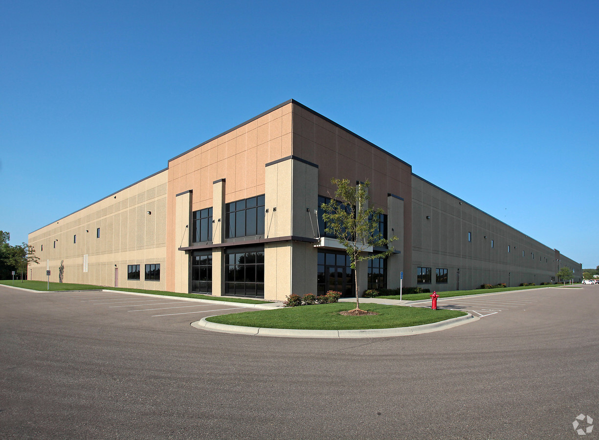
Property Record
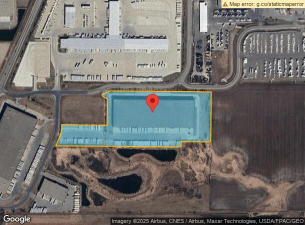
9150 217Th St W, Lakeville, MN 55044
NEARBY LISTINGS FOR SALE OR LEASE
Property Detail
9150 217Th St W
Minneapolis-St. Paul-Bloomington, MN-WI
First Park Lakeville 3Rd Addition
22-26952-01-010
FIRST PARK LAKEVILLE 3RD ADDITION 1 1
Industrialgeneral
Dakota
X
Minnesota
27037C0194E
10
2024
18.86 AC
2023
South Central
060836
Minneapolis/St Paul
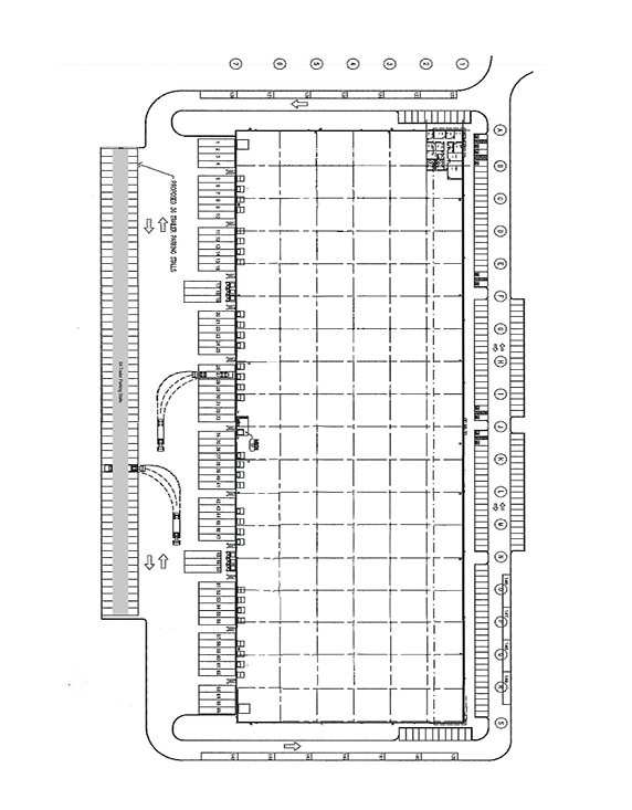
282,100 SF
DEMOGRAPHICS near 9150 217Th St W
1 Mile
3 Mile
5 Mile
2024 Total Population
2,470
23,433
60,953
2029 Population
2,512
24,262
63,013
Pop Growth 2024-2029
+ 1.70%
+ 3.54%
+ 3.38%
Average Age
36
36
37
2024 Total Households
814
7,673
20,750
HH Growth 2024-2029
+ 1.60%
+ 3.49%
+ 3.50%
Median Household Inc
$128,561
$121,236
$122,880
Avg Household Size
3.00
3.00
2.90
2024 Avg HH Vehicles
2.00
2.00
2.00
Median Home Value
$379,967
$417,093
$396,034
Median Year Built
1998
2002
1999
Nearby Places
- Restaurants
- Banks
- Shops
- Fitness
- Groceries
PUBLIC TRANSPORTATION
AIRPORT
Minneapolis-St Paul International/Wold-Chamberlain
DRIVE
WALK
Distance
Minneapolis-St Paul International/Wold-Chamberlain
31 min
23.0 mi
Freight Ports
Port Milwaukee
DRIVE
WALK
Distance
Port Milwaukee
384 min
344.2 mi
SALE & LEASE HISTORY
LISTING DATE
SALE/LEASE

Nov 11, 2022
For Lease
Nearby Properties
Address
Land Use
TOTAL SIZE
Lot Size
Zoning
Address
Land Use
TOTAL SIZE
Lot Size
Zoning
749,550 SF
71.74 AC
Address
Land Use
TOTAL SIZE
Lot Size
Zoning
179,859 SF
43.48 AC
Address
Land Use
TOTAL SIZE
Lot Size
Zoning
359,914 SF
18.86 AC
Address
Land Use
TOTAL SIZE
Lot Size
Zoning
374,622 SF
18.74 AC
Address
Land Use
TOTAL SIZE
Lot Size
Zoning
187,993 SF
21.88 AC
Address
Land Use
TOTAL SIZE
Lot Size
Zoning
121,600 SF
27.55 AC
Address
Land Use
TOTAL SIZE
Lot Size
Zoning
275,666 SF
23.58 AC
Address
Land Use
TOTAL SIZE
Lot Size
Zoning
151,200 SF
17.20 AC
Address
Land Use
TOTAL SIZE
Lot Size
Zoning
94,592 SF
14.30 AC
Address
Land Use
TOTAL SIZE
Lot Size
Zoning
276,560 SF
20.11 AC
Address
Land Use
TOTAL SIZE
Lot Size
Zoning
12.51 AC
Address
Land Use
TOTAL SIZE
Lot Size
Zoning
93,883 SF
4.17 AC
Address
Land Use
TOTAL SIZE
Lot Size
Zoning
53,022 SF
11.89 AC
Address
Land Use
TOTAL SIZE
Lot Size
Zoning
151,109 SF
14.54 AC
Address
Land Use
TOTAL SIZE
Lot Size
Zoning
56,950 SF
27.71 AC
Address
Land Use
TOTAL SIZE
Lot Size
Zoning
130,180 SF
9.01 AC
Address
Land Use
TOTAL SIZE
Lot Size
Zoning
78,220 SF
5.96 AC
Address
Land Use
TOTAL SIZE
Lot Size
Zoning
158,698 SF
8.59 AC
Address
Land Use
TOTAL SIZE
Lot Size
Zoning
109,440 SF
8.92 AC
Address
Land Use
TOTAL SIZE
Lot Size
Zoning
118,065 SF
7.63 AC
Address
Land Use
TOTAL SIZE
Lot Size
Zoning
102,664 SF
3.82 AC
Address
Land Use
TOTAL SIZE
Lot Size
Zoning
112,730 SF
5.73 AC
Address
Land Use
TOTAL SIZE
Lot Size
Zoning
131,634 SF
10.76 AC
Address
Land Use
TOTAL SIZE
Lot Size
Zoning
49,460 SF
14.65 AC
Address
Land Use
TOTAL SIZE
Lot Size
Zoning
84,582 SF
14.20 AC
Address
Land Use
TOTAL SIZE
Lot Size
Zoning
54,378 SF
6.48 AC
Address
Land Use
TOTAL SIZE
Lot Size
Zoning
75,411 SF
1.12 AC
Address
Land Use
TOTAL SIZE
Lot Size
Zoning
61,674 SF
10.30 AC
The World's #1 Commercial Real Estate Marketplace
Connect with us
© 2025 CoStar Group
The information above has been obtained from sources believed reliable. While we do not doubt its accuracy we have not verified it and make no guarantee, warranty or representation about it. It is your responsibility to independently confirm its accuracy and completeness. Any projections, opinions, assumptions, or estimates used are for example only and do not represent the current or future performance of the property. The value of this transaction to you depends on tax and other factors which should be evaluated by your tax, financial, and legal advisors. You and your advisors should conduct a careful, independent investigation of the property to determine to your satisfaction the suitability of the property for your needs.