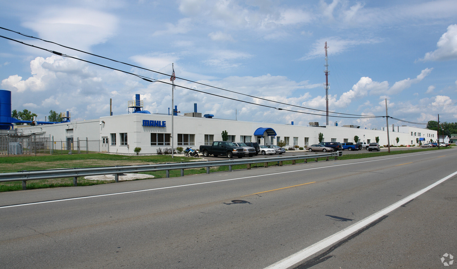
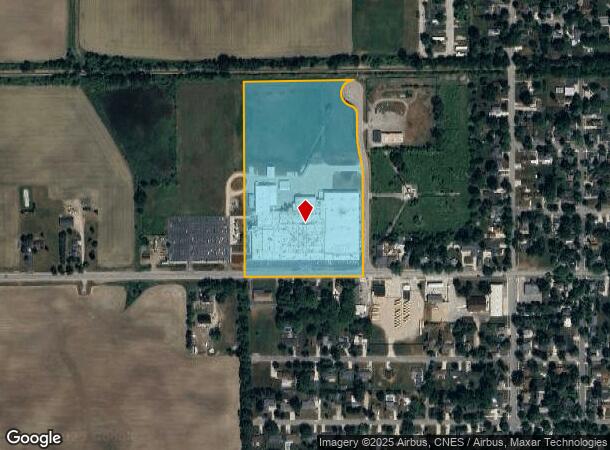
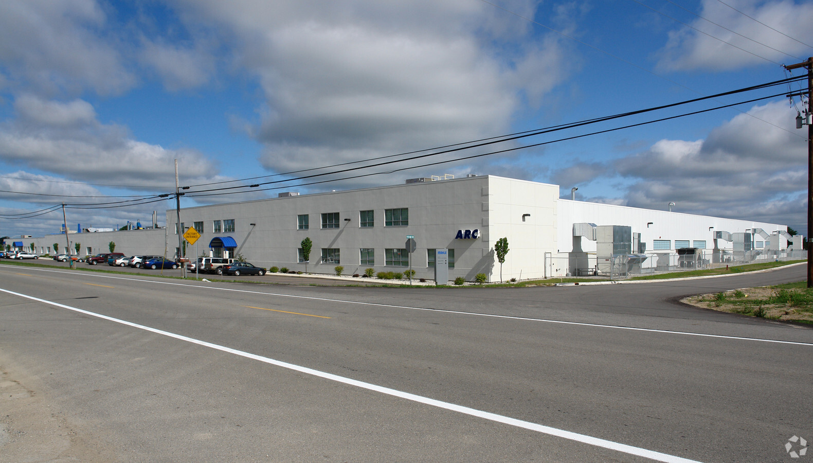
Property Record
916 W State St, Saint Johns, MI 48879
NEARBY LISTINGS FOR SALE OR LEASE
-
-
View all Saint Johns listings for sale on LoopNet.com
Property Detail
916 W State St
300-008-400-025-50
Perrins Add
Manufacturinglight
Clinton
X
Michigan
26057C0450C
16.85 AC
2023
Outlying Clinton County
2024
West Michigan
010801
Lansing-East Lansing, MI
137,552 SF
DEMOGRAPHICS near 916 W State St
1 Mile
3 Mile
5 Mile
2024 Total Population
4,832
10,031
12,537
2029 Population
4,951
10,237
12,777
Pop Growth 2024-2029
+ 2.46%
+ 2.05%
+ 1.91%
Average Age
40
41
42
2024 Total Households
2,047
4,179
5,097
HH Growth 2024-2029
+ 2.34%
+ 2.03%
+ 1.90%
Median Household Inc
$71,470
$71,547
$72,841
Avg Household Size
2.30
2.30
2.40
2024 Avg HH Vehicles
2.00
2.00
2.00
Median Home Value
$155,810
$179,911
$191,858
Median Year Built
1954
1969
1970
Nearby Places
- Restaurants
- Banks
- Shops
- Fitness
- Groceries
PUBLIC TRANSPORTATION
AIRPORT
Capital Region International
DRIVE
WALK
Distance
Capital Region International
31 min
24.8 mi
Freight Ports
Port of Toledo
DRIVE
WALK
Distance
Port of Toledo
165 min
134.2 mi
Nearby Properties
Address
Land Use
TOTAL SIZE
Lot Size
Zoning
Address
Land Use
TOTAL SIZE
Lot Size
Zoning
375,000 SF
Address
Land Use
TOTAL SIZE
Lot Size
Zoning
339,220 SF
36.58 AC
I-1
Address
Land Use
TOTAL SIZE
Lot Size
Zoning
106,182 SF
65 AC
Address
Land Use
TOTAL SIZE
Lot Size
Zoning
46,540 SF
13.78 AC
RO
Address
Land Use
TOTAL SIZE
Lot Size
Zoning
116.63 AC
A2
Address
Land Use
TOTAL SIZE
Lot Size
Zoning
75,000 SF
Address
Land Use
TOTAL SIZE
Lot Size
Zoning
163,881 SF
14.07 AC
I-1
Address
Land Use
TOTAL SIZE
Lot Size
Zoning
190,942 SF
18.57 AC
C-2
Address
Land Use
TOTAL SIZE
Lot Size
Zoning
80 AC
AGR
Address
Land Use
TOTAL SIZE
Lot Size
Zoning
79,006 SF
31.12 AC
R3
Address
Land Use
TOTAL SIZE
Lot Size
Zoning
24,890 SF
8.13 AC
R3
Address
Land Use
TOTAL SIZE
Lot Size
Zoning
54,390 SF
22.62 AC
MC
Address
Land Use
TOTAL SIZE
Lot Size
Zoning
70,510 SF
9.33 AC
C-2
Address
Land Use
TOTAL SIZE
Lot Size
Zoning
22,740 SF
4.13 AC
GC
Address
Land Use
TOTAL SIZE
Lot Size
Zoning
36,505 SF
14.76 AC
GC
Address
Land Use
TOTAL SIZE
Lot Size
Zoning
6,208 SF
7.09 AC
R3
Address
Land Use
TOTAL SIZE
Lot Size
Zoning
69,347 SF
11.25 AC
GC
Address
Land Use
TOTAL SIZE
Lot Size
Zoning
51,312 SF
5.60 AC
GC
Address
Land Use
TOTAL SIZE
Lot Size
Zoning
34,423 SF
2.92 AC
O
Address
Land Use
TOTAL SIZE
Lot Size
Zoning
50,630 SF
2.77 AC
R3
Address
Land Use
TOTAL SIZE
Lot Size
Zoning
13,300 SF
32.81 AC
A-2
Address
Land Use
TOTAL SIZE
Lot Size
Zoning
17,141 SF
2.91 AC
I-1
Address
Land Use
TOTAL SIZE
Lot Size
Zoning
7,520 SF
3.21 AC
R3
Address
Land Use
TOTAL SIZE
Lot Size
Zoning
17,760 SF
3.59 AC
R3
Address
Land Use
TOTAL SIZE
Lot Size
Zoning
792 SF
14.48 AC
RMH
Address
Land Use
TOTAL SIZE
Lot Size
Zoning
17,760 SF
3.42 AC
R3
Address
Land Use
TOTAL SIZE
Lot Size
Zoning
8,897 SF
2.89 AC
GC
Address
Land Use
TOTAL SIZE
Lot Size
Zoning
89,500 SF
15.03 AC
C-2
Address
Land Use
TOTAL SIZE
Lot Size
Zoning
54,154 SF
4.28 AC
I-1
The World's #1 Commercial Real Estate Marketplace
Connect with us
© 2025 CoStar Group
The information above has been obtained from sources believed reliable. While we do not doubt its accuracy we have not verified it and make no guarantee, warranty or representation about it. It is your responsibility to independently confirm its accuracy and completeness. Any projections, opinions, assumptions, or estimates used are for example only and do not represent the current or future performance of the property. The value of this transaction to you depends on tax and other factors which should be evaluated by your tax, financial, and legal advisors. You and your advisors should conduct a careful, independent investigation of the property to determine to your satisfaction the suitability of the property for your needs.