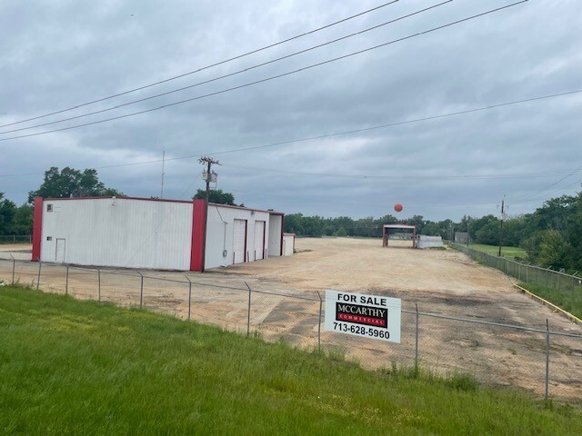
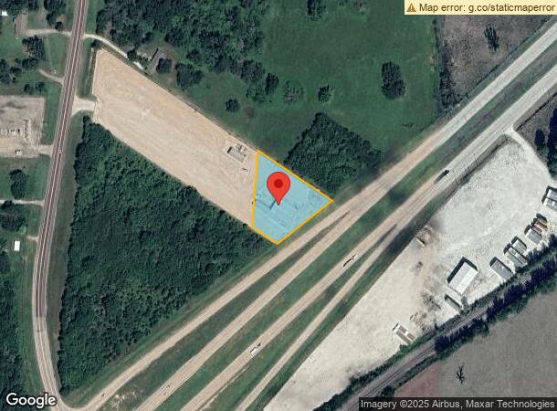
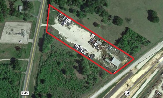
Property Record
9182 N Us Highway 79, Palestine, TX 75803
NEARBY LISTINGS FOR SALE OR LEASE
Property Detail
9182 N Us Highway 79
R59112
James Madden
Industrialgeneral
A0039 MADDEN, JAMES BLOCK 1169 TRACT 10C
X
Anderson
48289C0050C
Texas
2023
0.75 AC
2024
Texas East Area
950902
Other Market Areas
4,990 SF
Palestine, TX
DEMOGRAPHICS near 9182 N Us Highway 79
1 Mile
3 Mile
5 Mile
2024 Total Population
65
995
4,478
2029 Population
66
1,006
4,522
Pop Growth 2024-2029
+ 1.54%
+ 1.11%
+ 0.98%
Average Age
42
42
41
2024 Total Households
25
382
1,573
HH Growth 2024-2029
0.00%
+ 1.05%
+ 0.89%
Median Household Inc
$47,500
$47,211
$47,610
Avg Household Size
2.60
2.60
2.60
2024 Avg HH Vehicles
2.00
2.00
2.00
Median Home Value
$145,454
$145,209
$133,333
Median Year Built
1981
1981
1981
Nearby Places
- Restaurants
- Banks
- Shops
- Fitness
- Groceries
SALE & LEASE HISTORY
LISTING DATE
SALE/LEASE

Jan 05, 2021
For Sale
Nearby Properties
Address
Land Use
TOTAL SIZE
Lot Size
Zoning
Address
Land Use
TOTAL SIZE
Lot Size
Zoning
1,160,508 SF
247.48 AC
Address
Land Use
TOTAL SIZE
Lot Size
Zoning
Address
Land Use
TOTAL SIZE
Lot Size
Zoning
41,004 SF
23.61 AC
Address
Land Use
TOTAL SIZE
Lot Size
Zoning
11,872 SF
15 AC
Address
Land Use
TOTAL SIZE
Lot Size
Zoning
10,700 SF
4 AC
Address
Land Use
TOTAL SIZE
Lot Size
Zoning
13,940 SF
48.66 AC
Address
Land Use
TOTAL SIZE
Lot Size
Zoning
2,376 SF
81.59 AC
Address
Land Use
TOTAL SIZE
Lot Size
Zoning
18,585 SF
2.59 AC
Address
Land Use
TOTAL SIZE
Lot Size
Zoning
2,242 SF
131.98 AC
Address
Land Use
TOTAL SIZE
Lot Size
Zoning
5,440 SF
3.35 AC
Address
Land Use
TOTAL SIZE
Lot Size
Zoning
5,600 SF
2.96 AC
Address
Land Use
TOTAL SIZE
Lot Size
Zoning
Address
Land Use
TOTAL SIZE
Lot Size
Zoning
6,780 SF
16.34 AC
Address
Land Use
TOTAL SIZE
Lot Size
Zoning
4,800 SF
6.88 AC
Address
Land Use
TOTAL SIZE
Lot Size
Zoning
2,298 SF
39.67 AC
Address
Land Use
TOTAL SIZE
Lot Size
Zoning
12,000 SF
2 AC
Address
Land Use
TOTAL SIZE
Lot Size
Zoning
288 SF
83.77 AC
Address
Land Use
TOTAL SIZE
Lot Size
Zoning
90.35 AC
Address
Land Use
TOTAL SIZE
Lot Size
Zoning
Address
Land Use
TOTAL SIZE
Lot Size
Zoning
3,820 SF
1.25 AC
Address
Land Use
TOTAL SIZE
Lot Size
Zoning
17,379 SF
11.96 AC
Address
Land Use
TOTAL SIZE
Lot Size
Zoning
10,650 SF
2.97 AC
Address
Land Use
TOTAL SIZE
Lot Size
Zoning
1,224 SF
871.39 AC
Address
Land Use
TOTAL SIZE
Lot Size
Zoning
1,064 SF
53.41 AC
Address
Land Use
TOTAL SIZE
Lot Size
Zoning
9,336 SF
12.98 AC
Address
Land Use
TOTAL SIZE
Lot Size
Zoning
10,659 SF
3.29 AC
Address
Land Use
TOTAL SIZE
Lot Size
Zoning
10,641 SF
1.05 AC
Address
Land Use
TOTAL SIZE
Lot Size
Zoning
5,000 SF
3.32 AC
Address
Land Use
TOTAL SIZE
Lot Size
Zoning
Address
Land Use
TOTAL SIZE
Lot Size
Zoning
11,200 SF
9.61 AC
The World's #1 Commercial Real Estate Marketplace
Connect with us
© 2025 CoStar Group
The information above has been obtained from sources believed reliable. While we do not doubt its accuracy we have not verified it and make no guarantee, warranty or representation about it. It is your responsibility to independently confirm its accuracy and completeness. Any projections, opinions, assumptions, or estimates used are for example only and do not represent the current or future performance of the property. The value of this transaction to you depends on tax and other factors which should be evaluated by your tax, financial, and legal advisors. You and your advisors should conduct a careful, independent investigation of the property to determine to your satisfaction the suitability of the property for your needs.