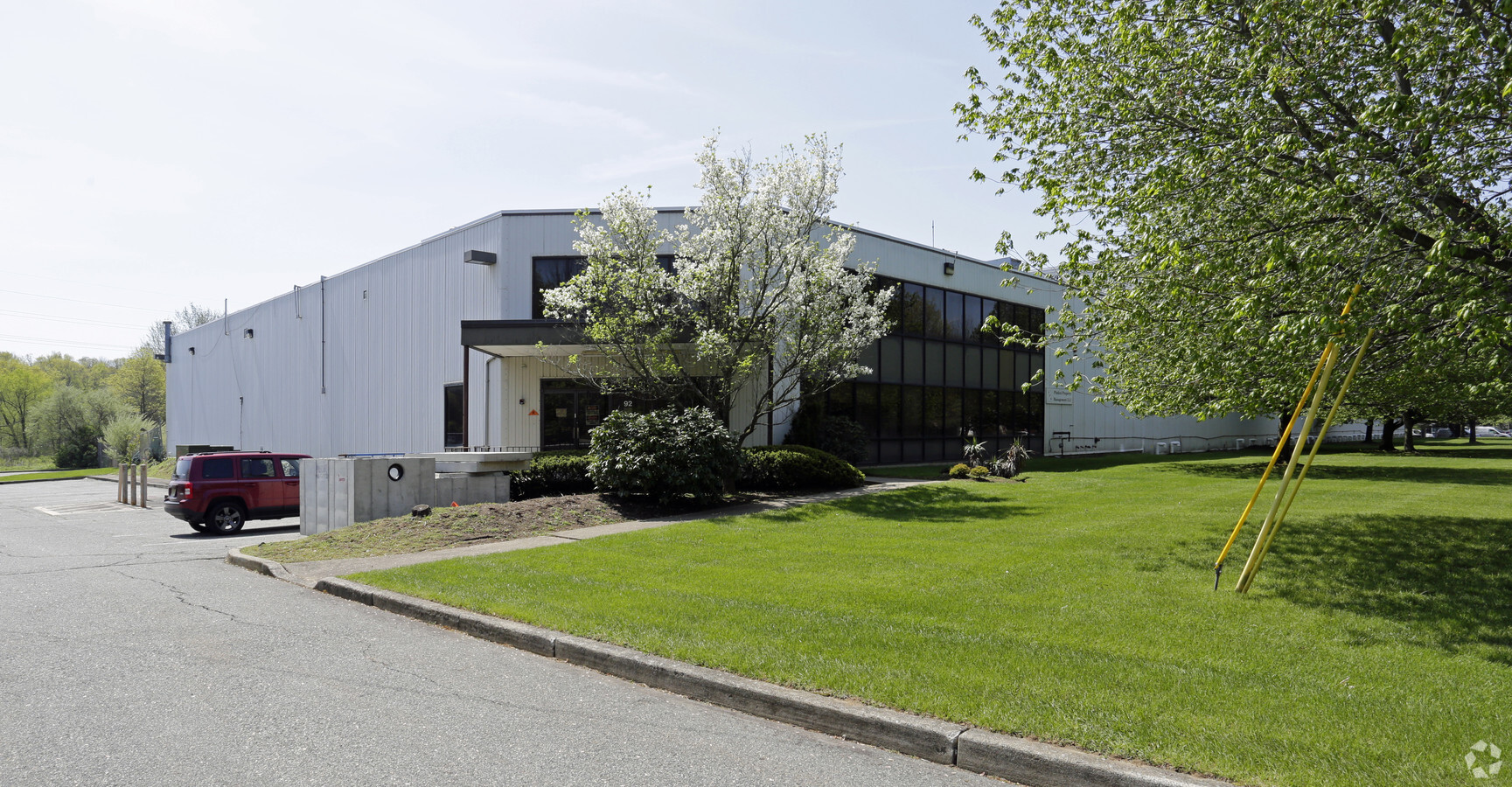
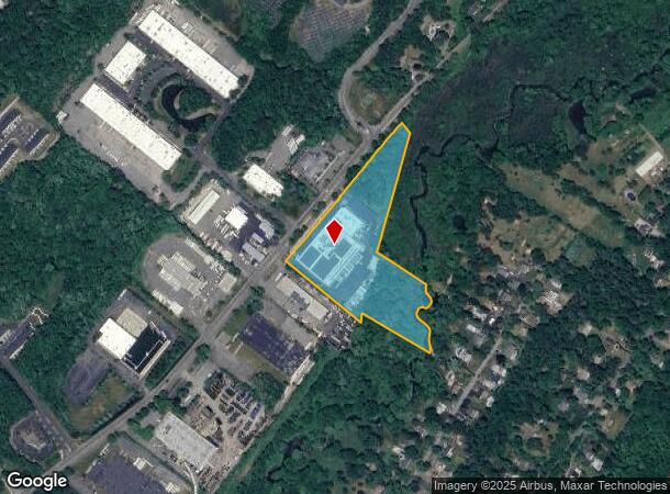
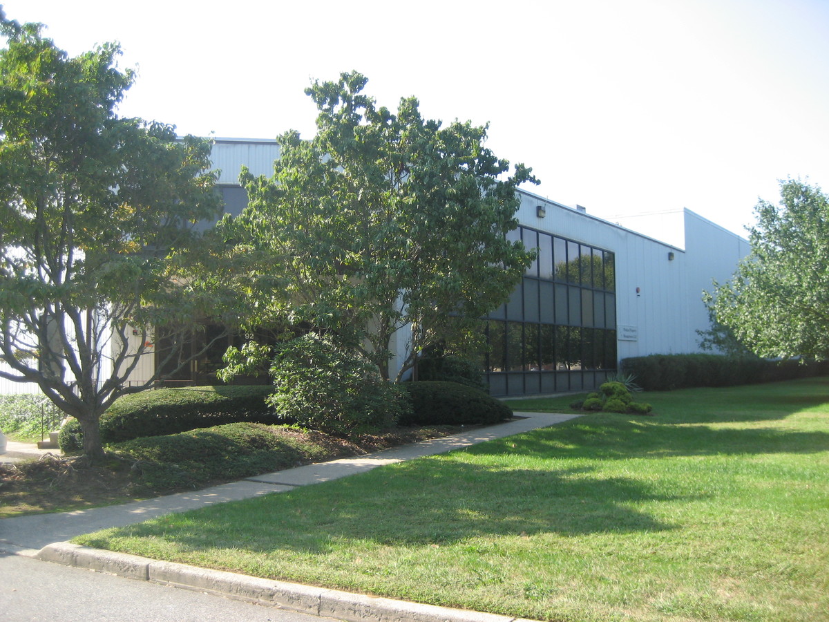
Property Record
92 Green Pond Rd, Rockaway, NJ 07866

NEARBY LISTINGS FOR SALE OR LEASE
Property Detail
92 Green Pond Rd
Newark, NJ-PA
ADDITIONAL LOTS: 29,30
35-22103-0000-00016
Morris
Officebuilding
New Jersey
2023
16
2024
8.29 AC
044404
Eastern Morris
23,499 SF
Northern New Jersey
DEMOGRAPHICS near 92 Green Pond Rd
1 Mile
3 Mile
5 Mile
2024 Total Population
4,121
38,602
112,061
2029 Population
4,147
38,845
112,503
Pop Growth 2024-2029
+ 0.63%
+ 0.63%
+ 0.39%
Average Age
41
44
42
2024 Total Households
1,472
14,735
40,964
HH Growth 2024-2029
+ 0.48%
+ 0.70%
+ 0.43%
Median Household Inc
$149,126
$128,260
$112,259
Avg Household Size
2.80
2.60
2.70
2024 Avg HH Vehicles
2.00
2.00
2.00
Median Home Value
$426,515
$425,932
$439,705
Median Year Built
1963
1964
1966
Nearby Places
- Restaurants
- Banks
- Shops
- Fitness
- Groceries
PUBLIC TRANSPORTATION
COMMUTER RAIL
Denville (Montclair-Boonton Line - NJ Transit Commuter Rail (NJ Transit), Morris & Essex Morristown Line - NJ Transit Commuter Rail (NJ Transit))
Drive
Walk
Distance
Denville (Montclair-Boonton Line - NJ Transit Commuter Rail (NJ Transit), Morris & Essex Morristown Line - NJ Transit Commuter Rail (NJ Transit))
6 min
3.9 mi
Mount Tabor (Morris & Essex Morristown Line - NJ Transit Commuter Rail (NJ Transit))
Drive
Walk
Distance
Mount Tabor (Morris & Essex Morristown Line - NJ Transit Commuter Rail (NJ Transit))
7 min
4.5 mi
AIRPORT
Newark Liberty International
Drive
Walk
Distance
Newark Liberty International
40 min
30.0 mi
Freight Ports
Maher Terminal
Drive
Walk
Distance
Maher Terminal
42 min
30.2 mi
Nearby Properties
Address
Land Use
TOTAL SIZE
Lot Size
Zoning
Address
Land Use
TOTAL SIZE
Lot Size
Zoning
5686
557.09 AC
M
Address
Land Use
TOTAL SIZE
Lot Size
Zoning
24.83 AC
RM15
Address
Land Use
TOTAL SIZE
Lot Size
Zoning
278943
45.85 AC
PED
Address
Land Use
TOTAL SIZE
Lot Size
Zoning
11.90 AC
OB3
Address
Land Use
TOTAL SIZE
Lot Size
Zoning
428141
12.30 AC
OB-3
Address
Land Use
TOTAL SIZE
Lot Size
Zoning
270140
51.78 AC
R-1B
Address
Land Use
TOTAL SIZE
Lot Size
Zoning
18.35 AC
RMF8
Address
Land Use
TOTAL SIZE
Lot Size
Zoning
19436
33.20 AC
PED
Address
Land Use
TOTAL SIZE
Lot Size
Zoning
124041
13.72 AC
I
Address
Land Use
TOTAL SIZE
Lot Size
Zoning
156380
9.72 AC
I
Address
Land Use
TOTAL SIZE
Lot Size
Zoning
38.15 AC
R-1
Address
Land Use
TOTAL SIZE
Lot Size
Zoning
48455
8.66 AC
POS
Address
Land Use
TOTAL SIZE
Lot Size
Zoning
30638
7.44 AC
B-3
Address
Land Use
TOTAL SIZE
Lot Size
Zoning
87853
12.42 AC
R-B
Address
Land Use
TOTAL SIZE
Lot Size
Zoning
125850
30 AC
R-13
Address
Land Use
TOTAL SIZE
Lot Size
Zoning
72374
7.04 AC
ELRP
Address
Land Use
TOTAL SIZE
Lot Size
Zoning
39740
5.33 AC
R-B
Address
Land Use
TOTAL SIZE
Lot Size
Zoning
123828
97.29 AC
OBRL
Address
Land Use
TOTAL SIZE
Lot Size
Zoning
64888
9.96 AC
HC-2
Address
Land Use
TOTAL SIZE
Lot Size
Zoning
98100
7.83 AC
I
Address
Land Use
TOTAL SIZE
Lot Size
Zoning
83580
15.61 AC
PED
Address
Land Use
TOTAL SIZE
Lot Size
Zoning
90296
7.70 AC
I
Address
Land Use
TOTAL SIZE
Lot Size
Zoning
88180
13.51 AC
I
Address
Land Use
TOTAL SIZE
Lot Size
Zoning
68472
3.51 AC
I2
Address
Land Use
TOTAL SIZE
Lot Size
Zoning
99.50 AC
R-C
Address
Land Use
TOTAL SIZE
Lot Size
Zoning
2.06 AC
OB-3
Address
Land Use
TOTAL SIZE
Lot Size
Zoning
8 AC
A-1
Address
Land Use
TOTAL SIZE
Lot Size
Zoning
26439
17.18 AC
R-20
Address
Land Use
TOTAL SIZE
Lot Size
Zoning
3.26 AC
B-4
Start a new search to find other properties for sale or lease
Connect with us
© 2024 CoStar Group
The information above has been obtained from sources believed reliable. While we do not doubt its accuracy we have not verified it and make no guarantee, warranty or representation about it. It is your responsibility to independently confirm its accuracy and completeness. Any projections, opinions, assumptions, or estimates used are for example only and do not represent the current or future performance of the property. The value of this transaction to you depends on tax and other factors which should be evaluated by your tax, financial, and legal advisors. You and your advisors should conduct a careful, independent investigation of the property to determine to your satisfaction the suitability of the property for your needs.