Property Record
920 N 7Th Ave, Greeley, CO 80631

NEARBY LISTINGS FOR SALE OR LEASE
Property Detail
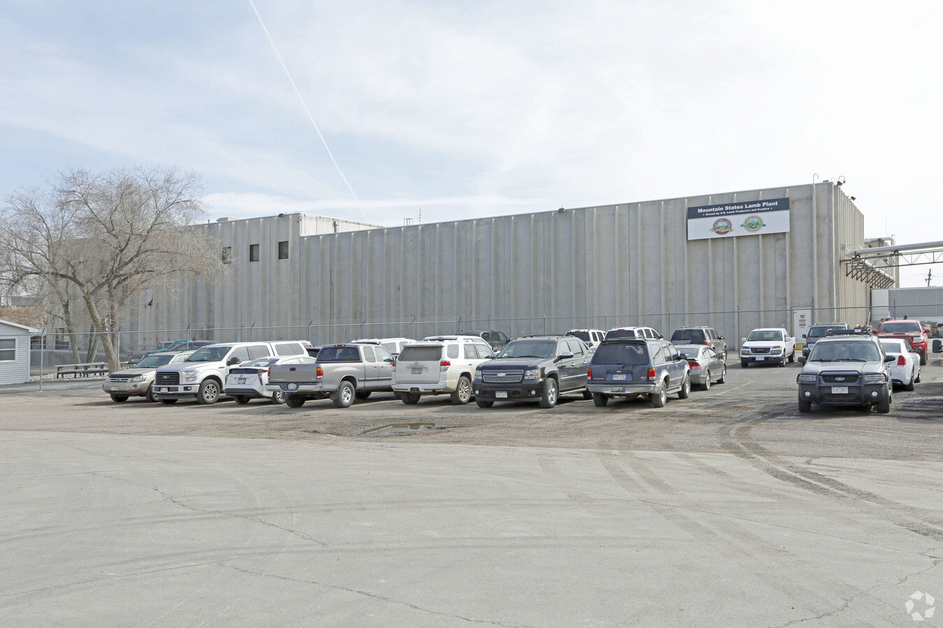
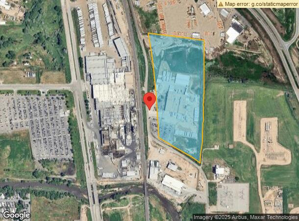
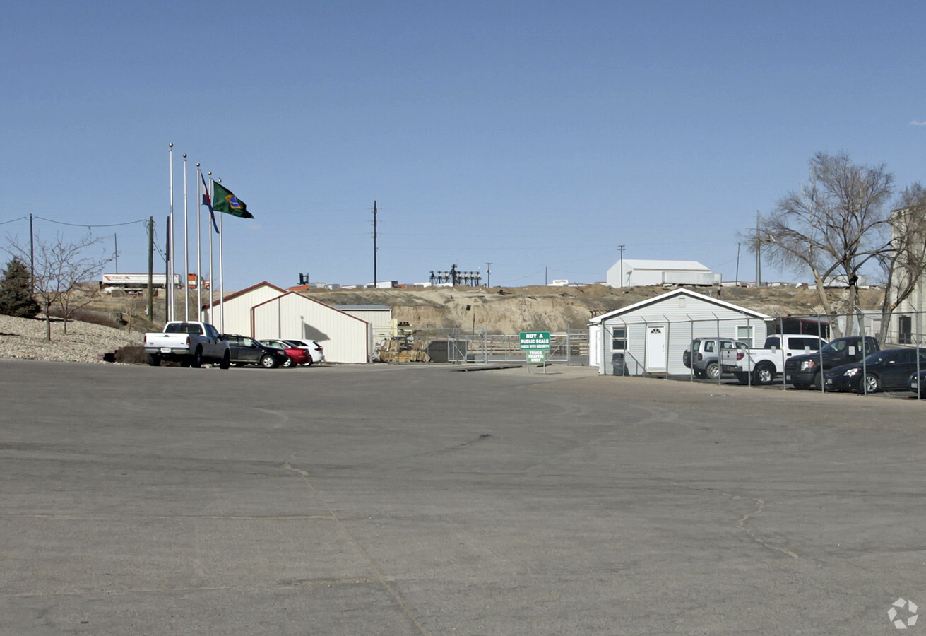
920 N 7Th Ave
Greeley, CO
Greeley Ind N 8 St E 7 Av
R0029690
GR 13862 PT 32-6-65 ALL L4 SE4NW4 & PT L1 NE4SW4 LYING W OF C/L FREE CHURCH LATERAL & PT L4 NE4SW4 LYING W OF C/L FREE CHURCH LATERAL & N OF 6TH AVE EXC RR R/W (MONFORT LAMB PLANT ANNX)
Industrialgeneral
Weld
AE
Colorado
08123C1529F
4,1
2023
17.36 AC
2024
Weld County
000701
Denver
100,198 SF
DEMOGRAPHICS near 920 N 7Th Ave
1 Mile
3 Mile
5 Mile
2024 Total Population
1,841
47,992
112,647
2029 Population
2,133
56,624
132,597
Pop Growth 2024-2029
+ 15.86%
+ 17.99%
+ 17.71%
Average Age
37
35
36
2024 Total Households
377
16,650
39,899
HH Growth 2024-2029
+ 18.04%
+ 18.73%
+ 18.49%
Median Household Inc
$50,211
$44,842
$57,092
Avg Household Size
2.70
2.70
2.70
2024 Avg HH Vehicles
2.00
2.00
2.00
Median Home Value
$450,000
$264,789
$327,270
Median Year Built
1974
1972
1979
Nearby Places
- Restaurants
- Banks
- Shops
- Fitness
- Groceries
Nearby Properties
Address
Land Use
TOTAL SIZE
Lot Size
Zoning
Address
Land Use
TOTAL SIZE
Lot Size
Zoning
45,631 SF
0.34 AC
SMC3*
Address
Land Use
TOTAL SIZE
Lot Size
Zoning
1,136,284 SF
23.26 AC
Address
Land Use
TOTAL SIZE
Lot Size
Zoning
689,580 SF
65.15 AC
Address
Land Use
TOTAL SIZE
Lot Size
Zoning
393,166 SF
4.53 AC
Address
Land Use
TOTAL SIZE
Lot Size
Zoning
237,575 SF
10.77 AC
Address
Land Use
TOTAL SIZE
Lot Size
Zoning
538,842 SF
33.91 AC
Address
Land Use
TOTAL SIZE
Lot Size
Zoning
113,715 SF
9.42 AC
Address
Land Use
TOTAL SIZE
Lot Size
Zoning
83,032 SF
9.22 AC
Address
Land Use
TOTAL SIZE
Lot Size
Zoning
99,348 SF
5.85 AC
Address
Land Use
TOTAL SIZE
Lot Size
Zoning
79,313 SF
23.46 AC
Address
Land Use
TOTAL SIZE
Lot Size
Zoning
87,378 SF
55.28 AC
Address
Land Use
TOTAL SIZE
Lot Size
Zoning
700,277 SF
16.35 AC
Address
Land Use
TOTAL SIZE
Lot Size
Zoning
63,960 SF
3.67 AC
Address
Land Use
TOTAL SIZE
Lot Size
Zoning
127,822 SF
1.38 AC
Address
Land Use
TOTAL SIZE
Lot Size
Zoning
132,968 SF
1.24 AC
Address
Land Use
TOTAL SIZE
Lot Size
Zoning
82,759 SF
2.05 AC
Address
Land Use
TOTAL SIZE
Lot Size
Zoning
198,845 SF
16.02 AC
Address
Land Use
TOTAL SIZE
Lot Size
Zoning
73,311 SF
5.11 AC
Address
Land Use
TOTAL SIZE
Lot Size
Zoning
132,547 SF
27.73 AC
Address
Land Use
TOTAL SIZE
Lot Size
Zoning
145,184 SF
19 AC
Address
Land Use
TOTAL SIZE
Lot Size
Zoning
78.18 AC
Address
Land Use
TOTAL SIZE
Lot Size
Zoning
124,456 SF
10.72 AC
Address
Land Use
TOTAL SIZE
Lot Size
Zoning
67,081 SF
4.36 AC
Address
Land Use
TOTAL SIZE
Lot Size
Zoning
253,204 SF
25.82 AC
Address
Land Use
TOTAL SIZE
Lot Size
Zoning
122,748 SF
4.13 AC
Address
Land Use
TOTAL SIZE
Lot Size
Zoning
128,054 SF
Address
Land Use
TOTAL SIZE
Lot Size
Zoning
227,794 SF
1.65 AC
Address
Land Use
TOTAL SIZE
Lot Size
Zoning
30,104 SF
2.83 AC
Address
Land Use
TOTAL SIZE
Lot Size
Zoning
95,845 SF
3.66 AC
Address
Land Use
TOTAL SIZE
Lot Size
Zoning
52,973 SF
1.93 AC
The World's #1 Commercial Real Estate Marketplace
Connect with us
© 2025 CoStar Group
The information above has been obtained from sources believed reliable. While we do not doubt its accuracy we have not verified it and make no guarantee, warranty or representation about it. It is your responsibility to independently confirm its accuracy and completeness. Any projections, opinions, assumptions, or estimates used are for example only and do not represent the current or future performance of the property. The value of this transaction to you depends on tax and other factors which should be evaluated by your tax, financial, and legal advisors. You and your advisors should conduct a careful, independent investigation of the property to determine to your satisfaction the suitability of the property for your needs.