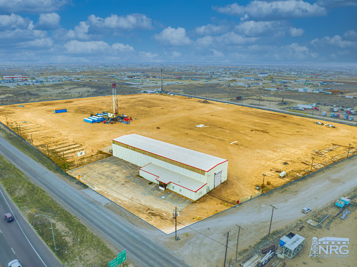
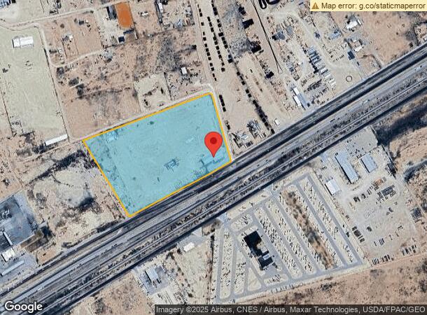
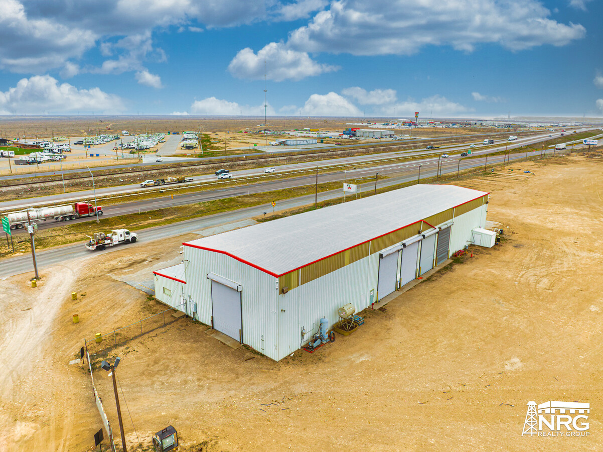
Property Record
9244 W Interstate 20, Odessa, TX 79763
This Property Is For Sale
NEARBY LISTINGS FOR SALE OR LEASE
Property Detail
9244 W Interstate 20
Odessa, TX
T & P Rr Company Survey
42910-00140-00000
T-2-S BLK 43 SEC 40 (CARD #12A) MOSS AVE IND SITES BLK 6 LOTS 11 & 12 & 13
Commercialnec
Ector
A
Texas
48135C0350E
11-13
2024
21.73 AC
2024
Midland & Odessa
002804
Other Market Areas
11,920 SF
DEMOGRAPHICS near 9244 W Interstate 20
1 Mile
3 Mile
5 Mile
2024 Total Population
284
8,302
23,495
2029 Population
271
7,917
22,644
Pop Growth 2024-2029
(4.58%)
(4.64%)
(3.62%)
Average Age
30
31
32
2024 Total Households
86
2,526
7,395
HH Growth 2024-2029
(4.65%)
(5.11%)
(4.06%)
Median Household Inc
$32,500
$37,632
$49,145
Avg Household Size
3.30
3.20
3.10
2024 Avg HH Vehicles
2.00
2.00
2.00
Median Home Value
$122,500
$95,920
$109,014
Median Year Built
1980
1979
1981
Nearby Places
- Restaurants
- Banks
- Shops
- Fitness
- Groceries
PUBLIC TRANSPORTATION
AIRPORT
Midland International Air And Space Port
DRIVE
WALK
Distance
Midland International Air And Space Port
28 min
21.7 mi
Freight Ports
Port of Corpus Christi
DRIVE
WALK
Distance
Port of Corpus Christi
506 min
488.3 mi
Nearby Properties
Address
Land Use
TOTAL SIZE
Lot Size
Zoning
Address
Land Use
TOTAL SIZE
Lot Size
Zoning
9,560 SF
141.91 AC
ES1
Address
Land Use
TOTAL SIZE
Lot Size
Zoning
34,762 SF
77.94 AC
ES1
Address
Land Use
TOTAL SIZE
Lot Size
Zoning
9,300 SF
70.29 AC
ES1
Address
Land Use
TOTAL SIZE
Lot Size
Zoning
8,847 SF
111.28 AC
EW5
Address
Land Use
TOTAL SIZE
Lot Size
Zoning
106,812 SF
28 AC
EW5
Address
Land Use
TOTAL SIZE
Lot Size
Zoning
26,482 SF
4.56 AC
EW1
Address
Land Use
TOTAL SIZE
Lot Size
Zoning
11,500 SF
11.42 AC
ES1
Address
Land Use
TOTAL SIZE
Lot Size
Zoning
72,428 SF
6.47 AC
EW3
Address
Land Use
TOTAL SIZE
Lot Size
Zoning
2,684 SF
203.90 AC
EW7
Address
Land Use
TOTAL SIZE
Lot Size
Zoning
750 SF
13.58 AC
EW3
Address
Land Use
TOTAL SIZE
Lot Size
Zoning
2,632 SF
395.72 AC
EW7
Address
Land Use
TOTAL SIZE
Lot Size
Zoning
1,872 SF
19.87 AC
ES1
Address
Land Use
TOTAL SIZE
Lot Size
Zoning
8,865 SF
2.83 AC
EW5
Address
Land Use
TOTAL SIZE
Lot Size
Zoning
10,128 SF
2 AC
EW5
Address
Land Use
TOTAL SIZE
Lot Size
Zoning
3,500 SF
10.77 AC
EW5
Address
Land Use
TOTAL SIZE
Lot Size
Zoning
8,000 SF
5.23 AC
EW7
Address
Land Use
TOTAL SIZE
Lot Size
Zoning
12,784 SF
1.53 AC
EW5
Address
Land Use
TOTAL SIZE
Lot Size
Zoning
2,800 SF
0.92 AC
EW3
Address
Land Use
TOTAL SIZE
Lot Size
Zoning
10,500 SF
6.38 AC
EW3
Address
Land Use
TOTAL SIZE
Lot Size
Zoning
9,432 SF
2.49 AC
EW7
Address
Land Use
TOTAL SIZE
Lot Size
Zoning
8,000 SF
5.16 AC
EW7
Address
Land Use
TOTAL SIZE
Lot Size
Zoning
8,000 SF
5 AC
EW7
Address
Land Use
TOTAL SIZE
Lot Size
Zoning
10,168 SF
5.70 AC
ES1
Address
Land Use
TOTAL SIZE
Lot Size
Zoning
2,520 SF
12.73 AC
EW5
Address
Land Use
TOTAL SIZE
Lot Size
Zoning
22,400 SF
18.22 AC
EW3
Address
Land Use
TOTAL SIZE
Lot Size
Zoning
9,600 SF
5 AC
EW3
Address
Land Use
TOTAL SIZE
Lot Size
Zoning
2,400 SF
10 AC
EW7
Address
Land Use
TOTAL SIZE
Lot Size
Zoning
3,300 SF
0.92 AC
EW3
Address
Land Use
TOTAL SIZE
Lot Size
Zoning
1,800 SF
4.50 AC
EW7
The World's #1 Commercial Real Estate Marketplace
Connect with us
© 2025 CoStar Group
The information above has been obtained from sources believed reliable. While we do not doubt its accuracy we have not verified it and make no guarantee, warranty or representation about it. It is your responsibility to independently confirm its accuracy and completeness. Any projections, opinions, assumptions, or estimates used are for example only and do not represent the current or future performance of the property. The value of this transaction to you depends on tax and other factors which should be evaluated by your tax, financial, and legal advisors. You and your advisors should conduct a careful, independent investigation of the property to determine to your satisfaction the suitability of the property for your needs.