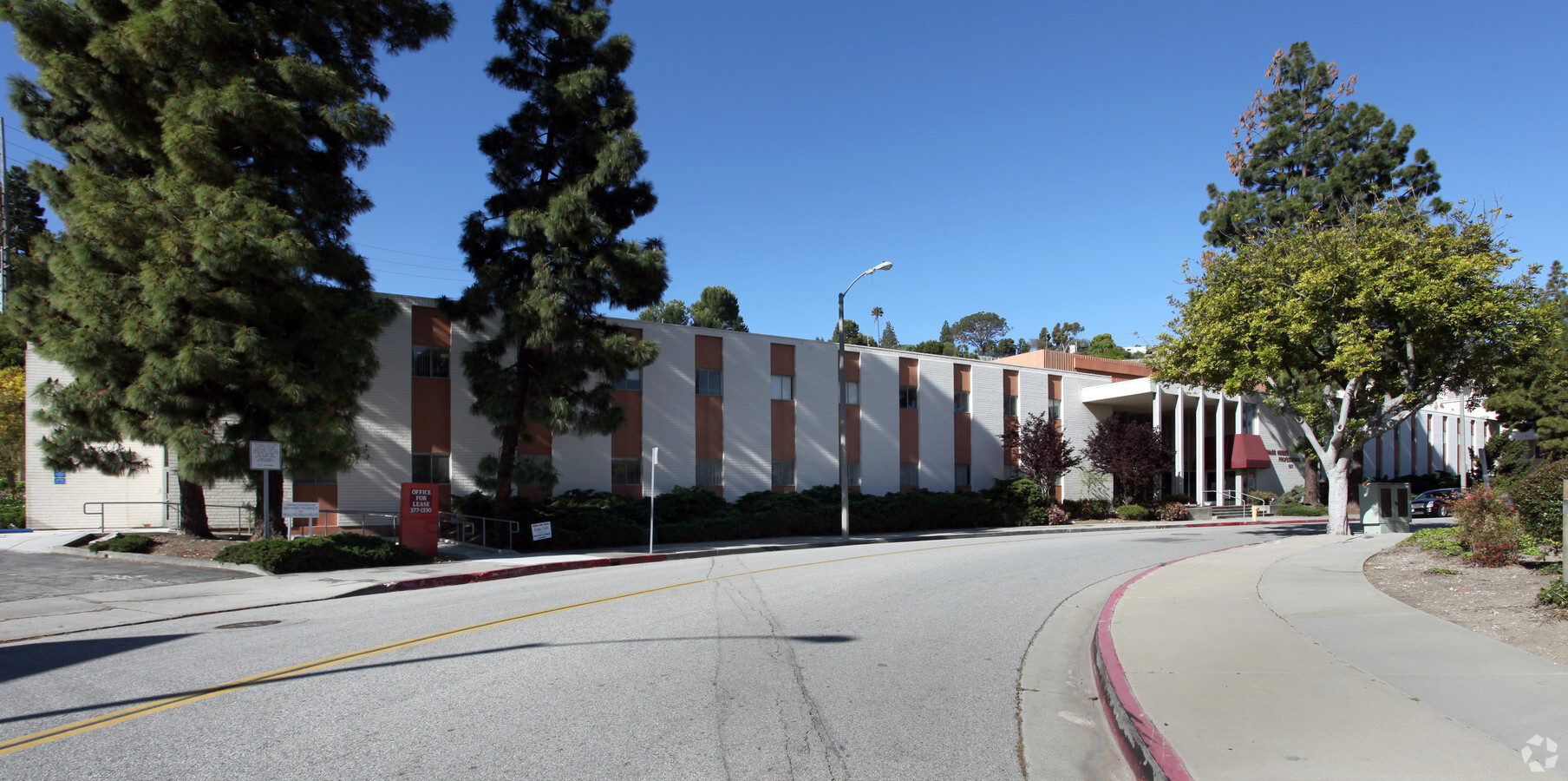
Property Record
927 Deep Valley Dr, Rolling Hills Estates, CA 90274


Current Lease Availabilities
NEARBY LISTINGS FOR SALE OR LEASE
Property Detail
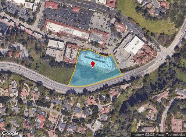
927 Deep Valley Dr
Los Angeles-Long Beach-Glendale, CA
60832
7589-003-017
TR=60832 LOT 1
Commercialacreage
Los Angeles
X
California
06037C1940F
1
2024
3.42 AC
2024
Beach Cities/Palos Verdes
670417
Los Angeles
DEMOGRAPHICS near 927 Deep Valley Dr
1 Mile
3 Mile
5 Mile
2024 Total Population
9,466
80,161
261,713
2029 Population
9,281
77,913
254,148
Pop Growth 2024-2029
(1.95%)
(2.80%)
(2.89%)
Average Age
48
46
44
2024 Total Households
3,529
30,276
100,474
HH Growth 2024-2029
(2.24%)
(3.06%)
(3.10%)
Median Household Inc
$161,122
$145,348
$110,477
Avg Household Size
2.60
2.60
2.50
2024 Avg HH Vehicles
2.00
2.00
2.00
Median Home Value
$1,117,676
$1,116,692
$997,276
Median Year Built
1968
1965
1966
Nearby Places
- Restaurants
- Banks
- Shops
- Fitness
- Groceries
PUBLIC TRANSPORTATION
AIRPORT
Long Beach (Daugherty Field)
DRIVE
WALK
Distance
Long Beach (Daugherty Field)
27 min
15.6 mi
Los Angeles International
DRIVE
WALK
Distance
Los Angeles International
28 min
17.0 mi
John Wayne/Orange County
DRIVE
WALK
Distance
John Wayne/Orange County
50 min
35.8 mi
Freight Ports
Port of Los Angeles
DRIVE
WALK
Distance
Port of Los Angeles
25 min
12.2 mi
Nearby Properties
Address
Land Use
TOTAL SIZE
Lot Size
Zoning
Address
Land Use
TOTAL SIZE
Lot Size
Zoning
459,495 SF
74.14 AC
RPCRSP-OHS
Address
Land Use
TOTAL SIZE
Lot Size
Zoning
67,570 SF
22.16 AC
RECG*
Address
Land Use
TOTAL SIZE
Lot Size
Zoning
116,441 SF
3.20 AC
RPRS1*
Address
Land Use
TOTAL SIZE
Lot Size
Zoning
67,581 SF
1.49 AC
OLD PCL003
Address
Land Use
TOTAL SIZE
Lot Size
Zoning
100,149 SF
1.99 AC
TORR-MD
Address
Land Use
TOTAL SIZE
Lot Size
Zoning
77,289 SF
1.18 AC
RPRS
Address
Land Use
TOTAL SIZE
Lot Size
Zoning
76,899 SF
1.30 AC
RPRS
Address
Land Use
TOTAL SIZE
Lot Size
Zoning
309,175 SF
5.24 AC
RPI-OH*
Address
Land Use
TOTAL SIZE
Lot Size
Zoning
73,550 SF
0.96 AC
RPRM3600*
Address
Land Use
TOTAL SIZE
Lot Size
Zoning
104,312 SF
2.82 AC
TOCR-MH
Address
Land Use
TOTAL SIZE
Lot Size
Zoning
170,865 SF
39.78 AC
RPI-OH*
Address
Land Use
TOTAL SIZE
Lot Size
Zoning
95,522 SF
4.56 AC
RPI-
Address
Land Use
TOTAL SIZE
Lot Size
Zoning
246,515 SF
5.06 AC
RPRM2000*
Address
Land Use
TOTAL SIZE
Lot Size
Zoning
16,272 SF
44.05 AC
LCRA20000*
Address
Land Use
TOTAL SIZE
Lot Size
Zoning
241,780 SF
3.86 AC
RPCN*
Address
Land Use
TOTAL SIZE
Lot Size
Zoning
137,403 SF
2.95 AC
TORR-MH
Address
Land Use
TOTAL SIZE
Lot Size
Zoning
149,736 SF
5.19 AC
RPRAIA
Address
Land Use
TOTAL SIZE
Lot Size
Zoning
148,950 SF
4.90 AC
RPRAIA
Address
Land Use
TOTAL SIZE
Lot Size
Zoning
445,505 SF
9.56 AC
TORR-MH
Address
Land Use
TOTAL SIZE
Lot Size
Zoning
78,195 SF
4.66 AC
TOCC-GEN
Address
Land Use
TOTAL SIZE
Lot Size
Zoning
133,834 SF
4.69 AC
RPRAIA
Address
Land Use
TOTAL SIZE
Lot Size
Zoning
54,341 SF
5.46 AC
TOCC-GEN
Address
Land Use
TOTAL SIZE
Lot Size
Zoning
262,085 SF
4.60 AC
TOHC-GEN
Address
Land Use
TOTAL SIZE
Lot Size
Zoning
135,633 SF
1.29 AC
RECG*
Address
Land Use
TOTAL SIZE
Lot Size
Zoning
36,096 SF
1.03 AC
TOCR-MH
Address
Land Use
TOTAL SIZE
Lot Size
Zoning
37,100 SF
1.37 AC
TORR-MD
Address
Land Use
TOTAL SIZE
Lot Size
Zoning
59,161 SF
1.76 AC
TOCR-MH
Address
Land Use
TOTAL SIZE
Lot Size
Zoning
49,640 SF
1.67 AC
TOCC-GEN
Address
Land Use
TOTAL SIZE
Lot Size
Zoning
145,376 SF
3.97 AC
TOMC-GEN
The World's #1 Commercial Real Estate Marketplace
Connect with us
© 2025 CoStar Group
The information above has been obtained from sources believed reliable. While we do not doubt its accuracy we have not verified it and make no guarantee, warranty or representation about it. It is your responsibility to independently confirm its accuracy and completeness. Any projections, opinions, assumptions, or estimates used are for example only and do not represent the current or future performance of the property. The value of this transaction to you depends on tax and other factors which should be evaluated by your tax, financial, and legal advisors. You and your advisors should conduct a careful, independent investigation of the property to determine to your satisfaction the suitability of the property for your needs.