Property Record
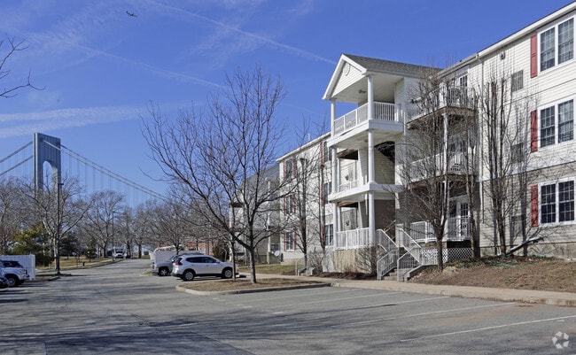
9275 Fort Hamilton Pkwy, Brooklyn, NY 11209


NEARBY LISTINGS FOR SALE OR LEASE
Property Detail
9275 Fort Hamilton Pkwy
New York-Jersey City-White Plains, NY-NJ
Fort Hamilton Military Install
06153-0001
DOCID-2017080301452001; APN 06153-0001
Militarybaseorcampcfb
Kings
VE
New York
3604970332F
1
0
170.96 AC
2025
Fort Hamilton
016200
Long Island (New York)
1,545,708 SF
DEMOGRAPHICS near 9275 Fort Hamilton Pkwy
1 Mile
3 Mile
5 Mile
2024 Total Population
29,231
516,969
1,252,654
2029 Population
27,460
478,002
1,177,485
Pop Growth 2024-2029
(6.06%)
(7.54%)
(6.00%)
Average Age
43
39
40
2024 Total Households
12,787
171,832
436,470
HH Growth 2024-2029
(6.44%)
(7.81%)
(6.24%)
Median Household Inc
$81,917
$60,228
$66,610
Avg Household Size
2.20
2.90
2.70
2024 Avg HH Vehicles
1.00
1.00
1.00
Median Home Value
$783,367
$830,814
$790,680
Median Year Built
1948
1948
1948
Nearby Places
Map Layers
Map Styles
 Street
 Aerial
- Restaurants
- Banks
- Shops
- Fitness
- Groceries
PUBLIC TRANSPORTATION
TRANSIT/SUBWAY
Bay Ridge-95 Street (R - New York MTA Subway (The Subway))
DRIVE
WALK
Distance
Bay Ridge-95 Street (R - New York MTA Subway (The Subway))
3 min
18 min
0.9 mi
COMMUTER RAIL
Clifton (Staten Island Railway - New York MTA Subway (The Subway))
DRIVE
WALK
Distance
Clifton (Staten Island Railway - New York MTA Subway (The Subway))
10 min
5.0 mi
Stapleton (Staten Island Railway - New York MTA Subway (The Subway))
DRIVE
WALK
Distance
Stapleton (Staten Island Railway - New York MTA Subway (The Subway))
12 min
5.6 mi
AIRPORT
LaGuardia
DRIVE
WALK
Distance
LaGuardia
30 min
17.4 mi
John F Kennedy International
DRIVE
WALK
Distance
John F Kennedy International
28 min
19.2 mi
Newark Liberty International
DRIVE
WALK
Distance
Newark Liberty International
31 min
19.6 mi
Freight Ports
NY - Red Hook Container Terminal
DRIVE
WALK
Distance
NY - Red Hook Container Terminal
11 min
6.3 mi
Nearby Properties
Address
Land Use
TOTAL SIZE
Lot Size
Zoning
Address
Land Use
TOTAL SIZE
Lot Size
Zoning
965,600 SF
6.65 AC
R5
Address
Land Use
TOTAL SIZE
Lot Size
Zoning
460,000 SF
3.21 AC
R6
Address
Land Use
TOTAL SIZE
Lot Size
Zoning
335,800 SF
1.51 AC
R6
Address
Land Use
TOTAL SIZE
Lot Size
Zoning
54.78 AC
PARK
Address
Land Use
TOTAL SIZE
Lot Size
Zoning
397,354 SF
0.61 AC
C5-2
Address
Land Use
TOTAL SIZE
Lot Size
Zoning
236,591 SF
207.66 AC
R3-2
Address
Land Use
TOTAL SIZE
Lot Size
Zoning
5,359,400 SF
59.07 AC
M2-1
Address
Land Use
TOTAL SIZE
Lot Size
Zoning
286,000 SF
12.63 AC
PARK
Address
Land Use
TOTAL SIZE
Lot Size
Zoning
301,400 SF
22.27 AC
M3-1
Address
Land Use
TOTAL SIZE
Lot Size
Zoning
139,557 SF
11.47 AC
M1-1
Address
Land Use
TOTAL SIZE
Lot Size
Zoning
171,591 SF
0.14 AC
C5-2
Address
Land Use
TOTAL SIZE
Lot Size
Zoning
846,056 SF
20.71 AC
R5
Address
Land Use
TOTAL SIZE
Lot Size
Zoning
702,770 SF
4.47 AC
R6
Address
Land Use
TOTAL SIZE
Lot Size
Zoning
292,528 SF
1.05 AC
R6
Address
Land Use
TOTAL SIZE
Lot Size
Zoning
152,440 SF
23.07 AC
R4B
Address
Land Use
TOTAL SIZE
Lot Size
Zoning
43,068 SF
216.83 AC
PARK
Address
Land Use
TOTAL SIZE
Lot Size
Zoning
356,000 SF
8.19 AC
R5
Address
Land Use
TOTAL SIZE
Lot Size
Zoning
221,704 SF
0.83 AC
R5B
Address
Land Use
TOTAL SIZE
Lot Size
Zoning
128,170 SF
0.87 AC
R7A
Address
Land Use
TOTAL SIZE
Lot Size
Zoning
16,570 SF
240.82 AC
PARK
Address
Land Use
TOTAL SIZE
Lot Size
Zoning
414,400 SF
2.70 AC
R7A
Address
Land Use
TOTAL SIZE
Lot Size
Zoning
105,328 SF
0.11 AC
M1-6
Address
Land Use
TOTAL SIZE
Lot Size
Zoning
219,973 SF
0.39 AC
R8
Address
Land Use
TOTAL SIZE
Lot Size
Zoning
131,650 SF
0.83 AC
R6
Address
Land Use
TOTAL SIZE
Lot Size
Zoning
148,410 SF
0.67 AC
R6
Address
Land Use
TOTAL SIZE
Lot Size
Zoning
330,780 SF
676.51 AC
C4-2A
Address
Land Use
TOTAL SIZE
Lot Size
Zoning
98,849 SF
0.83 AC
R7B
Address
Land Use
TOTAL SIZE
Lot Size
Zoning
547,448 SF
12.50 AC
R5
Address
Land Use
TOTAL SIZE
Lot Size
Zoning
222,265 SF
0.74 AC
R6
The World's #1 Commercial Real Estate Marketplace
Connect with us
© 2026 CoStar Group
The information above has been obtained from sources believed reliable. While we do not doubt its accuracy we have not verified it and make no guarantee, warranty or representation about it. It is your responsibility to independently confirm its accuracy and completeness. Any projections, opinions, assumptions, or estimates used are for example only and do not represent the current or future performance of the property. The value of this transaction to you depends on tax and other factors which should be evaluated by your tax, financial, and legal advisors. You and your advisors should conduct a careful, independent investigation of the property to determine to your satisfaction the suitability of the property for your needs.