Property Record
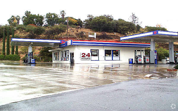
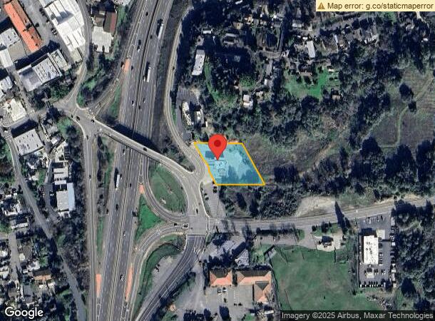
9300 Chantry Hill Rd, Newcastle, CA 95658
NEARBY LISTINGS FOR SALE OR LEASE
-
-
View all Newcastle listings for sale on LoopNet.com
Property Detail
9300 Chantry Hill Rd
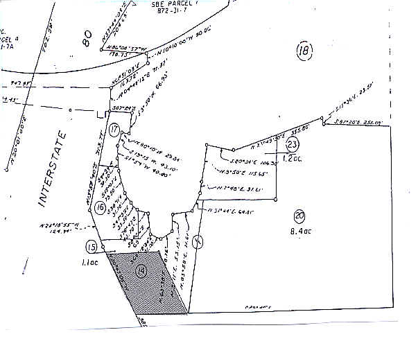
040-150-029
FR SEC 19 12 8
Servicestationmarket
Placer
X
California
06061C0960H
0.80 AC
2023
Auburn/Loomis
2023
Sacramento
020502
Sacramento--Roseville--Arden-Arcade, CA
1,246 SF
DEMOGRAPHICS near 9300 Chantry Hill Rd
1 Mile
3 Mile
5 Mile
2024 Total Population
1,288
12,172
39,982
2029 Population
1,373
13,023
42,806
Pop Growth 2024-2029
+ 6.60%
+ 6.99%
+ 7.06%
Average Age
46
46
45
2024 Total Households
513
4,756
15,967
HH Growth 2024-2029
+ 6.63%
+ 7.15%
+ 7.20%
Median Household Inc
$97,039
$113,592
$96,229
Avg Household Size
2.50
2.50
2.40
2024 Avg HH Vehicles
2.00
2.00
2.00
Median Home Value
$678,711
$739,217
$697,282
Median Year Built
1975
1978
1979
Nearby Places
- Restaurants
- Banks
- Shops
- Fitness
- Groceries
PUBLIC TRANSPORTATION
COMMUTER RAIL
Auburn-Conheim (Capitol Corridor - Capitol Corridor Joint Powers Authority)
DRIVE
WALK
Distance
Auburn-Conheim (Capitol Corridor - Capitol Corridor Joint Powers Authority)
7 min
4.6 mi
Auburn Amtrak (Capitol Corridor - Amtrak)
DRIVE
WALK
Distance
Auburn Amtrak (Capitol Corridor - Amtrak)
7 min
4.6 mi
AIRPORT
Sacramento International
DRIVE
WALK
Distance
Sacramento International
46 min
36.4 mi
Freight Ports
Port of Stockton
DRIVE
WALK
Distance
Port of Stockton
89 min
76.6 mi
Nearby Properties
Address
Land Use
TOTAL SIZE
Lot Size
Zoning
Address
Land Use
TOTAL SIZE
Lot Size
Zoning
50,450 SF
2.60 AC
Address
Land Use
TOTAL SIZE
Lot Size
Zoning
63,378 SF
30.30 AC
Address
Land Use
TOTAL SIZE
Lot Size
Zoning
878 SF
0.28 AC
C2DC
Address
Land Use
TOTAL SIZE
Lot Size
Zoning
2,736 SF
0.55 AC
HSDC
Address
Land Use
TOTAL SIZE
Lot Size
Zoning
22,015 SF
1.90 AC
Address
Land Use
TOTAL SIZE
Lot Size
Zoning
6,932 SF
11.80 AC
RAB100
Address
Land Use
TOTAL SIZE
Lot Size
Zoning
6,083 SF
1.30 AC
Address
Land Use
TOTAL SIZE
Lot Size
Zoning
29,500 SF
6.90 AC
INDC
Address
Land Use
TOTAL SIZE
Lot Size
Zoning
14,240 SF
2.80 AC
INDC
Address
Land Use
TOTAL SIZE
Lot Size
Zoning
18,490 SF
1.40 AC
Address
Land Use
TOTAL SIZE
Lot Size
Zoning
40,349 SF
7.80 AC
INDC
Address
Land Use
TOTAL SIZE
Lot Size
Zoning
9,952 SF
1 AC
Address
Land Use
TOTAL SIZE
Lot Size
Zoning
10,956 SF
8.15 AC
INDC
Address
Land Use
TOTAL SIZE
Lot Size
Zoning
6,485 SF
0.73 AC
Address
Land Use
TOTAL SIZE
Lot Size
Zoning
6,516 SF
0.66 AC
Address
Land Use
TOTAL SIZE
Lot Size
Zoning
38,222 SF
10.70 AC
INDC
Address
Land Use
TOTAL SIZE
Lot Size
Zoning
9.20 AC
C3UPDC
Address
Land Use
TOTAL SIZE
Lot Size
Zoning
16,000 SF
3.10 AC
INDC
Address
Land Use
TOTAL SIZE
Lot Size
Zoning
5,654 SF
0.75 AC
Address
Land Use
TOTAL SIZE
Lot Size
Zoning
31,762 SF
0.46 AC
INDC
Address
Land Use
TOTAL SIZE
Lot Size
Zoning
43,805 SF
0.39 AC
INDC
Address
Land Use
TOTAL SIZE
Lot Size
Zoning
24,566 SF
9.80 AC
INDC
Address
Land Use
TOTAL SIZE
Lot Size
Zoning
4,400 SF
0.61 AC
C2DC
Address
Land Use
TOTAL SIZE
Lot Size
Zoning
6,394 SF
1 AC
C2DH
Address
Land Use
TOTAL SIZE
Lot Size
Zoning
22,878 SF
22.80 AC
CPDAGDC
Address
Land Use
TOTAL SIZE
Lot Size
Zoning
8,908 SF
0.62 AC
Address
Land Use
TOTAL SIZE
Lot Size
Zoning
37.90 AC
RABX
Address
Land Use
TOTAL SIZE
Lot Size
Zoning
4,296 SF
1.40 AC
INDC
Address
Land Use
TOTAL SIZE
Lot Size
Zoning
54,400 SF
2.40 AC
INDC
The World's #1 Commercial Real Estate Marketplace
Connect with us
© 2025 CoStar Group
The information above has been obtained from sources believed reliable. While we do not doubt its accuracy we have not verified it and make no guarantee, warranty or representation about it. It is your responsibility to independently confirm its accuracy and completeness. Any projections, opinions, assumptions, or estimates used are for example only and do not represent the current or future performance of the property. The value of this transaction to you depends on tax and other factors which should be evaluated by your tax, financial, and legal advisors. You and your advisors should conduct a careful, independent investigation of the property to determine to your satisfaction the suitability of the property for your needs.