Property Record
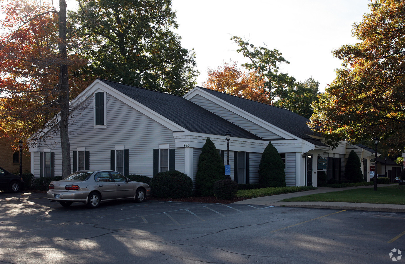
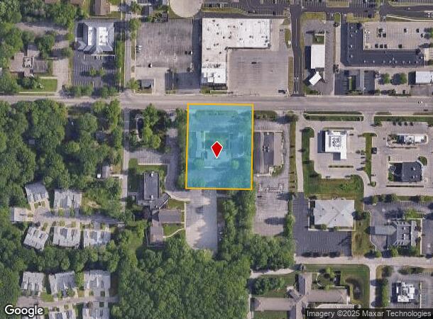
935 W Norton Ave, Norton Shores, MI 49441

Current Lease Availabilities
NEARBY LISTINGS FOR SALE OR LEASE
Property Detail
935 W Norton Ave
27-012-200-0020-00
CITY OF NORTON SHORESW 1/2 OF E 1/2 OF W 1/2 OF N 1/2 OF N 1/2 OF NE 1/4 OF NE 1/4 & E 99 FT OF W 1/2 OF NW 1/4 OF N 1/2 OF NE 1/4 OF NE 1/4SUBJ TO ANY/ALL ESMT/RESTRICTIONS OF RECORDN 33 FT FOR RD PURPOSESSEC 12 T9N R17W
Commercialnec
Muskegon
X
Michigan
26121C0259E
1.73 AC
2024
Muskegon Heights
2024
West Michigan
002400
Muskegon, MI
13,909 SF
DEMOGRAPHICS near 935 W Norton Ave
1 Mile
3 Mile
5 Mile
2024 Total Population
8,974
54,942
91,784
2029 Population
9,024
55,476
92,581
Pop Growth 2024-2029
+ 0.56%
+ 0.97%
+ 0.87%
Average Age
41
40
40
2024 Total Households
3,864
21,465
36,371
HH Growth 2024-2029
+ 0.49%
+ 0.93%
+ 0.85%
Median Household Inc
$54,091
$48,643
$49,671
Avg Household Size
2.30
2.30
2.30
2024 Avg HH Vehicles
2.00
2.00
2.00
Median Home Value
$147,600
$137,287
$144,000
Median Year Built
1963
1956
1959
Nearby Places
- Restaurants
- Banks
- Shops
- Fitness
- Groceries
Nearby Properties
Address
Land Use
TOTAL SIZE
Lot Size
Zoning
Address
Land Use
TOTAL SIZE
Lot Size
Zoning
273,059 SF
30.59 AC
PUD
Address
Land Use
TOTAL SIZE
Lot Size
Zoning
6,900 SF
165.61 AC
GI
Address
Land Use
TOTAL SIZE
Lot Size
Zoning
248,456 SF
19.18 AC
MFR
Address
Land Use
TOTAL SIZE
Lot Size
Zoning
41,382 SF
6.20 AC
PUD
Address
Land Use
TOTAL SIZE
Lot Size
Zoning
388,172 SF
21.50 AC
GI
Address
Land Use
TOTAL SIZE
Lot Size
Zoning
203,874 SF
18.55 AC
C-SE
Address
Land Use
TOTAL SIZE
Lot Size
Zoning
194,708 SF
15.59 AC
C-2
Address
Land Use
TOTAL SIZE
Lot Size
Zoning
19,171 SF
6.55 AC
MC
Address
Land Use
TOTAL SIZE
Lot Size
Zoning
193,750 SF
23.22 AC
GI
Address
Land Use
TOTAL SIZE
Lot Size
Zoning
122.75 AC
R-2
Address
Land Use
TOTAL SIZE
Lot Size
Zoning
68,782 SF
10.52 AC
C-2
Address
Land Use
TOTAL SIZE
Lot Size
Zoning
73,313 SF
4.94 AC
FBC-MSW
Address
Land Use
TOTAL SIZE
Lot Size
Zoning
124,416 SF
7.41 AC
MFR
Address
Land Use
TOTAL SIZE
Lot Size
Zoning
125,478 SF
7.90 AC
WM
Address
Land Use
TOTAL SIZE
Lot Size
Zoning
171,361 SF
12.26 AC
AR-8
Address
Land Use
TOTAL SIZE
Lot Size
Zoning
84,452 SF
6.82 AC
PUD
Address
Land Use
TOTAL SIZE
Lot Size
Zoning
399,872 SF
16.99 AC
I-2
Address
Land Use
TOTAL SIZE
Lot Size
Zoning
32,811 SF
5.87 AC
B-4
Address
Land Use
TOTAL SIZE
Lot Size
Zoning
212,648 SF
9.20 AC
"B-2, PUD"
Address
Land Use
TOTAL SIZE
Lot Size
Zoning
66,252 SF
2.34 AC
D2-IND
Address
Land Use
TOTAL SIZE
Lot Size
Zoning
67,896 SF
8.56 AC
B-4
Address
Land Use
TOTAL SIZE
Lot Size
Zoning
123,081 SF
8.50 AC
B-4
Address
Land Use
TOTAL SIZE
Lot Size
Zoning
15,303 SF
1.84 AC
MC
Address
Land Use
TOTAL SIZE
Lot Size
Zoning
224,070 SF
15.85 AC
GI
Address
Land Use
TOTAL SIZE
Lot Size
Zoning
51,021 SF
5.52 AC
PUD
Address
Land Use
TOTAL SIZE
Lot Size
Zoning
15,409 SF
2.51 AC
MC
Address
Land Use
TOTAL SIZE
Lot Size
Zoning
121,766 SF
10.29 AC
C-NE
Address
Land Use
TOTAL SIZE
Lot Size
Zoning
1,020 SF
90.15 AC
PUD
Address
Land Use
TOTAL SIZE
Lot Size
Zoning
56,341 SF
157.70 AC
R-1
Address
Land Use
TOTAL SIZE
Lot Size
Zoning
15,028 SF
1.21 AC
B-4
The World's #1 Commercial Real Estate Marketplace
Connect with us
© 2025 CoStar Group
The information above has been obtained from sources believed reliable. While we do not doubt its accuracy we have not verified it and make no guarantee, warranty or representation about it. It is your responsibility to independently confirm its accuracy and completeness. Any projections, opinions, assumptions, or estimates used are for example only and do not represent the current or future performance of the property. The value of this transaction to you depends on tax and other factors which should be evaluated by your tax, financial, and legal advisors. You and your advisors should conduct a careful, independent investigation of the property to determine to your satisfaction the suitability of the property for your needs.