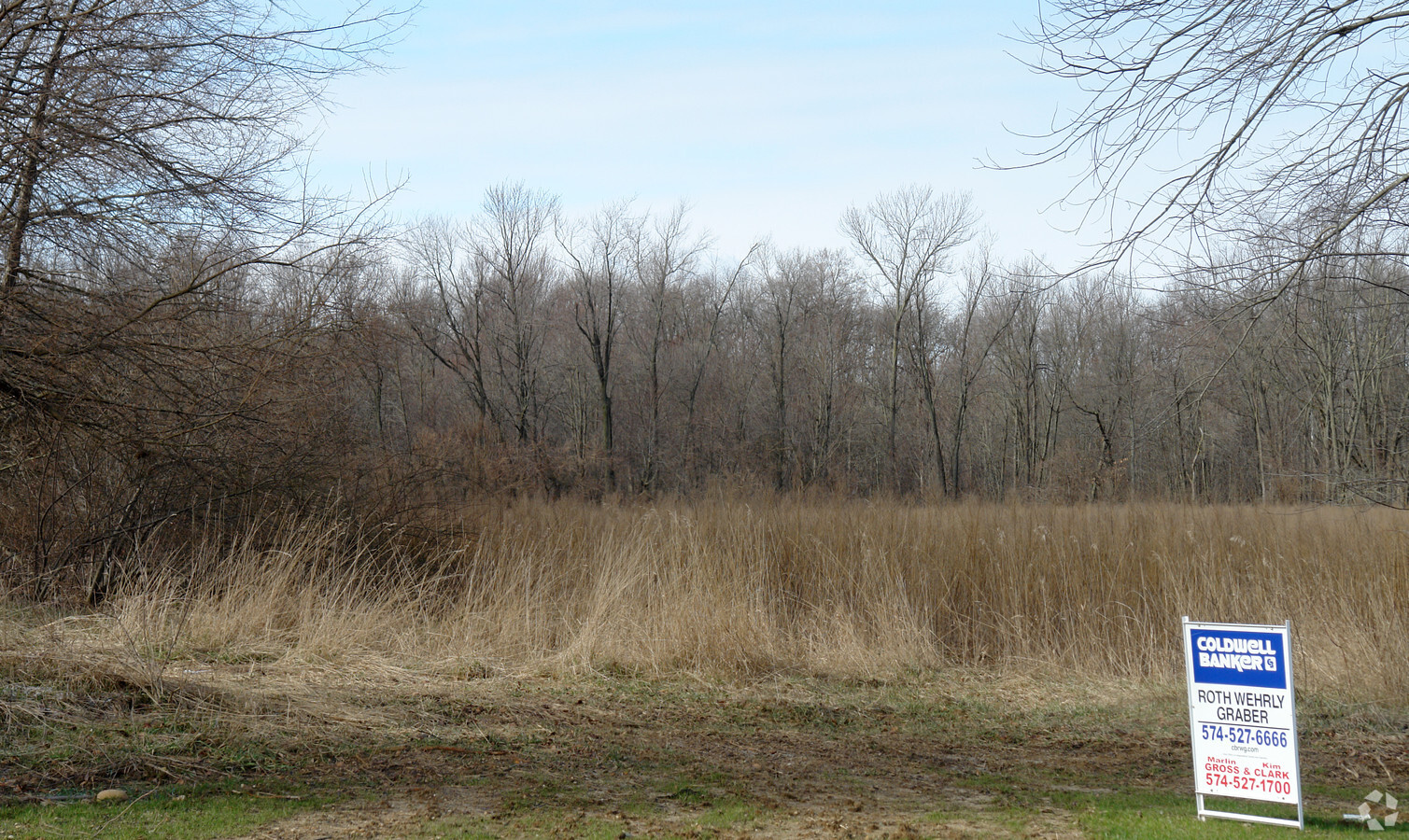
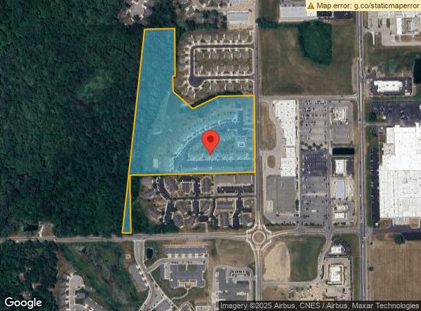
Property Record
937 Briar Ridge Cir, Warsaw, IN 46582
NEARBY LISTINGS FOR SALE OR LEASE
Property Detail
937 Briar Ridge Cir
Warsaw, IN
Nye-Brandt
43-07-29-300-861.000-017
28-115-20 LOT 3 LESS S PT & PT N PT NYE-BRANDT REPLAT
Apartment
Kosciusko
X
Indiana
18085C0163D
3
2023
19.57 AC
2023
Indiana North Area
961200
Other Market Areas
11,448 SF
DEMOGRAPHICS near 937 Briar Ridge Cir
1 Mile
3 Mile
5 Mile
2024 Total Population
2,085
13,452
31,076
2029 Population
2,071
13,416
31,057
Pop Growth 2024-2029
(0.67%)
(0.27%)
(0.06%)
Average Age
38
39
39
2024 Total Households
772
5,336
11,963
HH Growth 2024-2029
(0.91%)
(0.47%)
(0.22%)
Median Household Inc
$67,788
$58,519
$63,106
Avg Household Size
2.60
2.40
2.40
2024 Avg HH Vehicles
2.00
2.00
2.00
Median Home Value
$192,856
$148,761
$167,756
Median Year Built
1996
1984
1981
Nearby Places
- Restaurants
- Banks
- Shops
- Fitness
- Groceries
Nearby Properties
Address
Land Use
TOTAL SIZE
Lot Size
Zoning
Address
Land Use
TOTAL SIZE
Lot Size
Zoning
89,225 SF
6.73 AC
I-2 L
Address
Land Use
TOTAL SIZE
Lot Size
Zoning
1,920 SF
17.30 AC
M-1 M
Address
Land Use
TOTAL SIZE
Lot Size
Zoning
94,943 SF
3.88 AC
C-4 C
Address
Land Use
TOTAL SIZE
Lot Size
Zoning
188,659 SF
31 AC
C-3 A
Address
Land Use
TOTAL SIZE
Lot Size
Zoning
189,318 SF
19.66 AC
C-3 A
Address
Land Use
TOTAL SIZE
Lot Size
Zoning
63,312 SF
11.67 AC
I-2 L
Address
Land Use
TOTAL SIZE
Lot Size
Zoning
26.90 AC
IND-2
Address
Land Use
TOTAL SIZE
Lot Size
Zoning
50,534 SF
9.94 AC
C-3 A
Address
Land Use
TOTAL SIZE
Lot Size
Zoning
61,204 SF
14.69 AC
I-2 L
Address
Land Use
TOTAL SIZE
Lot Size
Zoning
182,921 SF
9.16 AC
I-2 L
Address
Land Use
TOTAL SIZE
Lot Size
Zoning
206,395 SF
21.88 AC
C-5 S
Address
Land Use
TOTAL SIZE
Lot Size
Zoning
59,252 SF
8.78 AC
C-3 A
Address
Land Use
TOTAL SIZE
Lot Size
Zoning
94,503 SF
2.37 AC
R-3
Address
Land Use
TOTAL SIZE
Lot Size
Zoning
55,085 SF
7.31 AC
I-2 L
Address
Land Use
TOTAL SIZE
Lot Size
Zoning
146,347 SF
18.44 AC
C-5 S
Address
Land Use
TOTAL SIZE
Lot Size
Zoning
37,278 SF
8.29 AC
R-3
Address
Land Use
TOTAL SIZE
Lot Size
Zoning
151,378 SF
24.48 AC
I-2 L
Address
Land Use
TOTAL SIZE
Lot Size
Zoning
133,703 SF
6.99 AC
I-2 L
Address
Land Use
TOTAL SIZE
Lot Size
Zoning
63,109 SF
8.56 AC
C-3 A
Address
Land Use
TOTAL SIZE
Lot Size
Zoning
50,865 SF
2.05 AC
C-3 A
Address
Land Use
TOTAL SIZE
Lot Size
Zoning
319,847 SF
15 AC
I-2 L
Address
Land Use
TOTAL SIZE
Lot Size
Zoning
41,482 SF
3.48 AC
COMME
Address
Land Use
TOTAL SIZE
Lot Size
Zoning
41,384 SF
10.17 AC
I-2 L
Address
Land Use
TOTAL SIZE
Lot Size
Zoning
68,961 SF
5.80 AC
C-3 A
Address
Land Use
TOTAL SIZE
Lot Size
Zoning
44,544 SF
7.68 AC
I-2 L
Address
Land Use
TOTAL SIZE
Lot Size
Zoning
32,522 SF
3.82 AC
M-1 M
Address
Land Use
TOTAL SIZE
Lot Size
Zoning
13,518 SF
1.55 AC
C-3 A
Address
Land Use
TOTAL SIZE
Lot Size
Zoning
936 SF
64.10 AC
AG
Address
Land Use
TOTAL SIZE
Lot Size
Zoning
30,000 SF
46.29 AC
IND-2
The World's #1 Commercial Real Estate Marketplace
Connect with us
© 2025 CoStar Group
The information above has been obtained from sources believed reliable. While we do not doubt its accuracy we have not verified it and make no guarantee, warranty or representation about it. It is your responsibility to independently confirm its accuracy and completeness. Any projections, opinions, assumptions, or estimates used are for example only and do not represent the current or future performance of the property. The value of this transaction to you depends on tax and other factors which should be evaluated by your tax, financial, and legal advisors. You and your advisors should conduct a careful, independent investigation of the property to determine to your satisfaction the suitability of the property for your needs.