Property Record
937 Gateway Commons Cir, Wake Forest, NC 27587
NEARBY LISTINGS FOR SALE OR LEASE
-
-
View all Wake Forest listings for sale on LoopNet.com
Property Detail
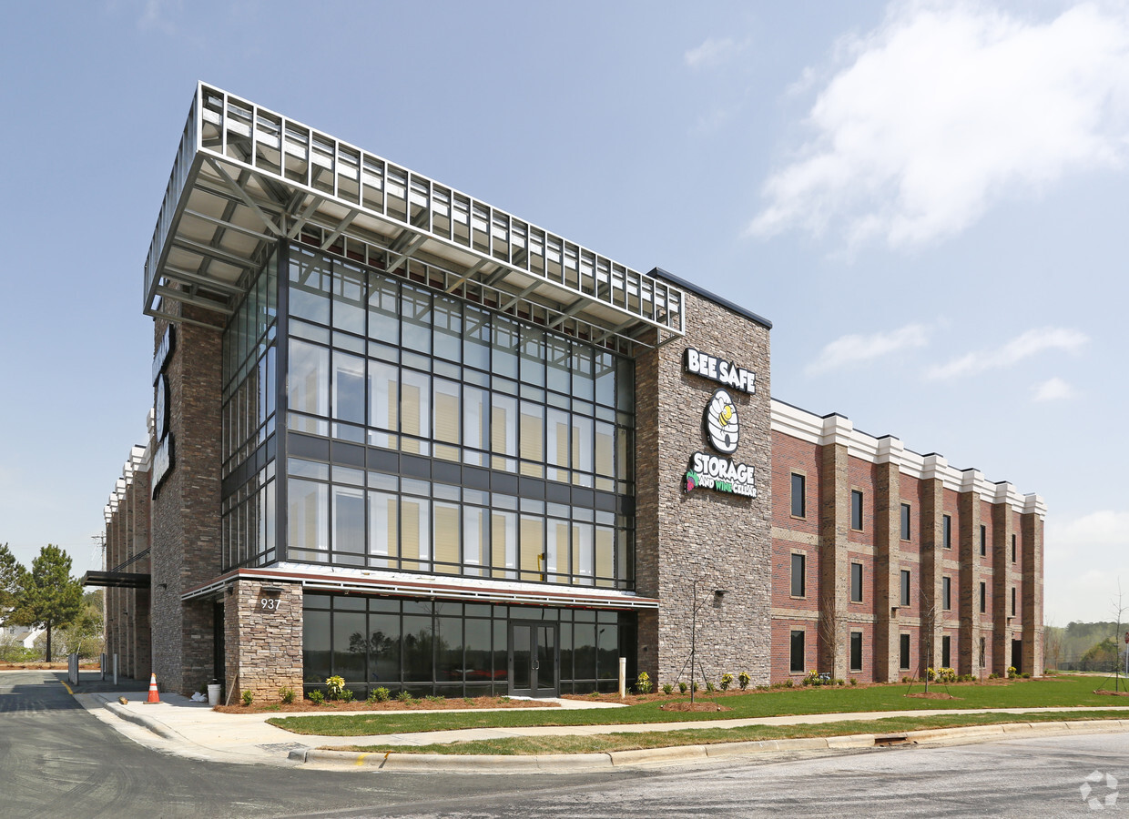
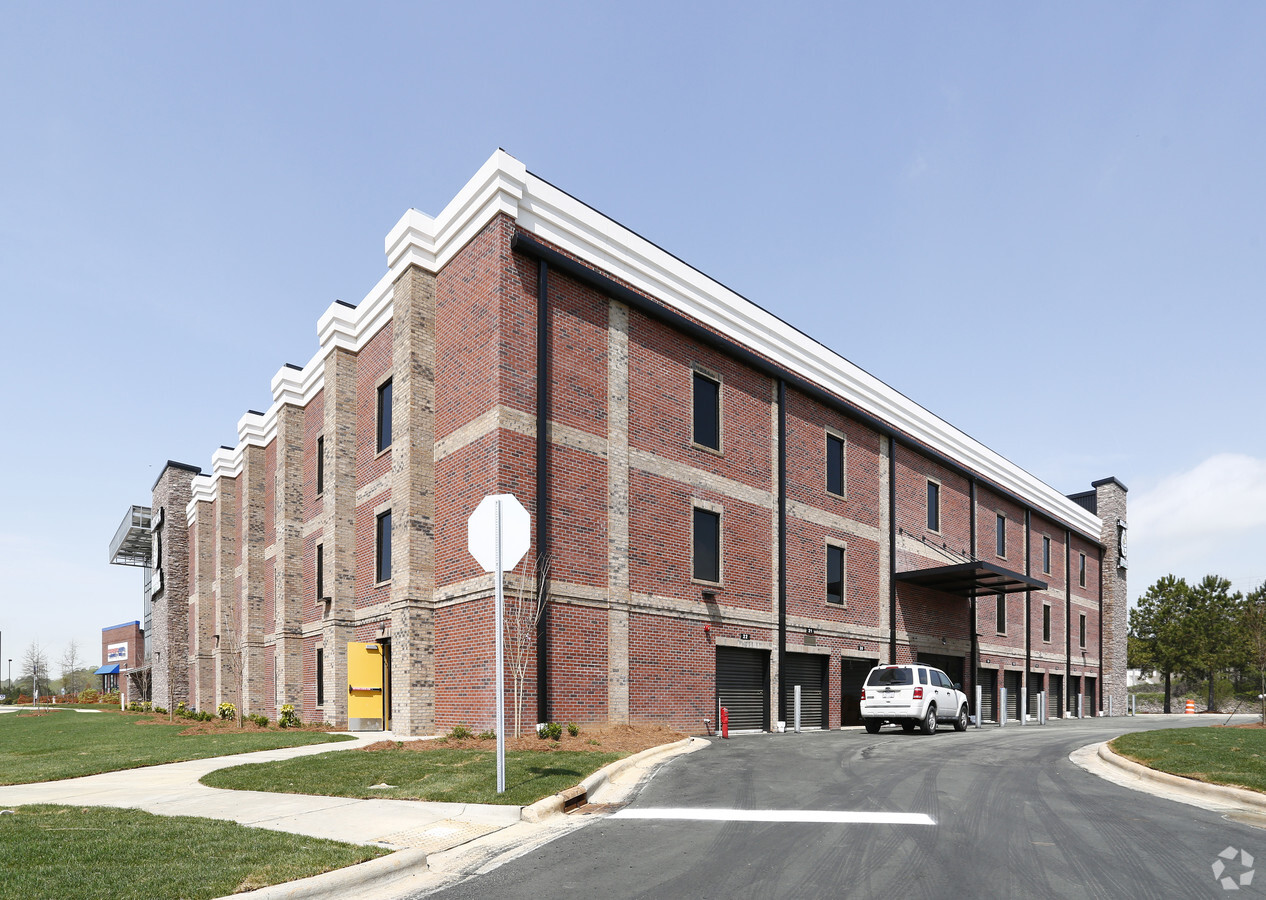
937 Gateway Commons Cir
Raleigh, NC
Bee Safe Strage Sanitary Sewer Easement
1840.08-98-8087-000
LO23 BE SAFE STORAGE BM2017-01371
Publicstorage
Wake
X
North Carolina
3720184000K
23
2024
1.78 AC
2024
Route 1
054219
Raleigh/Durham
75,210 SF
DEMOGRAPHICS near 937 Gateway Commons Cir
1 Mile
3 Mile
5 Mile
2024 Total Population
8,341
51,402
99,072
2029 Population
9,134
56,698
109,698
Pop Growth 2024-2029
+ 9.51%
+ 10.30%
+ 10.73%
Average Age
40
39
39
2024 Total Households
3,048
18,580
35,670
HH Growth 2024-2029
+ 9.58%
+ 10.33%
+ 10.74%
Median Household Inc
$100,338
$106,115
$109,681
Avg Household Size
2.70
2.70
2.70
2024 Avg HH Vehicles
2.00
2.00
2.00
Median Home Value
$394,914
$379,352
$384,331
Median Year Built
2007
2006
2005
Nearby Places
- Restaurants
- Banks
- Shops
- Fitness
- Groceries
PUBLIC TRANSPORTATION
AIRPORT
Raleigh-Durham International
DRIVE
WALK
Distance
Raleigh-Durham International
34 min
22.9 mi
Freight Ports
Virginia Port Authority - Richmond
DRIVE
WALK
Distance
Virginia Port Authority - Richmond
164 min
135.5 mi
Nearby Properties
Address
Land Use
TOTAL SIZE
Lot Size
Zoning
Address
Land Use
TOTAL SIZE
Lot Size
Zoning
378,421 SF
19.06 AC
RMX
Address
Land Use
TOTAL SIZE
Lot Size
Zoning
283,870 SF
11.39 AC
RMX
Address
Land Use
TOTAL SIZE
Lot Size
Zoning
442,480 SF
52.02 AC
GR3
Address
Land Use
TOTAL SIZE
Lot Size
Zoning
306,712 SF
14.03 AC
PUD
Address
Land Use
TOTAL SIZE
Lot Size
Zoning
279,704 SF
12.40 AC
RMX
Address
Land Use
TOTAL SIZE
Lot Size
Zoning
263,777 SF
93.84 AC
GR3
Address
Land Use
TOTAL SIZE
Lot Size
Zoning
306,050 SF
30.45 AC
GR10
Address
Land Use
TOTAL SIZE
Lot Size
Zoning
248,945 SF
16.41 AC
GR10
Address
Land Use
TOTAL SIZE
Lot Size
Zoning
232,734 SF
57.28 AC
GR3
Address
Land Use
TOTAL SIZE
Lot Size
Zoning
243,797 SF
22.57 AC
GR10
Address
Land Use
TOTAL SIZE
Lot Size
Zoning
225,390 SF
14.95 AC
GR10
Address
Land Use
TOTAL SIZE
Lot Size
Zoning
195,861 SF
20.26 AC
GR10
Address
Land Use
TOTAL SIZE
Lot Size
Zoning
283,795 SF
31.33 AC
ICD
Address
Land Use
TOTAL SIZE
Lot Size
Zoning
162,909 SF
9.84 AC
RMX
Address
Land Use
TOTAL SIZE
Lot Size
Zoning
186,546 SF
6.84 AC
RMX
Address
Land Use
TOTAL SIZE
Lot Size
Zoning
166,192 SF
13.59 AC
GR10
Address
Land Use
TOTAL SIZE
Lot Size
Zoning
154,602 SF
40 AC
ICD
Address
Land Use
TOTAL SIZE
Lot Size
Zoning
137,650 SF
36.63 AC
GR5
Address
Land Use
TOTAL SIZE
Lot Size
Zoning
111,616 SF
4.69 AC
NMX
Address
Land Use
TOTAL SIZE
Lot Size
Zoning
97,878 SF
26.85 AC
GR5
Address
Land Use
TOTAL SIZE
Lot Size
Zoning
109,762 SF
11.87 AC
GR10
Address
Land Use
TOTAL SIZE
Lot Size
Zoning
107,082 SF
4.17 AC
RMX
Address
Land Use
TOTAL SIZE
Lot Size
Zoning
106,593 SF
15.32 AC
HB
Address
Land Use
TOTAL SIZE
Lot Size
Zoning
209,548 SF
31.80 AC
HB
Address
Land Use
TOTAL SIZE
Lot Size
Zoning
51,125 SF
18.99 AC
HB
Address
Land Use
TOTAL SIZE
Lot Size
Zoning
210,619 SF
18.73 AC
HB
Address
Land Use
TOTAL SIZE
Lot Size
Zoning
88,053 SF
12.16 AC
GR10
Address
Land Use
TOTAL SIZE
Lot Size
Zoning
101,307 SF
21 AC
HB
Address
Land Use
TOTAL SIZE
Lot Size
Zoning
117,680 SF
11.99 AC
GR10
Address
Land Use
TOTAL SIZE
Lot Size
Zoning
90,009 SF
3.28 AC
HB
The World's #1 Commercial Real Estate Marketplace
Connect with us
© 2025 CoStar Group
The information above has been obtained from sources believed reliable. While we do not doubt its accuracy we have not verified it and make no guarantee, warranty or representation about it. It is your responsibility to independently confirm its accuracy and completeness. Any projections, opinions, assumptions, or estimates used are for example only and do not represent the current or future performance of the property. The value of this transaction to you depends on tax and other factors which should be evaluated by your tax, financial, and legal advisors. You and your advisors should conduct a careful, independent investigation of the property to determine to your satisfaction the suitability of the property for your needs.