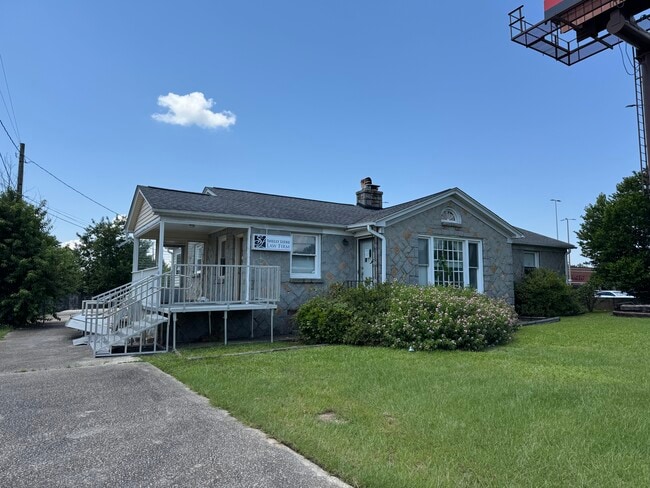
Property Record
939 Broad River Rd, Columbia, SC 29210


NEARBY LISTINGS FOR SALE OR LEASE
Property Detail
939 Broad River Rd
07310-01-02
Heirs Of J S Huffman
Commercialnec
TRACT E 75X175X75X175 #SU HUFFMAN HEIGHTS #PR V-178/179 5-23 W-82/83
X
Richland
45063C0164J
South Carolina
2025
0.30 AC
2024
St Andrews
010403
Columbia
1,849 SF
Columbia, SC
DEMOGRAPHICS near 939 Broad River Rd
1 Mile
3 Mile
5 Mile
2024 Total Population
5,252
67,316
158,673
2029 Population
5,319
70,224
165,965
Pop Growth 2024-2029
+ 1.28%
+ 4.32%
+ 4.60%
Average Age
34
38
37
2024 Total Households
2,828
30,093
67,799
HH Growth 2024-2029
+ 1.20%
+ 4.69%
+ 4.88%
Median Household Inc
$42,500
$45,017
$44,090
Avg Household Size
1.80
2.00
2.10
2024 Avg HH Vehicles
1.00
1.00
2.00
Median Home Value
$113,964
$156,806
$159,578
Median Year Built
1981
1975
1973
Nearby Places
Map Layers
Map Styles
 Street
 Aerial
- Restaurants
- Banks
- Shops
- Fitness
- Groceries
PUBLIC TRANSPORTATION
COMMUTER RAIL
DRIVE
WALK
Distance
8 min
3.9 mi
AIRPORT
Columbia Metro
DRIVE
WALK
Distance
Columbia Metro
24 min
12.1 mi
SALE & LEASE HISTORY
LISTING DATE
SALE/LEASE

Nov 06, 2023
For Lease
Nov 06, 2023
For Sale
Jul 29, 2025
For Sale
Nearby Properties
Address
Land Use
TOTAL SIZE
Lot Size
Zoning
Address
Land Use
TOTAL SIZE
Lot Size
Zoning
456,218 SF
1 AC
DAC
Address
Land Use
TOTAL SIZE
Lot Size
Zoning
160,510 SF
0.26 AC
DAC
Address
Land Use
TOTAL SIZE
Lot Size
Zoning
375,417 SF
3.92 AC
INS-GEN
Address
Land Use
TOTAL SIZE
Lot Size
Zoning
2.07 AC
DAC
Address
Land Use
TOTAL SIZE
Lot Size
Zoning
119,738 SF
10.30 AC
EC
Address
Land Use
TOTAL SIZE
Lot Size
Zoning
353,447 SF
0.53 AC
DAC
Address
Land Use
TOTAL SIZE
Lot Size
Zoning
128,160 SF
9.31 AC
RM-HD
Address
Land Use
TOTAL SIZE
Lot Size
Zoning
358,561 SF
42.10 AC
EC
Address
Land Use
TOTAL SIZE
Lot Size
Zoning
128,877 SF
24.71 AC
RM-HD
Address
Land Use
TOTAL SIZE
Lot Size
Zoning
163,868 SF
4.35 AC
CAC
Address
Land Use
TOTAL SIZE
Lot Size
Zoning
90,588 SF
3.72 AC
DAC
Address
Land Use
TOTAL SIZE
Lot Size
Zoning
9,620 SF
18.91 AC
GC
Address
Land Use
TOTAL SIZE
Lot Size
Zoning
221,186 SF
1.31 AC
DAC
Address
Land Use
TOTAL SIZE
Lot Size
Zoning
319,842 SF
0.78 AC
DAC
Address
Land Use
TOTAL SIZE
Lot Size
Zoning
183,392 SF
14.77 AC
RM-HD
Address
Land Use
TOTAL SIZE
Lot Size
Zoning
66,720 SF
19.20 AC
RM-2
Address
Land Use
TOTAL SIZE
Lot Size
Zoning
300,130 SF
7.56 AC
RAC
Address
Land Use
TOTAL SIZE
Lot Size
Zoning
228,005 SF
0.40 AC
DAC
Address
Land Use
TOTAL SIZE
Lot Size
Zoning
290,324 SF
38.74 AC
RM-2
Address
Land Use
TOTAL SIZE
Lot Size
Zoning
278,912 SF
23.24 AC
RM-HD
Address
Land Use
TOTAL SIZE
Lot Size
Zoning
232,600 SF
17.65 AC
RM-2
Address
Land Use
TOTAL SIZE
Lot Size
Zoning
296,228 SF
0.84 AC
DAC
Address
Land Use
TOTAL SIZE
Lot Size
Zoning
207,112 SF
16.86 AC
RM-HD
Address
Land Use
TOTAL SIZE
Lot Size
Zoning
221,614 SF
0.81 AC
DAC
Address
Land Use
TOTAL SIZE
Lot Size
Zoning
175,000 SF
0.23 AC
DAC
Address
Land Use
TOTAL SIZE
Lot Size
Zoning
245,506 SF
14.13 AC
GC
Address
Land Use
TOTAL SIZE
Lot Size
Zoning
177,177 SF
9.50 AC
C-1
Address
Land Use
TOTAL SIZE
Lot Size
Zoning
220,568 SF
14.53 AC
RM-2
Address
Land Use
TOTAL SIZE
Lot Size
Zoning
231,468 SF
17.41 AC
RM-2
Address
Land Use
TOTAL SIZE
Lot Size
Zoning
237,885 SF
20.76 AC
RM-2
The World's #1 Commercial Real Estate Marketplace
Connect with us
© 2025 CoStar Group
The information above has been obtained from sources believed reliable. While we do not doubt its accuracy we have not verified it and make no guarantee, warranty or representation about it. It is your responsibility to independently confirm its accuracy and completeness. Any projections, opinions, assumptions, or estimates used are for example only and do not represent the current or future performance of the property. The value of this transaction to you depends on tax and other factors which should be evaluated by your tax, financial, and legal advisors. You and your advisors should conduct a careful, independent investigation of the property to determine to your satisfaction the suitability of the property for your needs.