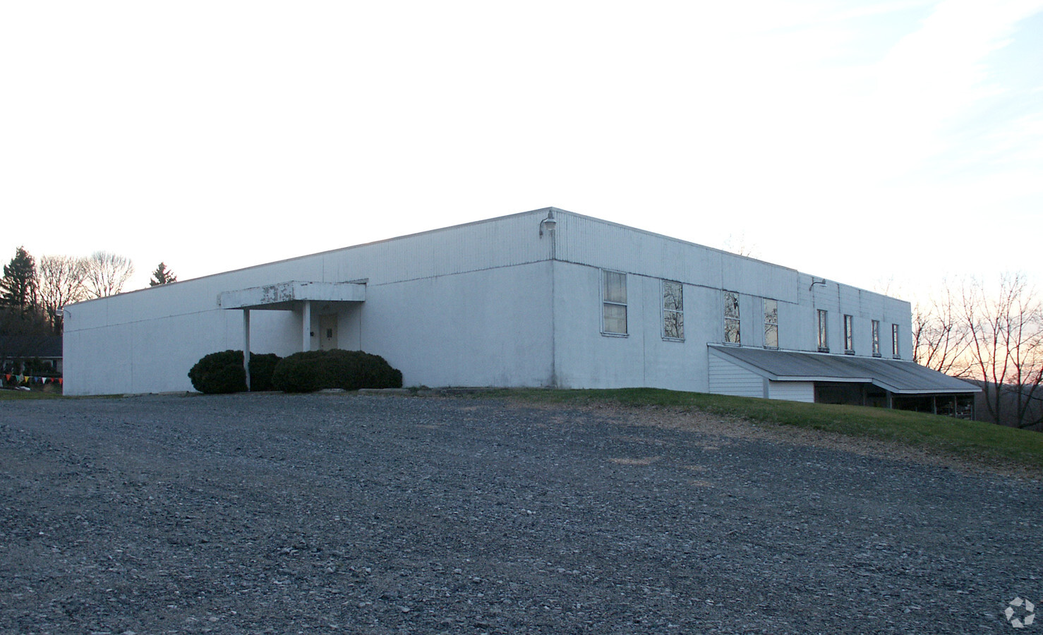
Property Record
939 Pottstown Pike, Chester Springs, PA 19425
NEARBY LISTINGS FOR SALE OR LEASE
Property Detail
939 Pottstown Pike
25-006-0035.0000
Property/William Williams
Officebuilding
2.8 AC & COMM BLDG
X
Chester
42029C0090G
Pennsylvania
2024
2.80 AC
2024
Chester
301900
Philadelphia
20,810 SF
Philadelphia-Camden-Wilmington, PA-NJ-DE-MD
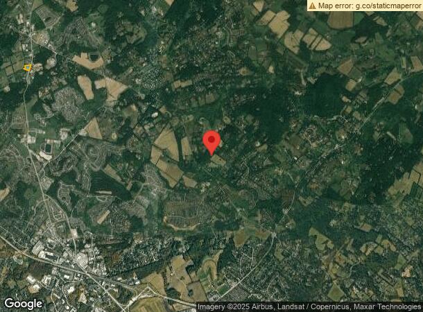
DEMOGRAPHICS near 939 Pottstown Pike
1 Mile
3 Mile
5 Mile
2024 Total Population
3,882
19,592
42,744
2029 Population
4,058
20,524
44,615
Pop Growth 2024-2029
+ 4.53%
+ 4.76%
+ 4.38%
Average Age
38
39
41
2024 Total Households
1,366
6,446
15,025
HH Growth 2024-2029
+ 4.90%
+ 4.87%
+ 4.56%
Median Household Inc
$126,032
$175,575
$153,386
Avg Household Size
2.80
3.00
2.80
2024 Avg HH Vehicles
2.00
2.00
2.00
Median Home Value
$472,365
$558,131
$493,002
Median Year Built
2003
2000
1993
Nearby Places
- Restaurants
- Banks
- Shops
- Fitness
- Groceries
PUBLIC TRANSPORTATION
COMMUTER RAIL
Whitford (R5 - Southeastern Pennsylvania Transportation Authority Regional Rail (SEPTA Regional Rail))
DRIVE
WALK
Distance
Whitford (R5 - Southeastern Pennsylvania Transportation Authority Regional Rail (SEPTA Regional Rail))
17 min
7.9 mi
Exton (R5 - Southeastern Pennsylvania Transportation Authority Regional Rail (SEPTA Regional Rail))
DRIVE
WALK
Distance
Exton (R5 - Southeastern Pennsylvania Transportation Authority Regional Rail (SEPTA Regional Rail))
16 min
8.1 mi
AIRPORT
Philadelphia International
DRIVE
WALK
Distance
Philadelphia International
60 min
37.0 mi
Freight Ports
Port of Wilmington, RI
DRIVE
WALK
Distance
Port of Wilmington, RI
57 min
32.4 mi
Nearby Properties
Address
Land Use
TOTAL SIZE
Lot Size
Zoning
Address
Land Use
TOTAL SIZE
Lot Size
Zoning
567,795 SF
4.07 AC
TCM
Address
Land Use
TOTAL SIZE
Lot Size
Zoning
313,166 SF
4.36 AC
RA
Address
Land Use
TOTAL SIZE
Lot Size
Zoning
440,731 SF
41.15 AC
RA
Address
Land Use
TOTAL SIZE
Lot Size
Zoning
449,617 SF
36.60 AC
R2
Address
Land Use
TOTAL SIZE
Lot Size
Zoning
210,211 SF
18.51 AC
R2
Address
Land Use
TOTAL SIZE
Lot Size
Zoning
253,570 SF
12.20 AC
L1
Address
Land Use
TOTAL SIZE
Lot Size
Zoning
171,609 SF
21.10 AC
RA
Address
Land Use
TOTAL SIZE
Lot Size
Zoning
203,450 SF
27.18 AC
R2
Address
Land Use
TOTAL SIZE
Lot Size
Zoning
158,574 SF
12.01 AC
RA
Address
Land Use
TOTAL SIZE
Lot Size
Zoning
149,289 SF
8.63 AC
R2
Address
Land Use
TOTAL SIZE
Lot Size
Zoning
105,651 SF
35.64 AC
R3
Address
Land Use
TOTAL SIZE
Lot Size
Zoning
87,400 SF
18.10 AC
C1
Address
Land Use
TOTAL SIZE
Lot Size
Zoning
101,894 SF
14.15 AC
C1
Address
Land Use
TOTAL SIZE
Lot Size
Zoning
126,842 SF
13.50 AC
PC
Address
Land Use
TOTAL SIZE
Lot Size
Zoning
86,901 SF
0.61 AC
PCID
Address
Land Use
TOTAL SIZE
Lot Size
Zoning
107,160 SF
0.82 AC
PCID
Address
Land Use
TOTAL SIZE
Lot Size
Zoning
119,408 SF
11.69 AC
RA
Address
Land Use
TOTAL SIZE
Lot Size
Zoning
125,664 SF
13.09 AC
RA
Address
Land Use
TOTAL SIZE
Lot Size
Zoning
94,661 SF
9.40 AC
RA
Address
Land Use
TOTAL SIZE
Lot Size
Zoning
69,435 SF
41.90 AC
CR
Address
Land Use
TOTAL SIZE
Lot Size
Zoning
130,670 SF
8.50 AC
PI
Address
Land Use
TOTAL SIZE
Lot Size
Zoning
89,484 SF
4.20 AC
PC2
Address
Land Use
TOTAL SIZE
Lot Size
Zoning
84,121 SF
8.90 AC
RA
Address
Land Use
TOTAL SIZE
Lot Size
Zoning
87,266 SF
8.17 AC
RA
Address
Land Use
TOTAL SIZE
Lot Size
Zoning
42,063 SF
11.45 AC
C3
Address
Land Use
TOTAL SIZE
Lot Size
Zoning
73,352 SF
0.67 AC
PCID
Address
Land Use
TOTAL SIZE
Lot Size
Zoning
93,280 SF
7.12 AC
PIC
Address
Land Use
TOTAL SIZE
Lot Size
Zoning
73,614 SF
24.80 AC
MHP
Address
Land Use
TOTAL SIZE
Lot Size
Zoning
81,492 SF
11.54 AC
RR
Address
Land Use
TOTAL SIZE
Lot Size
Zoning
19.14 AC
LI
The World's #1 Commercial Real Estate Marketplace
Connect with us
© 2025 CoStar Group
The information above has been obtained from sources believed reliable. While we do not doubt its accuracy we have not verified it and make no guarantee, warranty or representation about it. It is your responsibility to independently confirm its accuracy and completeness. Any projections, opinions, assumptions, or estimates used are for example only and do not represent the current or future performance of the property. The value of this transaction to you depends on tax and other factors which should be evaluated by your tax, financial, and legal advisors. You and your advisors should conduct a careful, independent investigation of the property to determine to your satisfaction the suitability of the property for your needs.