Property Record
94 Mcfarland Blvd, Northport, AL 35476

NEARBY LISTINGS FOR SALE OR LEASE
Property Detail
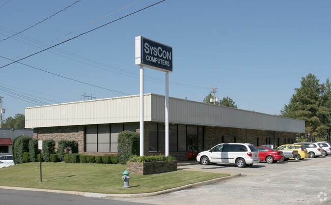
94 Mcfarland Blvd
31-01-11-2-001-007.003
BEG INT N ROW HWY 82 & W LINE SE1/4-NW1/4; TH E 100 TO POB; TH E 100; N 384.8; W 109.9; S 377.3 TO POB IN SE1/4-NW1/4 S11 T21S R10W
Commercialofficeresidentialmixeduse
Tuscaloosa
X
Alabama
01125C0506G
0.92 AC
2025
Tuscaloosa
2024
Birmingham
010204
Tuscaloosa, AL
5,040 SF
DEMOGRAPHICS near 94 Mcfarland Blvd
1 Mile
3 Mile
5 Mile
2024 Total Population
8,149
69,582
130,362
2029 Population
9,246
77,633
147,042
Pop Growth 2024-2029
+ 13.46%
+ 11.57%
+ 12.80%
Average Age
40
33
35
2024 Total Households
3,793
23,639
48,577
HH Growth 2024-2029
+ 12.97%
+ 15.31%
+ 14.55%
Median Household Inc
$73,672
$45,325
$44,575
Avg Household Size
2.00
2.10
2.20
2024 Avg HH Vehicles
2.00
2.00
2.00
Median Home Value
$305,147
$276,114
$221,600
Median Year Built
1985
1990
1990
Nearby Places
Map Layers
Map Styles
 Street
 Aerial
- Restaurants
- Banks
- Shops
- Fitness
- Groceries
PUBLIC TRANSPORTATION
COMMUTER RAIL
DRIVE
WALK
Distance
9 min
4.8 mi
SALE & LEASE HISTORY
LISTING DATE
SALE/LEASE

Aug 22, 2022
For Lease
Nearby Properties
Address
Land Use
TOTAL SIZE
Lot Size
Zoning
Address
Land Use
TOTAL SIZE
Lot Size
Zoning
22,791 SF
13 AC
Address
Land Use
TOTAL SIZE
Lot Size
Zoning
148,656 SF
2.79 AC
BC
Address
Land Use
TOTAL SIZE
Lot Size
Zoning
22,925 SF
13.45 AC
R4
Address
Land Use
TOTAL SIZE
Lot Size
Zoning
252,793 SF
2.73 AC
BN
Address
Land Use
TOTAL SIZE
Lot Size
Zoning
40,160 SF
10.79 AC
RMF1
Address
Land Use
TOTAL SIZE
Lot Size
Zoning
6,579 SF
15.07 AC
RMF1
Address
Land Use
TOTAL SIZE
Lot Size
Zoning
160,989 SF
1.53 AC
RMF2
Address
Land Use
TOTAL SIZE
Lot Size
Zoning
55.11 AC
I
Address
Land Use
TOTAL SIZE
Lot Size
Zoning
1.33 AC
BC
Address
Land Use
TOTAL SIZE
Lot Size
Zoning
176,360 SF
1.13 AC
RMF2
Address
Land Use
TOTAL SIZE
Lot Size
Zoning
15,888 SF
112 AC
I
Address
Land Use
TOTAL SIZE
Lot Size
Zoning
200,388 SF
1.22 AC
Address
Land Use
TOTAL SIZE
Lot Size
Zoning
21,811 SF
16 AC
R4
Address
Land Use
TOTAL SIZE
Lot Size
Zoning
110,337 SF
0.91 AC
RMF2
Address
Land Use
TOTAL SIZE
Lot Size
Zoning
105,728 SF
4.75 AC
BGO
Address
Land Use
TOTAL SIZE
Lot Size
Zoning
121,384 SF
21 AC
O-I
Address
Land Use
TOTAL SIZE
Lot Size
Zoning
20,224 SF
19 AC
RM2
Address
Land Use
TOTAL SIZE
Lot Size
Zoning
173,452 SF
2.30 AC
ML
Address
Land Use
TOTAL SIZE
Lot Size
Zoning
144,660 SF
1 AC
RMF2
Address
Land Use
TOTAL SIZE
Lot Size
Zoning
110,000 SF
5.80 AC
RD
Address
Land Use
TOTAL SIZE
Lot Size
Zoning
28,796 SF
15 AC
R4
Address
Land Use
TOTAL SIZE
Lot Size
Zoning
26,576 SF
2.53 AC
RD
Address
Land Use
TOTAL SIZE
Lot Size
Zoning
15.30 AC
Address
Land Use
TOTAL SIZE
Lot Size
Zoning
115,911 SF
4.48 AC
I
Address
Land Use
TOTAL SIZE
Lot Size
Zoning
45,716 SF
8.80 AC
R4
Address
Land Use
TOTAL SIZE
Lot Size
Zoning
12,048 SF
21 AC
RM2
Address
Land Use
TOTAL SIZE
Lot Size
Zoning
34 AC
R-3
Address
Land Use
TOTAL SIZE
Lot Size
Zoning
25,422 SF
8.90 AC
RMF1
Address
Land Use
TOTAL SIZE
Lot Size
Zoning
73,848 SF
1.73 AC
BGO
Address
Land Use
TOTAL SIZE
Lot Size
Zoning
56,613 SF
2.02 AC
BGO
The World's #1 Commercial Real Estate Marketplace
Connect with us
© 2026 CoStar Group
The information above has been obtained from sources believed reliable. While we do not doubt its accuracy we have not verified it and make no guarantee, warranty or representation about it. It is your responsibility to independently confirm its accuracy and completeness. Any projections, opinions, assumptions, or estimates used are for example only and do not represent the current or future performance of the property. The value of this transaction to you depends on tax and other factors which should be evaluated by your tax, financial, and legal advisors. You and your advisors should conduct a careful, independent investigation of the property to determine to your satisfaction the suitability of the property for your needs.