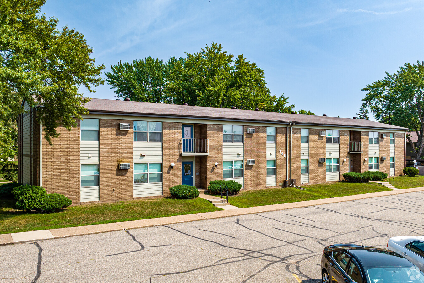
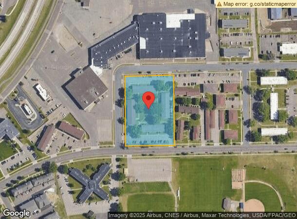
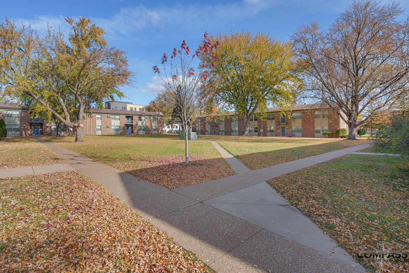
Property Record
941 Richard Dr, Eau Claire, WI 54701
NEARBY LISTINGS FOR SALE OR LEASE
Property Detail
941 Richard Dr
15-1054-J
A PCL OF LAND LYING IN THE NE 1/4-SE 1/4 SEC 30-27-9 DESC AS FOLL COMM AT THE SW COR OF THE SAID NE 1/4-SE 1/4 SEC 30 THC N 0
Apartment
Eau Claire
X
Wisconsin
55017C0725E
2.56 AC
2023
Eau Claire/Menomonie
2023
Other Market Areas
000900
Eau Claire, WI
12,792 SF
DEMOGRAPHICS near 941 Richard Dr
1 Mile
3 Mile
5 Mile
2024 Total Population
8,006
52,056
88,455
2029 Population
8,275
53,946
92,074
Pop Growth 2024-2029
+ 3.36%
+ 3.63%
+ 4.09%
Average Age
33
36
38
2024 Total Households
3,034
21,502
36,641
HH Growth 2024-2029
+ 3.63%
+ 3.73%
+ 4.18%
Median Household Inc
$47,843
$55,872
$62,542
Avg Household Size
2.20
2.20
2.20
2024 Avg HH Vehicles
2.00
2.00
2.00
Median Home Value
$229,526
$216,253
$231,644
Median Year Built
1975
1970
1976
Nearby Places
- Restaurants
- Banks
- Shops
- Fitness
- Groceries
Nearby Properties
Address
Land Use
TOTAL SIZE
Lot Size
Zoning
Address
Land Use
TOTAL SIZE
Lot Size
Zoning
203,723 SF
20.28 AC
CBDP
Address
Land Use
TOTAL SIZE
Lot Size
Zoning
361,759 SF
8.46 AC
C3P
Address
Land Use
TOTAL SIZE
Lot Size
Zoning
206,042 SF
5.59 AC
Address
Land Use
TOTAL SIZE
Lot Size
Zoning
199,534 SF
7.23 AC
C3H
Address
Land Use
TOTAL SIZE
Lot Size
Zoning
21.83 AC
I1
Address
Land Use
TOTAL SIZE
Lot Size
Zoning
114,683 SF
5.47 AC
C3H
Address
Land Use
TOTAL SIZE
Lot Size
Zoning
94,173 SF
9.36 AC
C3
Address
Land Use
TOTAL SIZE
Lot Size
Zoning
81,260 SF
2.32 AC
R4
Address
Land Use
TOTAL SIZE
Lot Size
Zoning
1.04 AC
P
Address
Land Use
TOTAL SIZE
Lot Size
Zoning
105,434 SF
1.55 AC
CBD
Address
Land Use
TOTAL SIZE
Lot Size
Zoning
66,393 SF
12.95 AC
Address
Land Use
TOTAL SIZE
Lot Size
Zoning
65,378 SF
1.83 AC
CBDP
Address
Land Use
TOTAL SIZE
Lot Size
Zoning
114,100 SF
2.64 AC
Address
Land Use
TOTAL SIZE
Lot Size
Zoning
68,024 SF
0.80 AC
CBD
Address
Land Use
TOTAL SIZE
Lot Size
Zoning
88,350 SF
0.40 AC
CBD
Address
Land Use
TOTAL SIZE
Lot Size
Zoning
36.58 AC
I1
Address
Land Use
TOTAL SIZE
Lot Size
Zoning
85,790 SF
5.68 AC
C3
Address
Land Use
TOTAL SIZE
Lot Size
Zoning
1.36 AC
CBD
Address
Land Use
TOTAL SIZE
Lot Size
Zoning
66,497 SF
0.81 AC
CBDP
Address
Land Use
TOTAL SIZE
Lot Size
Zoning
7,084 SF
26.73 AC
I2P
Address
Land Use
TOTAL SIZE
Lot Size
Zoning
92,339 SF
9.93 AC
C3
Address
Land Use
TOTAL SIZE
Lot Size
Zoning
90,580 SF
5.67 AC
C3P
Address
Land Use
TOTAL SIZE
Lot Size
Zoning
70,965 SF
0.78 AC
CBD
Address
Land Use
TOTAL SIZE
Lot Size
Zoning
73,414 SF
2.46 AC
C3P
Address
Land Use
TOTAL SIZE
Lot Size
Zoning
60,473 SF
1.83 AC
Address
Land Use
TOTAL SIZE
Lot Size
Zoning
153,536 SF
9.51 AC
I2P
Address
Land Use
TOTAL SIZE
Lot Size
Zoning
77,339 SF
6.45 AC
C2
Address
Land Use
TOTAL SIZE
Lot Size
Zoning
77,311 SF
3.39 AC
C3H
Address
Land Use
TOTAL SIZE
Lot Size
Zoning
42,670 SF
4.11 AC
C3P
Address
Land Use
TOTAL SIZE
Lot Size
Zoning
25.27 AC
I2
The World's #1 Commercial Real Estate Marketplace
Connect with us
© 2025 CoStar Group
The information above has been obtained from sources believed reliable. While we do not doubt its accuracy we have not verified it and make no guarantee, warranty or representation about it. It is your responsibility to independently confirm its accuracy and completeness. Any projections, opinions, assumptions, or estimates used are for example only and do not represent the current or future performance of the property. The value of this transaction to you depends on tax and other factors which should be evaluated by your tax, financial, and legal advisors. You and your advisors should conduct a careful, independent investigation of the property to determine to your satisfaction the suitability of the property for your needs.