Property Record
9521 S 700 E, Sandy, UT 84070
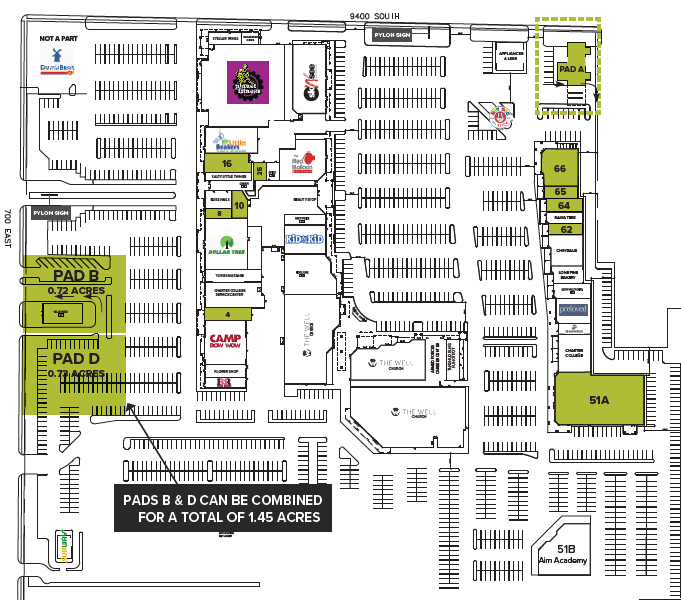
Current Lease Availabilities
NEARBY LISTINGS FOR SALE OR LEASE
Property Detail
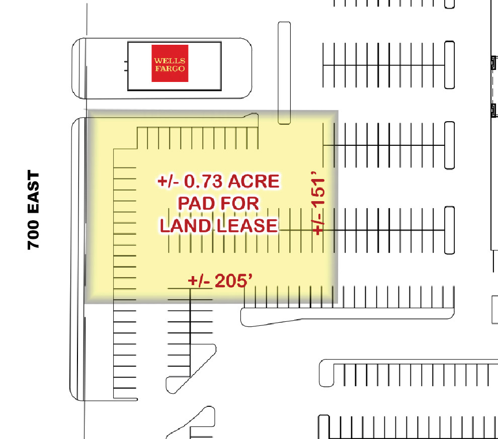
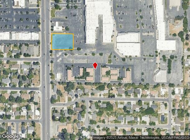
9521 S 700 E
Salt Lake City, UT
Sandy Mall Sub
28-08-101-065-0000
LOT 2, SANDY MALL SUB.
Commercialacreage
Salt Lake
X
Utah
49035C0453G
2
2023
0.73 AC
2023
Southeast Valley
112604
Salt Lake City
DEMOGRAPHICS near 9521 S 700 E
1 Mile
3 Mile
5 Mile
2024 Total Population
17,024
125,776
288,660
2029 Population
17,240
126,914
291,670
Pop Growth 2024-2029
+ 1.27%
+ 0.90%
+ 1.04%
Average Age
39
38
39
2024 Total Households
6,194
44,584
101,360
HH Growth 2024-2029
+ 1.37%
+ 0.92%
+ 0.99%
Median Household Inc
$81,282
$88,248
$92,621
Avg Household Size
2.70
2.80
2.80
2024 Avg HH Vehicles
2.00
2.00
2.00
Median Home Value
$393,893
$459,596
$500,685
Median Year Built
1978
1984
1987
Nearby Places
- Restaurants
- Banks
- Shops
- Fitness
- Groceries
PUBLIC TRANSPORTATION
TRANSIT/SUBWAY
Sandy Expo (TRAX Murray/Midvale/University Line - Utah Transit Authority (UTA), TRAX Salt Lake/Sandy Line - Utah Transit Authority (UTA))
DRIVE
WALK
Distance
Sandy Expo (TRAX Murray/Midvale/University Line - Utah Transit Authority (UTA), TRAX Salt Lake/Sandy Line - Utah Transit Authority (UTA))
3 min
20 min
1.0 mi
COMMUTER RAIL
South Jordan Station (FrontRunner - Utah Transit Authority (UTA))
DRIVE
WALK
Distance
South Jordan Station (FrontRunner - Utah Transit Authority (UTA))
7 min
3.0 mi
Draper Station (FrontRunner - Utah Transit Authority (UTA))
DRIVE
WALK
Distance
Draper Station (FrontRunner - Utah Transit Authority (UTA))
13 min
6.7 mi
AIRPORT
Salt Lake City International
DRIVE
WALK
Distance
Salt Lake City International
26 min
19.7 mi
Provo Municipal
DRIVE
WALK
Distance
Provo Municipal
47 min
34.0 mi
Freight Ports
Port of Stockton
DRIVE
WALK
Distance
Port of Stockton
727 min
710.1 mi
Nearby Properties
Address
Land Use
TOTAL SIZE
Lot Size
Zoning
Address
Land Use
TOTAL SIZE
Lot Size
Zoning
397,171 SF
35.56 AC
1208
Address
Land Use
TOTAL SIZE
Lot Size
Zoning
512,301 SF
25.39 AC
SD(H)
Address
Land Use
TOTAL SIZE
Lot Size
Zoning
512,301 SF
25.39 AC
SD(H)
Address
Land Use
TOTAL SIZE
Lot Size
Zoning
553,122 SF
13.64 AC
SD-X
Address
Land Use
TOTAL SIZE
Lot Size
Zoning
566,327 SF
7.02 AC
CBD-O
Address
Land Use
TOTAL SIZE
Lot Size
Zoning
258,000 SF
13.25 AC
1D
Address
Land Use
TOTAL SIZE
Lot Size
Zoning
153,245 SF
27.10 AC
PUD137
Address
Land Use
TOTAL SIZE
Lot Size
Zoning
106,318 SF
4.46 AC
CBD-O
Address
Land Use
TOTAL SIZE
Lot Size
Zoning
372,355 SF
13.80 AC
C-F
Address
Land Use
TOTAL SIZE
Lot Size
Zoning
500,249 SF
3.16 AC
MU
Address
Land Use
TOTAL SIZE
Lot Size
Zoning
500,249 SF
3.16 AC
MU
Address
Land Use
TOTAL SIZE
Lot Size
Zoning
164,539 SF
5.29 AC
MU
Address
Land Use
TOTAL SIZE
Lot Size
Zoning
124,434 SF
13.64 AC
PUD-15
Address
Land Use
TOTAL SIZE
Lot Size
Zoning
376,067 SF
6.05 AC
MU
Address
Land Use
TOTAL SIZE
Lot Size
Zoning
81,865 SF
19.46 AC
Z-C-FF
Address
Land Use
TOTAL SIZE
Lot Size
Zoning
327,940 SF
3.95 AC
SD
Address
Land Use
TOTAL SIZE
Lot Size
Zoning
327,940 SF
3.37 AC
SD
Address
Land Use
TOTAL SIZE
Lot Size
Zoning
192,626 SF
5.72 AC
CF
Address
Land Use
TOTAL SIZE
Lot Size
Zoning
103,114 SF
14.82 AC
RM 25
Address
Land Use
TOTAL SIZE
Lot Size
Zoning
101,790 SF
5.69 AC
PUD(16
Address
Land Use
TOTAL SIZE
Lot Size
Zoning
379,911 SF
5.78 AC
mu
Address
Land Use
TOTAL SIZE
Lot Size
Zoning
34,872 SF
11.59 AC
c-f
Address
Land Use
TOTAL SIZE
Lot Size
Zoning
176,826 SF
6.13 AC
SD(H)
Address
Land Use
TOTAL SIZE
Lot Size
Zoning
470,856 SF
10.74 AC
CBDO
Address
Land Use
TOTAL SIZE
Lot Size
Zoning
168,488 SF
21.11 AC
1107
Address
Land Use
TOTAL SIZE
Lot Size
Zoning
280,668 SF
12 AC
CBD
Address
Land Use
TOTAL SIZE
Lot Size
Zoning
200,922 SF
3.82 AC
2000
Address
Land Use
TOTAL SIZE
Lot Size
Zoning
465,026 SF
5.36 AC
CBD
Address
Land Use
TOTAL SIZE
Lot Size
Zoning
85,549 SF
2.37 AC
CBD-O
Address
Land Use
TOTAL SIZE
Lot Size
Zoning
199,446 SF
12.65 AC
RM25
The World's #1 Commercial Real Estate Marketplace
Connect with us
© 2025 CoStar Group
The information above has been obtained from sources believed reliable. While we do not doubt its accuracy we have not verified it and make no guarantee, warranty or representation about it. It is your responsibility to independently confirm its accuracy and completeness. Any projections, opinions, assumptions, or estimates used are for example only and do not represent the current or future performance of the property. The value of this transaction to you depends on tax and other factors which should be evaluated by your tax, financial, and legal advisors. You and your advisors should conduct a careful, independent investigation of the property to determine to your satisfaction the suitability of the property for your needs.