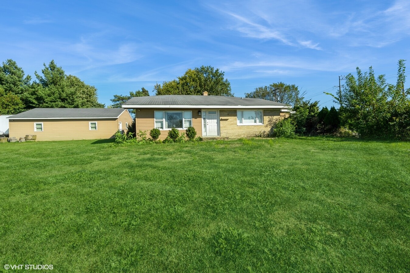
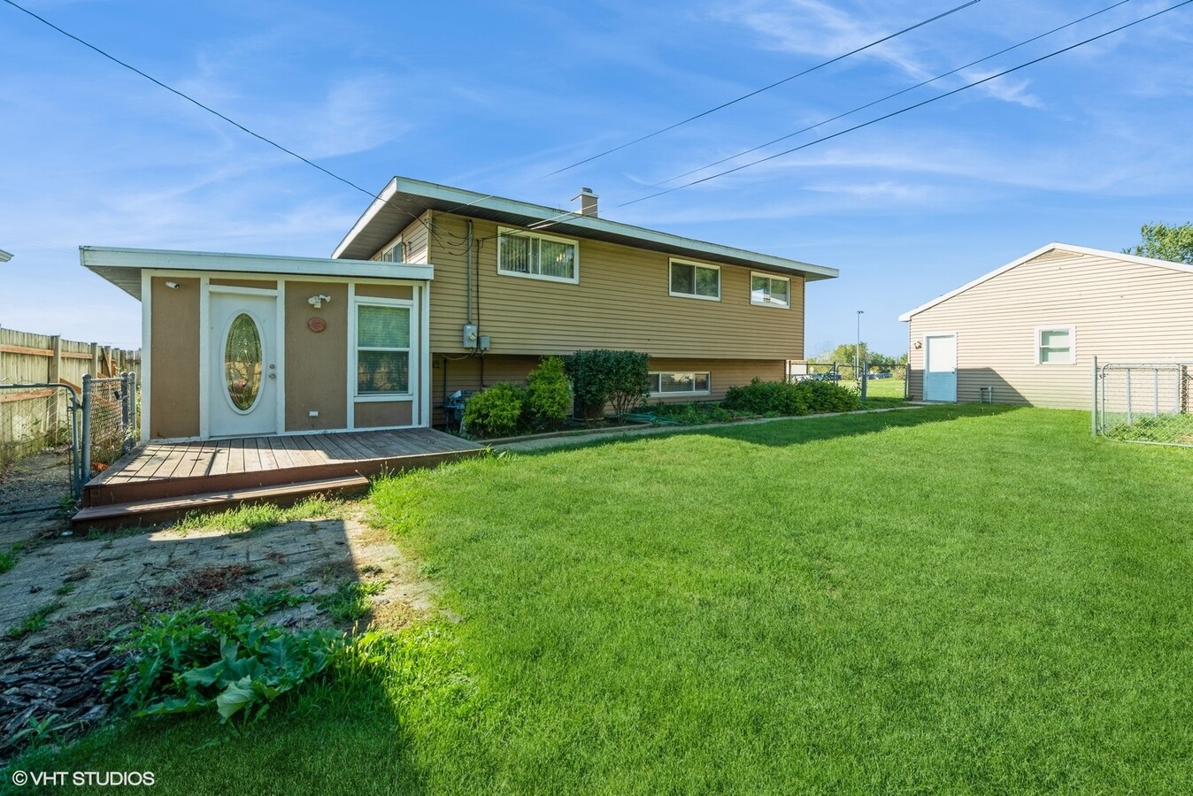
Property Record
9550 S Il Route 31, Algonquin, IL 60102

NEARBY LISTINGS FOR SALE OR LEASE
Property Detail
9550 S Il Route 31
Chicago-Naperville-Elgin, IL-IN-WI
Fox River Trail
19-22-252-036
McHenry
Residentialnec
Illinois
X
0.26 AC
17111C0335J
Far Northwest
1,656 SF
Chicago
DEMOGRAPHICS near 9550 S Il Route 31
1 Mile
3 Mile
5 Mile
2024 Total Population
2,225
53,599
149,431
2029 Population
2,228
53,658
149,239
Pop Growth 2024-2029
+ 0.13%
+ 0.11%
(0.13%)
Average Age
40
41
40
2024 Total Households
803
20,025
52,924
HH Growth 2024-2029
+ 0.25%
+ 0.10%
(0.13%)
Median Household Inc
$97,139
$87,993
$97,675
Avg Household Size
2.70
2.60
2.80
2024 Avg HH Vehicles
2.00
2.00
2.00
Median Home Value
$259,677
$243,028
$262,847
Median Year Built
1991
1986
1989
Nearby Places
- Restaurants
- Banks
- Shops
- Fitness
- Groceries
PUBLIC TRANSPORTATION
COMMUTER RAIL
Cary Station (Union Pacific Northwest Line - Northeast Illinois Regional Commuter Railroad (Metra))
DRIVE
WALK
Distance
Cary Station (Union Pacific Northwest Line - Northeast Illinois Regional Commuter Railroad (Metra))
6 min
3.1 mi
Pingree Road Station (Union Pacific Northwest Line - Northeast Illinois Regional Commuter Railroad (Metra))
DRIVE
WALK
Distance
Pingree Road Station (Union Pacific Northwest Line - Northeast Illinois Regional Commuter Railroad (Metra))
8 min
3.7 mi
AIRPORT
Chicago O'Hare International
DRIVE
WALK
Distance
Chicago O'Hare International
46 min
31.4 mi
Freight Ports
Port Milwaukee
DRIVE
WALK
Distance
Port Milwaukee
101 min
74.1 mi
SALE & LEASE HISTORY
LISTING DATE
SALE/LEASE

Nov 21, 2024
For Sale
Nearby Properties
Address
Land Use
TOTAL SIZE
Lot Size
Zoning
Address
Land Use
TOTAL SIZE
Lot Size
Zoning
Address
Land Use
TOTAL SIZE
Lot Size
Zoning
Address
Land Use
TOTAL SIZE
Lot Size
Zoning
28.48 AC
Address
Land Use
TOTAL SIZE
Lot Size
Zoning
449,650 SF
25 AC
Address
Land Use
TOTAL SIZE
Lot Size
Zoning
15.94 AC
Address
Land Use
TOTAL SIZE
Lot Size
Zoning
147,496 SF
11.81 AC
Address
Land Use
TOTAL SIZE
Lot Size
Zoning
Address
Land Use
TOTAL SIZE
Lot Size
Zoning
136,739 SF
15.07 AC
Address
Land Use
TOTAL SIZE
Lot Size
Zoning
64,269 SF
5.08 AC
Address
Land Use
TOTAL SIZE
Lot Size
Zoning
20.81 AC
Address
Land Use
TOTAL SIZE
Lot Size
Zoning
217,182 SF
22.43 AC
Address
Land Use
TOTAL SIZE
Lot Size
Zoning
106,309 SF
12.96 AC
Address
Land Use
TOTAL SIZE
Lot Size
Zoning
71,703 SF
0.50 AC
Address
Land Use
TOTAL SIZE
Lot Size
Zoning
8.32 AC
Address
Land Use
TOTAL SIZE
Lot Size
Zoning
Address
Land Use
TOTAL SIZE
Lot Size
Zoning
9,614 SF
1.42 AC
Address
Land Use
TOTAL SIZE
Lot Size
Zoning
72,173 SF
5.23 AC
Address
Land Use
TOTAL SIZE
Lot Size
Zoning
66,594 SF
5.22 AC
Address
Land Use
TOTAL SIZE
Lot Size
Zoning
47,164 SF
0.70 AC
Address
Land Use
TOTAL SIZE
Lot Size
Zoning
56,900 SF
5.93 AC
Address
Land Use
TOTAL SIZE
Lot Size
Zoning
504,206 SF
11.06 AC
Address
Land Use
TOTAL SIZE
Lot Size
Zoning
127,059 SF
16.84 AC
Address
Land Use
TOTAL SIZE
Lot Size
Zoning
122,668 SF
9.73 AC
Address
Land Use
TOTAL SIZE
Lot Size
Zoning
134,523 SF
15.27 AC
Address
Land Use
TOTAL SIZE
Lot Size
Zoning
161,610 SF
15.03 AC
Address
Land Use
TOTAL SIZE
Lot Size
Zoning
10.48 AC
Address
Land Use
TOTAL SIZE
Lot Size
Zoning
81,873 SF
9.38 AC
Address
Land Use
TOTAL SIZE
Lot Size
Zoning
35,452 SF
105.76 AC
Address
Land Use
TOTAL SIZE
Lot Size
Zoning
124,301 SF
8.80 AC
Address
Land Use
TOTAL SIZE
Lot Size
Zoning
61,955 SF
7.48 AC
The World's #1 Commercial Real Estate Marketplace
Connect with us
© 2025 CoStar Group
The information above has been obtained from sources believed reliable. While we do not doubt its accuracy we have not verified it and make no guarantee, warranty or representation about it. It is your responsibility to independently confirm its accuracy and completeness. Any projections, opinions, assumptions, or estimates used are for example only and do not represent the current or future performance of the property. The value of this transaction to you depends on tax and other factors which should be evaluated by your tax, financial, and legal advisors. You and your advisors should conduct a careful, independent investigation of the property to determine to your satisfaction the suitability of the property for your needs.