Property Record
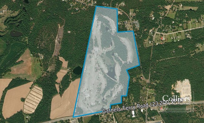
9560 Garners Ferry Rd, Hopkins, SC 29061


NEARBY LISTINGS FOR SALE OR LEASE
Property Detail
9560 Garners Ferry Rd
24800-06-31
#SU #PR V-73
Commercialnec
Richland
AE
South Carolina
45079C0405L
182.30 AC
2025
Southeast Columbia
2024
Columbia
011901
Columbia, SC
3,333 SF
DEMOGRAPHICS near 9560 Garners Ferry Rd
1 Mile
3 Mile
5 Mile
2024 Total Population
473
12,849
27,022
2029 Population
482
13,056
27,447
Pop Growth 2024-2029
+ 1.90%
+ 1.61%
+ 1.57%
Average Age
44
40
40
2024 Total Households
194
5,052
11,055
HH Growth 2024-2029
+ 1.55%
+ 1.66%
+ 1.61%
Median Household Inc
$63,750
$57,719
$55,502
Avg Household Size
2.40
2.50
2.40
2024 Avg HH Vehicles
2.00
2.00
2.00
Median Home Value
$237,931
$160,654
$159,394
Median Year Built
1984
1991
1986
Nearby Places
Map Layers
Map Styles
 Street
 Aerial
- Restaurants
- Banks
- Shops
- Fitness
- Groceries
PUBLIC TRANSPORTATION
AIRPORT
Columbia Metro
DRIVE
WALK
Distance
Columbia Metro
36 min
22.7 mi
Freight Ports
North Charleston Terminal
DRIVE
WALK
Distance
North Charleston Terminal
130 min
114.1 mi
SALE & LEASE HISTORY
LISTING DATE
SALE/LEASE

Feb 13, 2019
For Sale
Nearby Properties
Address
Land Use
TOTAL SIZE
Lot Size
Zoning
Address
Land Use
TOTAL SIZE
Lot Size
Zoning
56.15 AC
PDD
Address
Land Use
TOTAL SIZE
Lot Size
Zoning
51,516 SF
9.12 AC
GC
Address
Land Use
TOTAL SIZE
Lot Size
Zoning
34,900 SF
20 AC
PDD
Address
Land Use
TOTAL SIZE
Lot Size
Zoning
19,465 SF
4.41 AC
RU
Address
Land Use
TOTAL SIZE
Lot Size
Zoning
25,184 SF
31 AC
M-1
Address
Land Use
TOTAL SIZE
Lot Size
Zoning
7,642 SF
2.42 AC
GC
Address
Land Use
TOTAL SIZE
Lot Size
Zoning
9,591 SF
14.68 AC
RU
Address
Land Use
TOTAL SIZE
Lot Size
Zoning
12,438 SF
8.02 AC
RS-LD
Address
Land Use
TOTAL SIZE
Lot Size
Zoning
10,868 SF
1.79 AC
GC
Address
Land Use
TOTAL SIZE
Lot Size
Zoning
80.37 AC
M-1
Address
Land Use
TOTAL SIZE
Lot Size
Zoning
8,263 SF
1.39 AC
GC
Address
Land Use
TOTAL SIZE
Lot Size
Zoning
16,460 SF
3.15 AC
RSF-3
Address
Land Use
TOTAL SIZE
Lot Size
Zoning
5,664 SF
1.47 AC
GC
Address
Land Use
TOTAL SIZE
Lot Size
Zoning
8,760 SF
0.97 AC
GC
Address
Land Use
TOTAL SIZE
Lot Size
Zoning
6,575 SF
2.06 AC
GC
Address
Land Use
TOTAL SIZE
Lot Size
Zoning
48.92 AC
RM-MD
Address
Land Use
TOTAL SIZE
Lot Size
Zoning
204.44 AC
RU
Address
Land Use
TOTAL SIZE
Lot Size
Zoning
1,656 SF
4.87 AC
GC
Address
Land Use
TOTAL SIZE
Lot Size
Zoning
15,000 SF
17 AC
M-1
Address
Land Use
TOTAL SIZE
Lot Size
Zoning
5,103 SF
33.16 AC
OI
Address
Land Use
TOTAL SIZE
Lot Size
Zoning
19.15 AC
PDD
Address
Land Use
TOTAL SIZE
Lot Size
Zoning
5,060 SF
9.73 AC
RU
Address
Land Use
TOTAL SIZE
Lot Size
Zoning
6,208 SF
3.30 AC
RU
Address
Land Use
TOTAL SIZE
Lot Size
Zoning
4,910 SF
0.04 AC
RU
Address
Land Use
TOTAL SIZE
Lot Size
Zoning
10,440 SF
1.59 AC
GC
Address
Land Use
TOTAL SIZE
Lot Size
Zoning
5,605 SF
1.02 AC
RU
Address
Land Use
TOTAL SIZE
Lot Size
Zoning
5,605 SF
3 AC
RS-MD
Address
Land Use
TOTAL SIZE
Lot Size
Zoning
2,800 SF
1.38 AC
GC
Address
Land Use
TOTAL SIZE
Lot Size
Zoning
3,744 SF
5 AC
RU
Address
Land Use
TOTAL SIZE
Lot Size
Zoning
2,306 SF
1 AC
RS-LD
The World's #1 Commercial Real Estate Marketplace
Connect with us
© 2025 CoStar Group
The information above has been obtained from sources believed reliable. While we do not doubt its accuracy we have not verified it and make no guarantee, warranty or representation about it. It is your responsibility to independently confirm its accuracy and completeness. Any projections, opinions, assumptions, or estimates used are for example only and do not represent the current or future performance of the property. The value of this transaction to you depends on tax and other factors which should be evaluated by your tax, financial, and legal advisors. You and your advisors should conduct a careful, independent investigation of the property to determine to your satisfaction the suitability of the property for your needs.