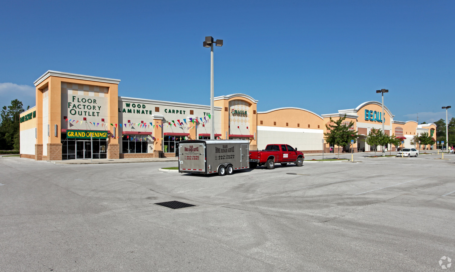
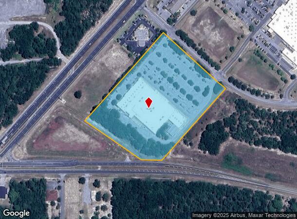
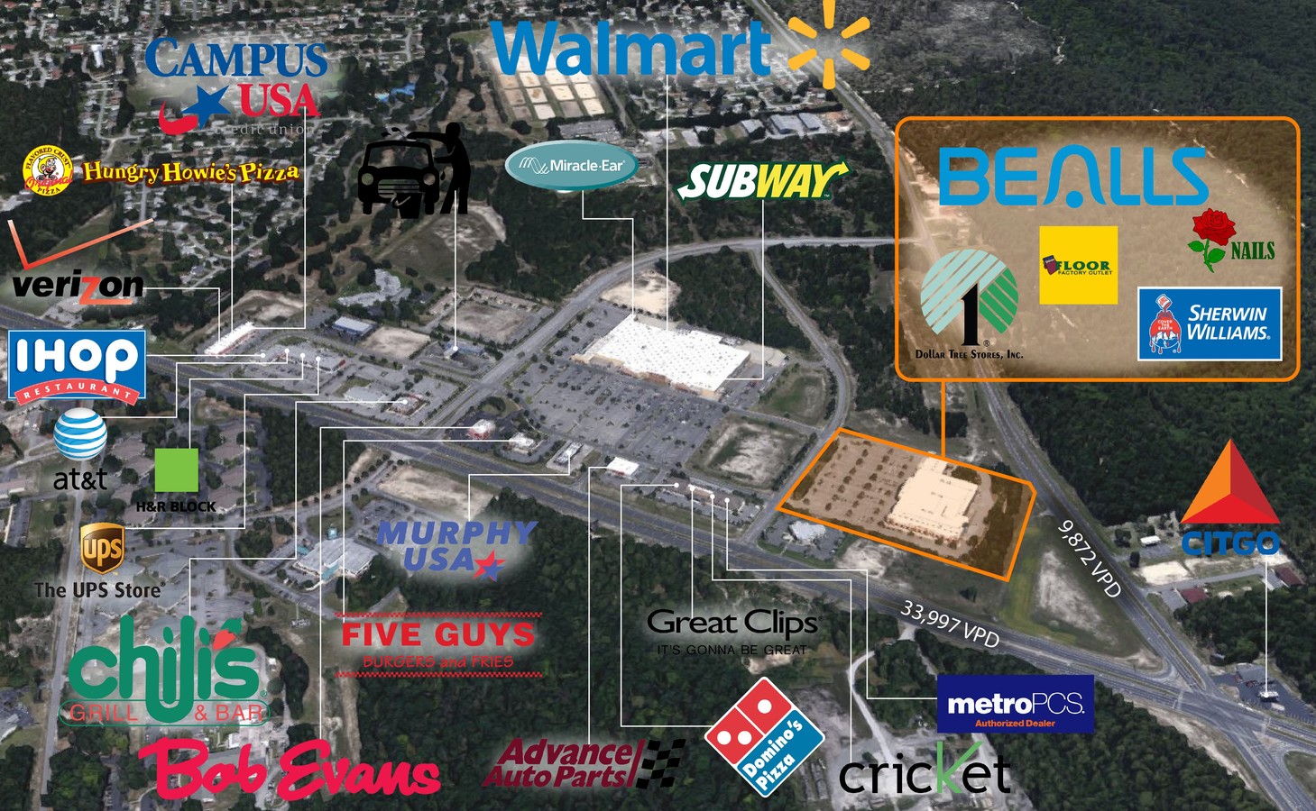
Property Record
9598 Sw 114Th St, Ocala, FL 34481

Current Lease Availabilities
NEARBY LISTINGS FOR SALE OR LEASE
Property Detail
9598 Sw 114Th St
Ocala, FL
Country Oaks At Marion Center A
35341-001-24
SEC 35 TWP 16 RGE 20 PLAT BOOK 011 PAGE 013 COUNTRY OAKS AT MARION CENTER A REPLAT OF A PORTION OF TRACT 2 MARION CENTER PB 009 PG 039 LOT 4
Regionalshoppingcenterormallwithanchorstore
Marion
X
Florida
12083C0692E
4
2023
10.50 AC
2023
Outlying Marion County
001008
Ocala
90,929 SF
DEMOGRAPHICS near 9598 Sw 114Th St
1 Mile
3 Mile
5 Mile
2024 Total Population
667
20,871
47,754
2029 Population
742
23,654
54,406
Pop Growth 2024-2029
+ 11.24%
+ 13.33%
+ 13.93%
Average Age
71
64
58
2024 Total Households
395
11,253
23,228
HH Growth 2024-2029
+ 11.14%
+ 13.16%
+ 13.71%
Median Household Inc
$44,999
$54,291
$56,902
Avg Household Size
1.60
1.80
2.00
2024 Avg HH Vehicles
1.00
1.00
2.00
Median Home Value
$155,833
$167,096
$191,994
Median Year Built
1990
1994
1998
Nearby Places
- Restaurants
- Banks
- Shops
- Fitness
- Groceries
Nearby Properties
Address
Land Use
TOTAL SIZE
Lot Size
Zoning
Address
Land Use
TOTAL SIZE
Lot Size
Zoning
62,253 SF
6.52 AC
PUD
Address
Land Use
TOTAL SIZE
Lot Size
Zoning
96,094 SF
13.66 AC
B2
Address
Land Use
TOTAL SIZE
Lot Size
Zoning
74,928 SF
7.80 AC
PUD
Address
Land Use
TOTAL SIZE
Lot Size
Zoning
203,356 SF
27.08 AC
B4
Address
Land Use
TOTAL SIZE
Lot Size
Zoning
28,813 SF
70.30 AC
B4
Address
Land Use
TOTAL SIZE
Lot Size
Zoning
18,035 SF
3.33 AC
B2
Address
Land Use
TOTAL SIZE
Lot Size
Zoning
3,474.32 AC
A1
Address
Land Use
TOTAL SIZE
Lot Size
Zoning
88,777 SF
10.50 AC
B4
Address
Land Use
TOTAL SIZE
Lot Size
Zoning
43,619 SF
6.04 AC
R3
Address
Land Use
TOTAL SIZE
Lot Size
Zoning
7,677 SF
26.27 AC
B2
Address
Land Use
TOTAL SIZE
Lot Size
Zoning
98,205 SF
13.41 AC
B2
Address
Land Use
TOTAL SIZE
Lot Size
Zoning
69,278 SF
7.52 AC
B4
Address
Land Use
TOTAL SIZE
Lot Size
Zoning
42,159 SF
5.95 AC
B2
Address
Land Use
TOTAL SIZE
Lot Size
Zoning
58,381 SF
5.12 AC
R3
Address
Land Use
TOTAL SIZE
Lot Size
Zoning
68,180 SF
5.40 AC
B5
Address
Land Use
TOTAL SIZE
Lot Size
Zoning
27,563 SF
3.03 AC
B4
Address
Land Use
TOTAL SIZE
Lot Size
Zoning
47,378 SF
23.26 AC
A1
Address
Land Use
TOTAL SIZE
Lot Size
Zoning
16,214 SF
4.91 AC
B2
Address
Land Use
TOTAL SIZE
Lot Size
Zoning
286.80 AC
PUD
Address
Land Use
TOTAL SIZE
Lot Size
Zoning
27,862 SF
17.04 AC
A1
Address
Land Use
TOTAL SIZE
Lot Size
Zoning
37,213 SF
14.54 AC
A1
Address
Land Use
TOTAL SIZE
Lot Size
Zoning
41,642 SF
5.47 AC
B4
Address
Land Use
TOTAL SIZE
Lot Size
Zoning
17,428 SF
2.01 AC
B4
Address
Land Use
TOTAL SIZE
Lot Size
Zoning
20,288 SF
7.20 AC
B2
Address
Land Use
TOTAL SIZE
Lot Size
Zoning
45,364 SF
6.69 AC
B2
Address
Land Use
TOTAL SIZE
Lot Size
Zoning
16,308 SF
1.74 AC
B2
Address
Land Use
TOTAL SIZE
Lot Size
Zoning
955 AC
A1
Address
Land Use
TOTAL SIZE
Lot Size
Zoning
7,014 SF
2.15 AC
B2
Address
Land Use
TOTAL SIZE
Lot Size
Zoning
16,954 SF
1.68 AC
B4
The World's #1 Commercial Real Estate Marketplace
Connect with us
© 2025 CoStar Group
The information above has been obtained from sources believed reliable. While we do not doubt its accuracy we have not verified it and make no guarantee, warranty or representation about it. It is your responsibility to independently confirm its accuracy and completeness. Any projections, opinions, assumptions, or estimates used are for example only and do not represent the current or future performance of the property. The value of this transaction to you depends on tax and other factors which should be evaluated by your tax, financial, and legal advisors. You and your advisors should conduct a careful, independent investigation of the property to determine to your satisfaction the suitability of the property for your needs.