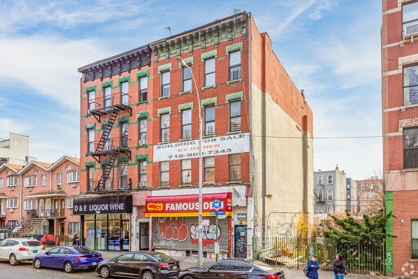
Property Record
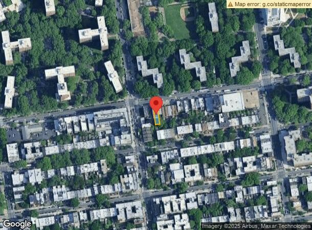
960 Myrtle Ave, Brooklyn, NY 11206

NEARBY LISTINGS FOR SALE OR LEASE
Property Detail
960 Myrtle Ave
01757-0011
DOCID-2024031100237001
Retailwithmorethanonenonretailuse
Kings
X
New York
3604970204F
11
2024
0.06 AC
2024
Bedford-Stuyvesant
028300
Long Island (New York)
6,000 SF
New York-Jersey City-White Plains, NY-NJ
DEMOGRAPHICS near 960 Myrtle Ave
1 Mile
3 Mile
5 Mile
2024 Total Population
211,146
1,237,249
2,993,287
2029 Population
200,585
1,168,615
2,806,144
Pop Growth 2024-2029
(5.00%)
(5.55%)
(6.25%)
Average Age
34
38
39
2024 Total Households
74,139
495,646
1,215,089
HH Growth 2024-2029
(5.72%)
(5.96%)
(6.52%)
Median Household Inc
$61,014
$74,946
$80,889
Avg Household Size
2.70
2.40
2.30
2024 Avg HH Vehicles
.00
.00
.00
Median Home Value
$995,021
$953,457
$844,030
Median Year Built
1954
1948
1949
Nearby Places
- Restaurants
- Banks
- Shops
- Fitness
- Groceries
PUBLIC TRANSPORTATION
TRANSIT/SUBWAY
Myrtle-Willoughby Avenues (G - New York MTA Subway (The Subway))
DRIVE
WALK
Distance
Myrtle-Willoughby Avenues (G - New York MTA Subway (The Subway))
1 min
7 min
0.4 mi
Flushing Avenue (J,M Line) (J - New York MTA Subway (The Subway), M - New York MTA Subway (The Subway))
DRIVE
WALK
Distance
Flushing Avenue (J,M Line) (J - New York MTA Subway (The Subway), M - New York MTA Subway (The Subway))
1 min
7 min
0.4 mi
Myrtle Avenue (J - New York MTA Subway (The Subway), M - New York MTA Subway (The Subway), Z - New York MTA Subway (The Subway))
DRIVE
WALK
Distance
Myrtle Avenue (J - New York MTA Subway (The Subway), M - New York MTA Subway (The Subway), Z - New York MTA Subway (The Subway))
1 min
8 min
0.4 mi
Lorimer Street (J,M Line) (J - New York MTA Subway (The Subway), M - New York MTA Subway (The Subway))
DRIVE
WALK
Distance
Lorimer Street (J,M Line) (J - New York MTA Subway (The Subway), M - New York MTA Subway (The Subway))
2 min
12 min
0.6 mi
Flushing Avenue (G Line) (G - New York MTA Subway (The Subway))
DRIVE
WALK
Distance
Flushing Avenue (G Line) (G - New York MTA Subway (The Subway))
2 min
13 min
0.7 mi
COMMUTER RAIL
Nostrand Avenue Station (Far Rockaway Branch - Long Island Rail Road, Hempstead Branch - Long Island Rail Road, Long Beach Branch - Long Island Rail Road, West Hempstead Branch - Long Island Rail Road)
DRIVE
WALK
Distance
Nostrand Avenue Station (Far Rockaway Branch - Long Island Rail Road, Hempstead Branch - Long Island Rail Road, Long Beach Branch - Long Island Rail Road, West Hempstead Branch - Long Island Rail Road)
5 min
1.7 mi
Atlantic Terminal (Babylon Branch - Long Island Rail Road, City Terminal Zone - Long Island Rail Road, Hempstead Branch - Long Island Rail Road, West Hempstead Branch - Long Island Rail Road)
DRIVE
WALK
Distance
Atlantic Terminal (Babylon Branch - Long Island Rail Road, City Terminal Zone - Long Island Rail Road, Hempstead Branch - Long Island Rail Road, West Hempstead Branch - Long Island Rail Road)
8 min
2.7 mi
AIRPORT
Laguardia
DRIVE
WALK
Distance
Laguardia
18 min
8.5 mi
John F Kennedy International
DRIVE
WALK
Distance
John F Kennedy International
22 min
12.3 mi
Newark Liberty International
DRIVE
WALK
Distance
Newark Liberty International
29 min
16.3 mi
Freight Ports
NY - Red Hook Container Terminal
DRIVE
WALK
Distance
NY - Red Hook Container Terminal
10 min
4.6 mi
SALE & LEASE HISTORY
LISTING DATE
SALE/LEASE

Sep 25, 2019
For Sale
Sep 24, 2016
For Sale
Oct 30, 2019
For Sale
Jul 17, 2019
For Sale
Feb 18, 2019
For Sale
Apr 26, 2022
For Sale
Apr 24, 2020
For Sale
Nearby Properties
Address
Land Use
TOTAL SIZE
Lot Size
Zoning
Address
Land Use
TOTAL SIZE
Lot Size
Zoning
2,812,739 SF
2.10 AC
C5-3
Address
Land Use
TOTAL SIZE
Lot Size
Zoning
1,104,505 SF
2.32 AC
C4-7
Address
Land Use
TOTAL SIZE
Lot Size
Zoning
7,064,736 SF
147.61 AC
M3-1
Address
Land Use
TOTAL SIZE
Lot Size
Zoning
758 SF
1.45 AC
PARK
Address
Land Use
TOTAL SIZE
Lot Size
Zoning
1,503,150 SF
20.47 AC
R5
Address
Land Use
TOTAL SIZE
Lot Size
Zoning
393.54 AC
PARK
Address
Land Use
TOTAL SIZE
Lot Size
Zoning
577,381 SF
3.19 AC
R6
Address
Land Use
TOTAL SIZE
Lot Size
Zoning
942,992 SF
2.22 AC
R7-1
Address
Land Use
TOTAL SIZE
Lot Size
Zoning
2,948,300 SF
27.71 AC
R7-2
Address
Land Use
TOTAL SIZE
Lot Size
Zoning
1,330,743 SF
2.20 AC
C6-4
Address
Land Use
TOTAL SIZE
Lot Size
Zoning
296,915 SF
0.31 AC
C5-3
Address
Land Use
TOTAL SIZE
Lot Size
Zoning
830,879 SF
1 AC
C5-4
Address
Land Use
TOTAL SIZE
Lot Size
Zoning
383,249 SF
1.32 AC
R6
Address
Land Use
TOTAL SIZE
Lot Size
Zoning
783,137 SF
0.79 AC
C64.5
Address
Land Use
TOTAL SIZE
Lot Size
Zoning
835,231 SF
11.32 AC
R6
Address
Land Use
TOTAL SIZE
Lot Size
Zoning
449,695 SF
0.60 AC
C6-2
Address
Land Use
TOTAL SIZE
Lot Size
Zoning
869,038 SF
1.53 AC
M1-1
Address
Land Use
TOTAL SIZE
Lot Size
Zoning
1,658,649 SF
15.93 AC
R7-2
Address
Land Use
TOTAL SIZE
Lot Size
Zoning
1,061,228 SF
8.86 AC
R5
Address
Land Use
TOTAL SIZE
Lot Size
Zoning
579,404 SF
11.20 AC
R6
Address
Land Use
TOTAL SIZE
Lot Size
Zoning
790,392 SF
0.74 AC
M1-1
Address
Land Use
TOTAL SIZE
Lot Size
Zoning
550,232 SF
1.68 AC
R7-2
Address
Land Use
TOTAL SIZE
Lot Size
Zoning
561,945 SF
11.58 AC
R6
Address
Land Use
TOTAL SIZE
Lot Size
Zoning
589,750 SF
1.19 AC
R6
Address
Land Use
TOTAL SIZE
Lot Size
Zoning
662,532 SF
1.21 AC
C6-4
Address
Land Use
TOTAL SIZE
Lot Size
Zoning
978,544 SF
1.60 AC
C61A
Address
Land Use
TOTAL SIZE
Lot Size
Zoning
370,363 SF
0.34 AC
C6-4
Address
Land Use
TOTAL SIZE
Lot Size
Zoning
392,162 SF
1.86 AC
M3-1
Address
Land Use
TOTAL SIZE
Lot Size
Zoning
667,250 SF
1.06 AC
C64.5
Address
Land Use
TOTAL SIZE
Lot Size
Zoning
629,064 SF
0.99 AC
C6-4
The World's #1 Commercial Real Estate Marketplace
Connect with us
© 2025 CoStar Group
The information above has been obtained from sources believed reliable. While we do not doubt its accuracy we have not verified it and make no guarantee, warranty or representation about it. It is your responsibility to independently confirm its accuracy and completeness. Any projections, opinions, assumptions, or estimates used are for example only and do not represent the current or future performance of the property. The value of this transaction to you depends on tax and other factors which should be evaluated by your tax, financial, and legal advisors. You and your advisors should conduct a careful, independent investigation of the property to determine to your satisfaction the suitability of the property for your needs.