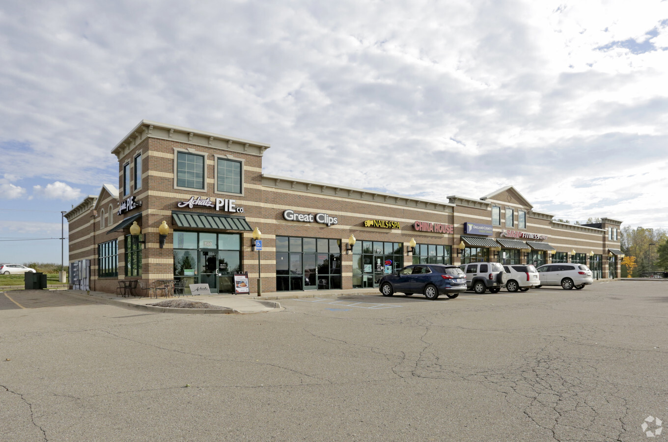
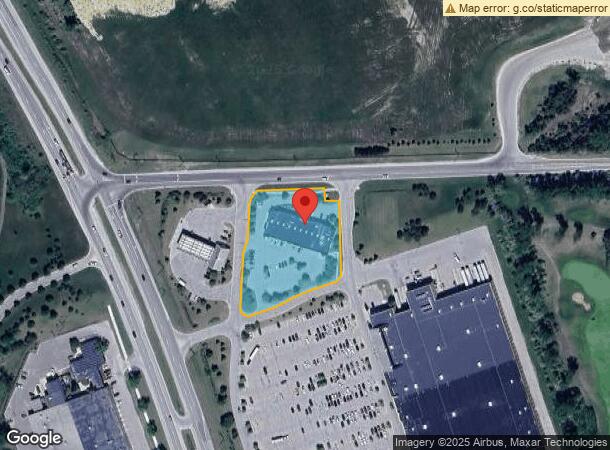
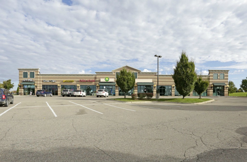
Property Record
960 N Lapeer Rd, Oxford, MI 48371
NEARBY LISTINGS FOR SALE OR LEASE
Property Detail
960 N Lapeer Rd
04-22-200-019
T5N, R10E, SEC 22 PART OF NW 1/4 BEG AT PT DIST S 87-58-43 W 156.80 FT & S 18-24-11 E 34.40 FT, S 87-58-43 W 453.86 FT FROM N
Regionalshoppingcenterormallwithanchorstore
Oakland
X
Michigan
26125C0210F
1.92 AC
2024
St Clair & Lapeer Counties
2024
Detroit
121000
Detroit-Warren-Dearborn, MI
14,571 SF
DEMOGRAPHICS near 960 N Lapeer Rd
1 Mile
3 Mile
5 Mile
2024 Total Population
2,572
19,232
40,450
2029 Population
2,567
19,097
40,198
Pop Growth 2024-2029
(0.19%)
(0.70%)
(0.62%)
Average Age
39
40
41
2024 Total Households
923
7,178
15,194
HH Growth 2024-2029
(0.11%)
(0.74%)
(0.63%)
Median Household Inc
$119,852
$93,239
$101,356
Avg Household Size
2.80
2.60
2.60
2024 Avg HH Vehicles
2.00
2.00
2.00
Median Home Value
$367,867
$322,737
$334,714
Median Year Built
2005
1992
1987
Nearby Places
- Restaurants
- Banks
- Shops
- Fitness
- Groceries
PUBLIC TRANSPORTATION
AIRPORT
Bishop International
DRIVE
WALK
Distance
Bishop International
58 min
40.8 mi
Freight Ports
Port of Toledo
DRIVE
WALK
Distance
Port of Toledo
129 min
102.4 mi
SALE & LEASE HISTORY
LISTING DATE
SALE/LEASE

Sep 25, 2016
For Lease
Nov 29, 2023
For Lease
Mar 24, 2017
For Lease
Jan 23, 2019
For Lease
Jan 23, 2019
For Sale
Jan 08, 2018
For Lease
Dec 20, 2016
For Sale
Nearby Properties
Address
Land Use
TOTAL SIZE
Lot Size
Zoning
Address
Land Use
TOTAL SIZE
Lot Size
Zoning
172,881 SF
16.51 AC
Address
Land Use
TOTAL SIZE
Lot Size
Zoning
148,898 SF
14.55 AC
BI
Address
Land Use
TOTAL SIZE
Lot Size
Zoning
188,367 SF
Address
Land Use
TOTAL SIZE
Lot Size
Zoning
188,367 SF
26.37 AC
Address
Land Use
TOTAL SIZE
Lot Size
Zoning
4,670 SF
81.02 AC
MM
Address
Land Use
TOTAL SIZE
Lot Size
Zoning
207,073 SF
19.74 AC
Address
Land Use
TOTAL SIZE
Lot Size
Zoning
81,921 SF
9.08 AC
BI
Address
Land Use
TOTAL SIZE
Lot Size
Zoning
187,506 SF
19.19 AC
AI
Address
Land Use
TOTAL SIZE
Lot Size
Zoning
4,717 SF
73 AC
MM
Address
Land Use
TOTAL SIZE
Lot Size
Zoning
187,573 SF
12.29 AC
II
Address
Land Use
TOTAL SIZE
Lot Size
Zoning
10,920 SF
494.26 AC
SV
Address
Land Use
TOTAL SIZE
Lot Size
Zoning
39,217 SF
4.39 AC
BI
Address
Land Use
TOTAL SIZE
Lot Size
Zoning
78,297 SF
7.53 AC
II
Address
Land Use
TOTAL SIZE
Lot Size
Zoning
70,420 SF
4.49 AC
II
Address
Land Use
TOTAL SIZE
Lot Size
Zoning
61,936 SF
4.71 AC
II
Address
Land Use
TOTAL SIZE
Lot Size
Zoning
29,026 SF
2.66 AC
BI
Address
Land Use
TOTAL SIZE
Lot Size
Zoning
60,600 SF
14.31 AC
II
Address
Land Use
TOTAL SIZE
Lot Size
Zoning
52,208 SF
2.64 AC
II
Address
Land Use
TOTAL SIZE
Lot Size
Zoning
51,898 SF
3.56 AC
II
Address
Land Use
TOTAL SIZE
Lot Size
Zoning
49,731 SF
5.75 AC
II
Address
Land Use
TOTAL SIZE
Lot Size
Zoning
26,073 SF
63.54 AC
MM
Address
Land Use
TOTAL SIZE
Lot Size
Zoning
52,000 SF
5.13 AC
II
Address
Land Use
TOTAL SIZE
Lot Size
Zoning
11,483 SF
10.56 AC
BI
Address
Land Use
TOTAL SIZE
Lot Size
Zoning
68,162 SF
4.97 AC
II
Address
Land Use
TOTAL SIZE
Lot Size
Zoning
504 SF
18.16 AC
MM
Address
Land Use
TOTAL SIZE
Lot Size
Zoning
58,082 SF
2.75 AC
II
Address
Land Use
TOTAL SIZE
Lot Size
Zoning
52,336 SF
5.72 AC
II
The World's #1 Commercial Real Estate Marketplace
Connect with us
© 2025 CoStar Group
The information above has been obtained from sources believed reliable. While we do not doubt its accuracy we have not verified it and make no guarantee, warranty or representation about it. It is your responsibility to independently confirm its accuracy and completeness. Any projections, opinions, assumptions, or estimates used are for example only and do not represent the current or future performance of the property. The value of this transaction to you depends on tax and other factors which should be evaluated by your tax, financial, and legal advisors. You and your advisors should conduct a careful, independent investigation of the property to determine to your satisfaction the suitability of the property for your needs.