Property Record
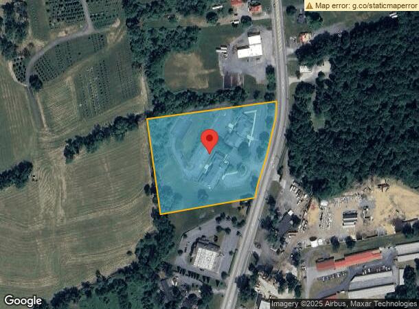
961 Pottstown Pike, Chester Springs, PA 19425
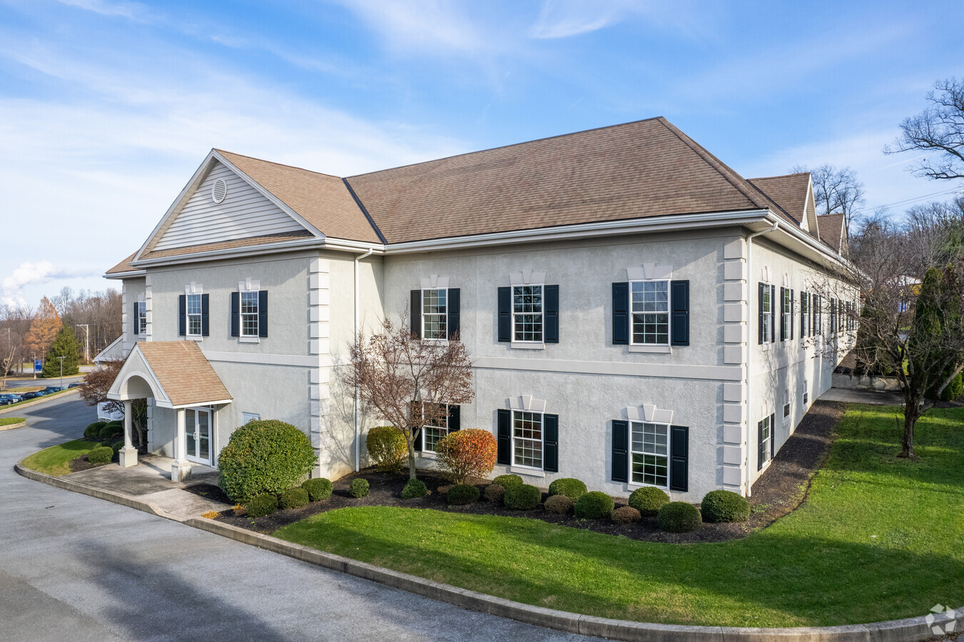
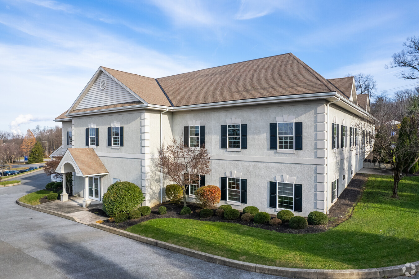
This Property Is For Sale
NEARBY LISTINGS FOR SALE OR LEASE
Property Detail
961 Pottstown Pike
25-006-0034.0000
4.9 AC & OFF BLDGS
Officebuilding
Chester
X
Pennsylvania
42029C0090G
4.90 AC
2024
Exton/Whitelands
2024
Philadelphia
301800
Philadelphia-Camden-Wilmington, PA-NJ-DE-MD
25,700 SF
DEMOGRAPHICS near 961 Pottstown Pike
1 Mile
3 Mile
5 Mile
2024 Total Population
3,887
19,673
42,430
2029 Population
4,063
20,609
44,287
Pop Growth 2024-2029
+ 4.53%
+ 4.76%
+ 4.38%
Average Age
38
39
41
2024 Total Households
1,367
6,474
14,903
HH Growth 2024-2029
+ 4.90%
+ 4.88%
+ 4.56%
Median Household Inc
$126,147
$175,298
$153,837
Avg Household Size
2.80
3.00
2.80
2024 Avg HH Vehicles
2.00
2.00
2.00
Median Home Value
$472,564
$556,803
$493,264
Median Year Built
2003
2000
1993
Nearby Places
- Restaurants
- Banks
- Shops
- Fitness
- Groceries
PUBLIC TRANSPORTATION
COMMUTER RAIL
Whitford (R5 - Southeastern Pennsylvania Transportation Authority Regional Rail (SEPTA Regional Rail))
DRIVE
WALK
Distance
Whitford (R5 - Southeastern Pennsylvania Transportation Authority Regional Rail (SEPTA Regional Rail))
17 min
8.2 mi
Exton (R5 - Southeastern Pennsylvania Transportation Authority Regional Rail (SEPTA Regional Rail))
DRIVE
WALK
Distance
Exton (R5 - Southeastern Pennsylvania Transportation Authority Regional Rail (SEPTA Regional Rail))
16 min
8.5 mi
AIRPORT
Philadelphia International
DRIVE
WALK
Distance
Philadelphia International
60 min
37.4 mi
Freight Ports
Port of Wilmington, RI
DRIVE
WALK
Distance
Port of Wilmington, RI
57 min
32.8 mi
Nearby Properties
Address
Land Use
TOTAL SIZE
Lot Size
Zoning
Address
Land Use
TOTAL SIZE
Lot Size
Zoning
253,570 SF
12.20 AC
L1
Address
Land Use
TOTAL SIZE
Lot Size
Zoning
284,792 SF
20.82 AC
R2
Address
Land Use
TOTAL SIZE
Lot Size
Zoning
203,450 SF
27.18 AC
R2
Address
Land Use
TOTAL SIZE
Lot Size
Zoning
149,289 SF
8.63 AC
R2
Address
Land Use
TOTAL SIZE
Lot Size
Zoning
105,651 SF
35.64 AC
R3
Address
Land Use
TOTAL SIZE
Lot Size
Zoning
87,400 SF
18.10 AC
C1
Address
Land Use
TOTAL SIZE
Lot Size
Zoning
101,894 SF
14.15 AC
C1
Address
Land Use
TOTAL SIZE
Lot Size
Zoning
272,135 SF
26.63 AC
R2
Address
Land Use
TOTAL SIZE
Lot Size
Zoning
108,603 SF
57.30 AC
AP
Address
Land Use
TOTAL SIZE
Lot Size
Zoning
42,063 SF
11.45 AC
C3
Address
Land Use
TOTAL SIZE
Lot Size
Zoning
73,614 SF
24.80 AC
MHP
Address
Land Use
TOTAL SIZE
Lot Size
Zoning
19.14 AC
LI
Address
Land Use
TOTAL SIZE
Lot Size
Zoning
51,628 SF
6.70 AC
R2
Address
Land Use
TOTAL SIZE
Lot Size
Zoning
44,800 SF
7.45 AC
R2
Address
Land Use
TOTAL SIZE
Lot Size
Zoning
4,567 SF
4.14 AC
C1
Address
Land Use
TOTAL SIZE
Lot Size
Zoning
63,364 SF
7.23 AC
R2
Address
Land Use
TOTAL SIZE
Lot Size
Zoning
18,806 SF
2 AC
C1
Address
Land Use
TOTAL SIZE
Lot Size
Zoning
24,400 SF
17.68 AC
C1
Address
Land Use
TOTAL SIZE
Lot Size
Zoning
43,798 SF
11.70 AC
C3
Address
Land Use
TOTAL SIZE
Lot Size
Zoning
37,045 SF
5.20 AC
R2
Address
Land Use
TOTAL SIZE
Lot Size
Zoning
344.25 AC
AP
Address
Land Use
TOTAL SIZE
Lot Size
Zoning
34,059 SF
24.10 AC
AP
Address
Land Use
TOTAL SIZE
Lot Size
Zoning
18,853 SF
4 AC
R3
Address
Land Use
TOTAL SIZE
Lot Size
Zoning
82,633 SF
2.70 AC
C1
Address
Land Use
TOTAL SIZE
Lot Size
Zoning
423.70 AC
AP
Address
Land Use
TOTAL SIZE
Lot Size
Zoning
30,590 SF
0.88 AC
L1
Address
Land Use
TOTAL SIZE
Lot Size
Zoning
126,036 SF
18.80 AC
IA1
Address
Land Use
TOTAL SIZE
Lot Size
Zoning
6,177 SF
131.60 AC
R3
Address
Land Use
TOTAL SIZE
Lot Size
Zoning
38,772 SF
7.18 AC
MHP
The World's #1 Commercial Real Estate Marketplace
Connect with us
© 2025 CoStar Group
The information above has been obtained from sources believed reliable. While we do not doubt its accuracy we have not verified it and make no guarantee, warranty or representation about it. It is your responsibility to independently confirm its accuracy and completeness. Any projections, opinions, assumptions, or estimates used are for example only and do not represent the current or future performance of the property. The value of this transaction to you depends on tax and other factors which should be evaluated by your tax, financial, and legal advisors. You and your advisors should conduct a careful, independent investigation of the property to determine to your satisfaction the suitability of the property for your needs.